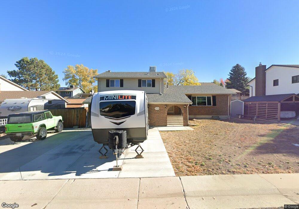
13154 Peacock Dr Lone Tree, CO 80124
Estimated Value: $549,000 - $558,100
3
Beds
3
Baths
2,288
Sq Ft
$242/Sq Ft
Est. Value
About This Home
This home is located at 13154 Peacock Dr, Lone Tree, CO 80124 and is currently estimated at $553,550, approximately $241 per square foot. 13154 Peacock Dr is a home located in Douglas County with nearby schools including Acres Green Elementary School, Cresthill Middle School, and Highlands Ranch High School.
Ownership History
Date
Name
Owned For
Owner Type
Purchase Details
Closed on
Aug 26, 2014
Sold by
Burns Deidra and Burns Ii William B
Bought by
Grant Ryan Michael and Grant Lisa Ann
Current Estimated Value
Home Financials for this Owner
Home Financials are based on the most recent Mortgage that was taken out on this home.
Original Mortgage
$275,500
Outstanding Balance
$211,147
Interest Rate
4.17%
Mortgage Type
New Conventional
Estimated Equity
$342,403
Purchase Details
Closed on
May 16, 2007
Sold by
Owen Gwendolyn Cox and Owen Robert William
Bought by
Burns Ii William B and Burns Deidra
Home Financials for this Owner
Home Financials are based on the most recent Mortgage that was taken out on this home.
Original Mortgage
$188,000
Interest Rate
7.35%
Mortgage Type
Stand Alone First
Purchase Details
Closed on
Jan 16, 1984
Sold by
Iversen Russell W and Iversen Raymond A
Bought by
William Owen Robert and Cox Owen Gwendolyn
Create a Home Valuation Report for This Property
The Home Valuation Report is an in-depth analysis detailing your home's value as well as a comparison with similar homes in the area
Home Values in the Area
Average Home Value in this Area
Purchase History
| Date | Buyer | Sale Price | Title Company |
|---|---|---|---|
| Grant Ryan Michael | $290,000 | Land Title Guarantee Company | |
| Burns Ii William B | $235,000 | Title America | |
| William Owen Robert | $91,500 | -- |
Source: Public Records
Mortgage History
| Date | Status | Borrower | Loan Amount |
|---|---|---|---|
| Open | Grant Ryan Michael | $275,500 | |
| Previous Owner | Burns Ii William B | $188,000 |
Source: Public Records
Tax History Compared to Growth
Tax History
| Year | Tax Paid | Tax Assessment Tax Assessment Total Assessment is a certain percentage of the fair market value that is determined by local assessors to be the total taxable value of land and additions on the property. | Land | Improvement |
|---|---|---|---|---|
| 2024 | $3,201 | $38,560 | $7,930 | $30,630 |
| 2023 | $3,234 | $38,560 | $7,930 | $30,630 |
| 2022 | $2,404 | $27,000 | $6,730 | $20,270 |
| 2021 | $2,500 | $27,000 | $6,730 | $20,270 |
| 2020 | $2,397 | $26,520 | $6,350 | $20,170 |
| 2019 | $2,405 | $26,520 | $6,350 | $20,170 |
| 2018 | $1,900 | $22,440 | $5,530 | $16,910 |
| 2017 | $1,931 | $22,440 | $5,530 | $16,910 |
| 2016 | $1,680 | $19,120 | $3,890 | $15,230 |
| 2015 | $1,718 | $19,120 | $3,890 | $15,230 |
| 2014 | $1,534 | $15,990 | $3,980 | $12,010 |
Source: Public Records
Map
Nearby Homes
- 789 Hamal Dr
- 979 Mercury Cir
- 13134 Deneb Dr
- 7971 Arrowhead Ct
- 202 Helena Cir
- 8049 Sweet Water Rd
- 7057 Chestnut Hill St
- 9275 Erminedale Dr
- 426 Jupiter Dr
- 7804 Silverweed Way
- 8159 Lodgepole Trail
- 9416 Kemper Dr
- 7041 Chestnut Hill Trail
- 250 Jupiter Dr
- 9412 La Quinta Way
- 8260 Lodgepole Trail
- 13678 Omega Cir
- 9308 Miles Dr Unit 5
- 8176 Lone Oak Ct
- 336 Aquarius Ct
- 13144 Peacock Dr
- 13164 Peacock Dr
- 965 Mercury Cir
- 969 Mercury Cir
- 959 Mercury Cir
- 13153 Peacock Dr
- 13174 Peacock Dr
- 13134 Peacock Dr
- 13163 Peacock Dr
- 975 Mercury Cir
- 955 Mercury Cir
- 13173 Peacock Dr
- 799 Hamal Dr
- 13184 Peacock Dr
- 13134 Canopus Dr
- 13124 Peacock Dr
- 964 Mercury Cir
- 949 Mercury Cir
- 958 Mercury Cir
- 817 Hamal Dr