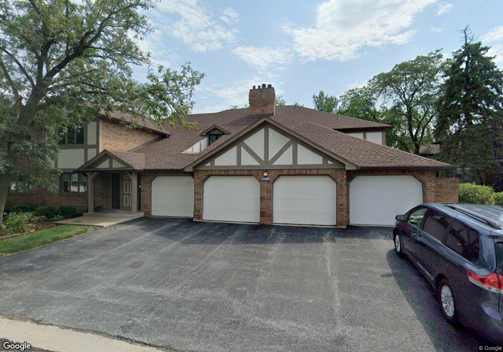
13159 S Westview Dr Unit 2A Palos Heights, IL 60463
Oak Hills NeighborhoodEstimated Value: $263,842 - $310,000
2
Beds
2
Baths
13,422
Sq Ft
$21/Sq Ft
Est. Value
About This Home
This home is located at 13159 S Westview Dr Unit 2A, Palos Heights, IL 60463 and is currently estimated at $280,961, approximately $20 per square foot. 13159 S Westview Dr Unit 2A is a home located in Cook County with nearby schools including Palos East Elementary School, Palos South Middle School, and Carl Sandburg High School.
Ownership History
Date
Name
Owned For
Owner Type
Purchase Details
Closed on
Aug 29, 2018
Sold by
Mccarthy Daniel P
Bought by
Mccarthy Daniel P and Daniel Paul Mccarthy Trust
Current Estimated Value
Purchase Details
Closed on
Jun 4, 1999
Sold by
Houtsma James H
Bought by
Mccarthy Daniel P
Home Financials for this Owner
Home Financials are based on the most recent Mortgage that was taken out on this home.
Original Mortgage
$100,000
Outstanding Balance
$26,243
Interest Rate
6.99%
Estimated Equity
$254,718
Purchase Details
Closed on
Mar 21, 1997
Sold by
Sutkus Sigmund J and Phillips Anthony M
Bought by
Houtsma James H
Home Financials for this Owner
Home Financials are based on the most recent Mortgage that was taken out on this home.
Original Mortgage
$109,600
Interest Rate
7.73%
Create a Home Valuation Report for This Property
The Home Valuation Report is an in-depth analysis detailing your home's value as well as a comparison with similar homes in the area
Home Values in the Area
Average Home Value in this Area
Purchase History
| Date | Buyer | Sale Price | Title Company |
|---|---|---|---|
| Mccarthy Daniel P | -- | Attorney | |
| Mccarthy Daniel P | $151,000 | Ticor Title | |
| Houtsma James H | $137,000 | Intercounty Title |
Source: Public Records
Mortgage History
| Date | Status | Borrower | Loan Amount |
|---|---|---|---|
| Open | Mccarthy Daniel P | $100,000 | |
| Previous Owner | Houtsma James H | $109,600 |
Source: Public Records
Tax History Compared to Growth
Tax History
| Year | Tax Paid | Tax Assessment Tax Assessment Total Assessment is a certain percentage of the fair market value that is determined by local assessors to be the total taxable value of land and additions on the property. | Land | Improvement |
|---|---|---|---|---|
| 2024 | $3,820 | $19,691 | $1,276 | $18,415 |
| 2023 | $2,784 | $19,691 | $1,276 | $18,415 |
| 2022 | $2,784 | $14,341 | $2,839 | $11,502 |
| 2021 | $2,671 | $14,341 | $2,839 | $11,502 |
| 2020 | $2,671 | $14,341 | $2,839 | $11,502 |
| 2019 | $2,021 | $13,035 | $2,592 | $10,443 |
| 2018 | $1,182 | $13,035 | $2,592 | $10,443 |
| 2017 | $1,121 | $13,035 | $2,592 | $10,443 |
| 2016 | $1,965 | $10,911 | $2,262 | $8,649 |
| 2015 | $1,871 | $10,911 | $2,262 | $8,649 |
| 2014 | $1,853 | $10,911 | $2,262 | $8,649 |
| 2013 | $2,147 | $10,720 | $2,262 | $8,458 |
Source: Public Records
Map
Nearby Homes
- 7930 W Lakeview Ct Unit 2A
- 13332 S Oakview Ct Unit V4
- 13302 S Oakview Ct Unit 1FR
- 7737 W Golf Dr Unit 101
- 7737 W Golf Dr Unit 201
- 13458 S Westview Dr Unit V4
- 13258 S Oak Ridge Trail Unit 1A
- 13253 S Oak Ridge Trail Unit 2B
- 7711 W Oak Ridge Ct Unit 2A
- 13154 N Country Club Ct Unit 2B
- 13028 S 82nd Ave
- 13310 S Country Club Ct Unit 2B
- Richmond Plan at Misty Meadow
- Dartmore Plan at Misty Meadow
- Compton Plan at Misty Meadow
- Beaumont Plan at Misty Meadow
- Barrington Plan at Misty Meadow
- 12905 S 82nd Ct
- 8309 W 132nd St
- 8132 Pickens Dr
- 13159 S Westview Dr Unit 1A
- 13159 S Westview Dr Unit 131592
- 13159 S Westview Dr Unit 131592
- 13159 S Westview Dr Unit 131591
- 13159 S Westview Dr Unit 131591
- 13159 S Westview Dr Unit 1B
- 13151 S Westview Dr Unit 131511
- 13151 S Westview Dr Unit 131511
- 13151 S Westview Dr Unit 131512
- 13151 S Westview Dr Unit 131512
- 13151 S Westview Dr Unit 1A
- 13151 S Westview Dr Unit 2A
- 13151 S Westview Dr Unit 2B
- 7921 W Lakeview Ct Unit 1A
- 7921 W Lakeview Ct Unit 79212B
- 7921 W Lakeview Ct Unit 79212A
- 7921 W Lakeview Ct Unit 79211B
- 7921 W Lakeview Ct Unit 79211A
- 7921 W Lakeview Ct Unit 2B
- 7921 W Lakeview Ct Unit 1B