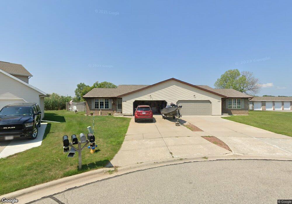
1316 Crown Ct Unit 1318 de Pere, WI 54115
Estimated Value: $381,000 - $420,000
2
Beds
2
Baths
2,224
Sq Ft
$181/Sq Ft
Est. Value
About This Home
This home is located at 1316 Crown Ct Unit 1318, de Pere, WI 54115 and is currently estimated at $403,537, approximately $181 per square foot. 1316 Crown Ct Unit 1318 is a home located in Brown County with nearby schools including Westwood Elementary School, Cms Iacademy at Lincoln Jackson, and Desert Pride Academy.
Ownership History
Date
Name
Owned For
Owner Type
Purchase Details
Closed on
Jun 11, 2020
Sold by
Arora Suraj and Arora Vidushi
Bought by
Sv Rental Properties Llc
Current Estimated Value
Purchase Details
Closed on
Feb 27, 2020
Sold by
Adams Richard and Adams Jean
Bought by
Arora Suraj and Arora Vidushi
Home Financials for this Owner
Home Financials are based on the most recent Mortgage that was taken out on this home.
Original Mortgage
$126,000
Interest Rate
3.6%
Mortgage Type
New Conventional
Purchase Details
Closed on
Jul 25, 2018
Sold by
Moulin James S De and Moulin Marlene H De
Bought by
Adams Richard and Adams Jean
Home Financials for this Owner
Home Financials are based on the most recent Mortgage that was taken out on this home.
Original Mortgage
$219,451
Interest Rate
4.49%
Mortgage Type
FHA
Create a Home Valuation Report for This Property
The Home Valuation Report is an in-depth analysis detailing your home's value as well as a comparison with similar homes in the area
Home Values in the Area
Average Home Value in this Area
Purchase History
| Date | Buyer | Sale Price | Title Company |
|---|---|---|---|
| Sv Rental Properties Llc | -- | None Available | |
| Arora Suraj | $256,000 | Liberty Title | |
| Adams Richard | $223,500 | Liberty Title |
Source: Public Records
Mortgage History
| Date | Status | Borrower | Loan Amount |
|---|---|---|---|
| Previous Owner | Arora Suraj | $126,000 | |
| Previous Owner | Adams Richard | $219,451 |
Source: Public Records
Tax History Compared to Growth
Tax History
| Year | Tax Paid | Tax Assessment Tax Assessment Total Assessment is a certain percentage of the fair market value that is determined by local assessors to be the total taxable value of land and additions on the property. | Land | Improvement |
|---|---|---|---|---|
| 2024 | $5,593 | $370,800 | $40,700 | $330,100 |
| 2023 | $5,042 | $321,500 | $40,700 | $280,800 |
| 2022 | $5,064 | $289,900 | $40,700 | $249,200 |
| 2021 | $4,896 | $256,000 | $33,900 | $222,100 |
| 2020 | $4,850 | $238,900 | $33,900 | $205,000 |
| 2019 | $5,188 | $257,000 | $33,900 | $223,100 |
| 2018 | $4,934 | $237,300 | $33,900 | $203,400 |
| 2017 | $4,537 | $213,700 | $33,900 | $179,800 |
| 2016 | $4,566 | $213,700 | $33,900 | $179,800 |
| 2015 | $4,470 | $204,900 | $33,900 | $171,000 |
| 2014 | $5,208 | $204,900 | $33,900 | $171,000 |
| 2013 | $5,208 | $204,900 | $33,900 | $171,000 |
Source: Public Records
Map
Nearby Homes
- 1276 S 9th St
- 1264 Franco Ct Unit 1266
- 1208 Meadow View Ln
- 1653 Crimson Ct
- 0 Scheuring Rd
- 1213 Danena Dr
- 1410 S 7th St
- 1509 S 7th St
- 978 Saint Anthony Dr Unit 2
- 1002 Aldrin St
- 1120 S 6th St
- 2045 Lost Dauphin Rd
- 1629 N Honeysuckle Dr
- 1617 N Honeysuckle Dr
- 657 Reid St
- 1319 Pond View Cir Unit 59
- 634 Grant St
- 3644 E Hank Ave
- 1371 Shelby Ln
- 806 4th St
- 1318 Crown Ct
- 1325 Crown Ct Unit 1327
- 1319 Crown Ct
- 1317 Crown Ct Unit 1319
- 1309 Crown Ct Unit 1311
- 1323 Meadow View Ln
- 1318 Franco Ct Unit 1320
- 1326 Franco Ct Unit 1328
- 1310 Franco Ct Unit 1312
- 1334 Franco Ct Unit 1336
- 1334 S Franco Ct Unit 1336
- 1334 S Franco Ct
- 1315 Meadow View Ln Unit 1317
- 1336 Franco Ct
- 1295 Crown Ct
- 1342 Franco Ct Unit 1344
- 1316 Meadow View Ln Unit 1
- 1318 Meadow View Ln Unit 2
- 1287 Crown Ct Unit 1289
- 1329 Franco Ct