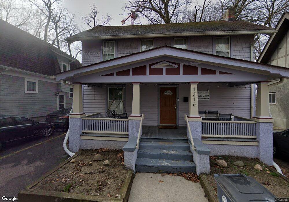
1316 Forest Ct Ann Arbor, MI 48104
Downtown Ann Arbor NeighborhoodEstimated Value: $615,000 - $1,444,000
3
Beds
1
Bath
1,344
Sq Ft
$646/Sq Ft
Est. Value
About This Home
This home is located at 1316 Forest Ct, Ann Arbor, MI 48104 and is currently estimated at $868,135, approximately $645 per square foot. 1316 Forest Ct is a home located in Washtenaw County with nearby schools including Burns Park Elementary School, Tappan Middle School, and Pioneer High School.
Ownership History
Date
Name
Owned For
Owner Type
Purchase Details
Closed on
Dec 11, 2012
Sold by
Langenburg Jennifer R
Bought by
Pampreen Daniel P
Current Estimated Value
Purchase Details
Closed on
Jun 21, 2012
Sold by
Pampreen Daniel P and Langenburg Jennifer
Bought by
Pampreen Daniel P
Home Financials for this Owner
Home Financials are based on the most recent Mortgage that was taken out on this home.
Original Mortgage
$128,269
Interest Rate
3.73%
Mortgage Type
FHA
Create a Home Valuation Report for This Property
The Home Valuation Report is an in-depth analysis detailing your home's value as well as a comparison with similar homes in the area
Home Values in the Area
Average Home Value in this Area
Purchase History
| Date | Buyer | Sale Price | Title Company |
|---|---|---|---|
| Pampreen Daniel P | -- | None Available | |
| Pampreen Daniel P | -- | None Available |
Source: Public Records
Mortgage History
| Date | Status | Borrower | Loan Amount |
|---|---|---|---|
| Previous Owner | Pampreen Daniel P | $128,269 |
Source: Public Records
Tax History
| Year | Tax Paid | Tax Assessment Tax Assessment Total Assessment is a certain percentage of the fair market value that is determined by local assessors to be the total taxable value of land and additions on the property. | Land | Improvement |
|---|---|---|---|---|
| 2025 | $7,716 | $225,900 | $0 | $0 |
| 2024 | $7,505 | $233,600 | $0 | $0 |
| 2023 | $6,930 | $222,600 | $0 | $0 |
| 2022 | $8,387 | $209,700 | $0 | $0 |
| 2021 | $8,150 | $204,300 | $0 | $0 |
| 2020 | $7,894 | $201,600 | $0 | $0 |
| 2019 | $7,530 | $201,600 | $201,600 | $0 |
| 2018 | $7,499 | $199,400 | $0 | $0 |
| 2017 | $7,127 | $204,900 | $0 | $0 |
| 2016 | $5,545 | $112,230 | $0 | $0 |
| 2015 | $6,659 | $111,895 | $0 | $0 |
| 2014 | $6,659 | $108,399 | $0 | $0 |
| 2013 | -- | $108,399 | $0 | $0 |
Source: Public Records
Map
Nearby Homes
- 1702 Hill St
- 1015 Olivia Ave
- 1124 Prospect St
- 1138 Lincoln Ave
- 1923 Geddes Ave
- 1212 Wells St
- 1224 Olivia Ave
- 845 Brookwood Place
- 912 Mary St
- 921 E Huron St Unit 6
- 555 E William St Unit 3K
- 555 E William St Unit 14C
- 555 E William St Unit 6A
- 555 E William St Unit 15J
- 555 E William St Unit 17H
- 555 E William St Unit 3J
- 555 E William St Unit 15K
- 555 E William St Unit 16K
- 555 E William St Unit 6H
- 555 E William St Unit 7G
- 1318 Forest Ct
- 1312 Forest Ct
- 1320 Forest Ct
- 1317 Forest Ct
- 1315 Forest Ct
- 1319 Forest Ct
- 1324 Forest Ct
- 701 S Forest Ave
- 1321 Forest Ct
- 1328 Forest Ct
- 1327 Forest Ct
- 625 S Forest Ave
- 1332 Forest Ct
- 715 S Forest Ave
- 721 S Forest Ave
- 1300 S University Ave
- 1300 S University Ave
- 1320 S University Ave
- 727 S Forest Ave
- 610 S Forest Ave
Your Personal Tour Guide
Ask me questions while you tour the home.