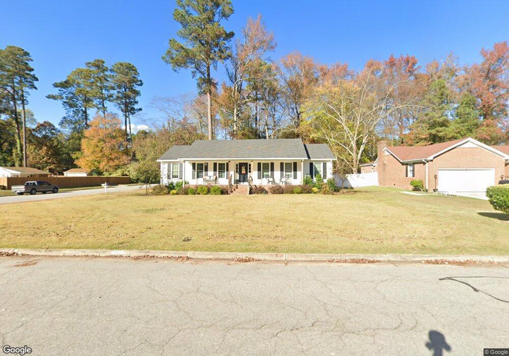
1316 Queen Anne Rd NW Wilson, NC 27896
Estimated Value: $257,000 - $299,000
3
Beds
2
Baths
1,670
Sq Ft
$161/Sq Ft
Est. Value
About This Home
This home is located at 1316 Queen Anne Rd NW, Wilson, NC 27896 and is currently estimated at $269,012, approximately $161 per square foot. 1316 Queen Anne Rd NW is a home located in Wilson County with nearby schools including John W. Jones Elementary School, James Hunt High School, and Forest Hills Middle School.
Ownership History
Date
Name
Owned For
Owner Type
Purchase Details
Closed on
Jun 12, 2019
Sold by
Ward Stephen A and Ward Heather M
Bought by
Herring Wendy Davis
Current Estimated Value
Home Financials for this Owner
Home Financials are based on the most recent Mortgage that was taken out on this home.
Original Mortgage
$125,000
Outstanding Balance
$111,545
Interest Rate
4.87%
Mortgage Type
Adjustable Rate Mortgage/ARM
Estimated Equity
$157,467
Purchase Details
Closed on
Nov 20, 2012
Sold by
Purvis Lynda N and Purvis Joseph G
Bought by
Ward Stephen A and Ward Heather M
Home Financials for this Owner
Home Financials are based on the most recent Mortgage that was taken out on this home.
Original Mortgage
$122,735
Interest Rate
3.25%
Mortgage Type
FHA
Create a Home Valuation Report for This Property
The Home Valuation Report is an in-depth analysis detailing your home's value as well as a comparison with similar homes in the area
Home Values in the Area
Average Home Value in this Area
Purchase History
| Date | Buyer | Sale Price | Title Company |
|---|---|---|---|
| Herring Wendy Davis | $125,000 | None Available | |
| Ward Stephen A | $125,000 | None Available |
Source: Public Records
Mortgage History
| Date | Status | Borrower | Loan Amount |
|---|---|---|---|
| Open | Herring Wendy Davis | $125,000 | |
| Previous Owner | Ward Stephen A | $122,735 |
Source: Public Records
Tax History Compared to Growth
Tax History
| Year | Tax Paid | Tax Assessment Tax Assessment Total Assessment is a certain percentage of the fair market value that is determined by local assessors to be the total taxable value of land and additions on the property. | Land | Improvement |
|---|---|---|---|---|
| 2025 | $2,540 | $226,788 | $45,000 | $181,788 |
| 2024 | $2,540 | $226,788 | $45,000 | $181,788 |
| 2023 | $1,740 | $133,306 | $30,000 | $103,306 |
| 2022 | $1,740 | $133,306 | $30,000 | $103,306 |
| 2021 | $1,740 | $133,306 | $30,000 | $103,306 |
| 2020 | $1,740 | $133,306 | $30,000 | $103,306 |
| 2019 | $1,740 | $133,306 | $30,000 | $103,306 |
| 2018 | $1,740 | $133,306 | $30,000 | $103,306 |
| 2017 | $1,713 | $133,306 | $30,000 | $103,306 |
| 2016 | $1,713 | $133,306 | $30,000 | $103,306 |
| 2014 | $1,578 | $126,727 | $30,000 | $96,727 |
Source: Public Records
Map
Nearby Homes
- 1401 Queen Anne Rd NW
- 1402 Dogwood Ln NW
- 2211 Chelsea Dr NW
- 1307 Waverly Rd NW
- 3513 Astor Dr NW
- 2112 Burnside Dr NW
- 3101 Quinn Dr NW
- 2112 Chelsea Dr NW
- 1205 Colonial Ave NW
- 3714 Columbia Ave NW
- 3610 Columbia Ave NW
- 1128 Knollwood Dr NW
- 3501 S Meade Place NW
- 1117 Parkside Dr NW
- 3517 S Meade Place NW
- 3316 Queensferry Dr NW
- 1106 Parkside Dr NW
- 1113 Parkside Dr NW
- 3204 Queensferry Dr NW
- 1716 Lakeside Dr NW
- 1314 Queen Anne Rd NW
- 2000 Burnside Dr NW
- 1400 Queen Anne Rd NW
- 1312 Queen Anne Rd NW
- 2002 Burnside Dr NW
- 2101 Dees Ct NW
- 1317 Queen Anne Rd NW
- 1315 Queen Anne Rd NW
- 1402 Queen Anne Rd NW
- 1310 Queen Anne Rd NW
- 1313 Waverly Rd NW
- 2103 Dees Ct NW
- 1313 Queen Anne Rd NW
- 2100 Burnside Dr NW
- 1403 Queen Anne Rd NW
- 1308 Queen Anne Rd NW
- 1311 NW Waverly Dr
- 1311 Waverly Rd NW
- 1311 Queen Anne Rd NW
- 1404 Queen Anne Rd NW