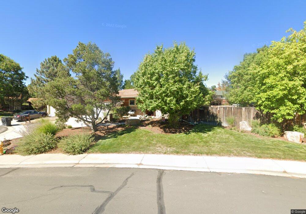
13165 Saint Paul Dr Thornton, CO 80241
Estimated Value: $493,000 - $539,000
4
Beds
2
Baths
1,556
Sq Ft
$328/Sq Ft
Est. Value
About This Home
This home is located at 13165 Saint Paul Dr, Thornton, CO 80241 and is currently estimated at $510,583, approximately $328 per square foot. 13165 Saint Paul Dr is a home located in Adams County with nearby schools including Tarver Elementary School, Century Middle School, and Horizon High School.
Ownership History
Date
Name
Owned For
Owner Type
Purchase Details
Closed on
May 3, 2012
Sold by
Sutherland T Mark and Sutherland Susan D
Bought by
Sutherland Susan D
Current Estimated Value
Purchase Details
Closed on
Jan 24, 1997
Sold by
Thiesfeld Jeffery R and Thiesfeld Melissa A
Bought by
Sutherland T Mark and Sutherland Susan D
Home Financials for this Owner
Home Financials are based on the most recent Mortgage that was taken out on this home.
Original Mortgage
$105,000
Outstanding Balance
$12,053
Interest Rate
7.73%
Estimated Equity
$498,530
Purchase Details
Closed on
Jun 19, 1992
Create a Home Valuation Report for This Property
The Home Valuation Report is an in-depth analysis detailing your home's value as well as a comparison with similar homes in the area
Home Values in the Area
Average Home Value in this Area
Purchase History
| Date | Buyer | Sale Price | Title Company |
|---|---|---|---|
| Sutherland Susan D | -- | None Available | |
| Sutherland T Mark | $140,000 | Land Title | |
| -- | $88,000 | -- |
Source: Public Records
Mortgage History
| Date | Status | Borrower | Loan Amount |
|---|---|---|---|
| Open | Sutherland T Mark | $105,000 |
Source: Public Records
Tax History Compared to Growth
Tax History
| Year | Tax Paid | Tax Assessment Tax Assessment Total Assessment is a certain percentage of the fair market value that is determined by local assessors to be the total taxable value of land and additions on the property. | Land | Improvement |
|---|---|---|---|---|
| 2024 | $3,509 | $31,190 | $6,560 | $24,630 |
| 2023 | $3,473 | $37,620 | $6,770 | $30,850 |
| 2022 | $2,891 | $26,240 | $6,460 | $19,780 |
| 2021 | $2,987 | $26,240 | $6,460 | $19,780 |
| 2020 | $2,807 | $25,160 | $6,650 | $18,510 |
| 2019 | $2,813 | $25,160 | $6,650 | $18,510 |
| 2018 | $2,607 | $22,660 | $7,490 | $15,170 |
| 2017 | $2,371 | $22,660 | $7,490 | $15,170 |
| 2016 | $1,906 | $17,740 | $3,660 | $14,080 |
| 2015 | $1,904 | $17,740 | $3,660 | $14,080 |
| 2014 | $1,741 | $15,770 | $3,420 | $12,350 |
Source: Public Records
Map
Nearby Homes
- 2788 E 132nd Cir
- 2691 E 132nd Ave
- 13080 Harrison Dr
- 2746 E 132nd Place
- 13068 Harrison Dr
- 13540 Detroit St
- 12814 Jackson Cir
- 3850 E 128th Way
- 4061 E 133rd Cir
- 3802 E 127th Ln
- 13022 Bellaire St
- 12672 Madison Ct
- 12711 Colorado Blvd Unit 914
- 12711 Colorado Blvd Unit 617F
- 13263 Clermont Cir
- 12811 Josephine Ct
- 12865 Clermont St
- 2275 E 129th Ave
- 13346 Birch Cir
- 12625 Madison Way
- 13167 Saint Paul Dr
- 13163 Saint Paul Dr
- 3144 E 132nd Ct
- 13173 Saint Paul Ct
- 3124 E 132nd Ct
- 13161 Saint Paul Dr
- 13158 Saint Paul Dr
- 13160 Saint Paul Dr
- 13169 Saint Paul Dr
- 3164 E 132nd Ct
- 13159 Saint Paul Dr
- 13175 Saint Paul Ct
- 13156 Saint Paul Dr
- 3104 E 132nd Ct
- 13162 Saint Paul Dr
- 13171 Saint Paul Ct
- 3145 E 132nd Ct
- 13148 Cook Ct
- 13154 Saint Paul Dr
- 13177 Saint Paul Ct