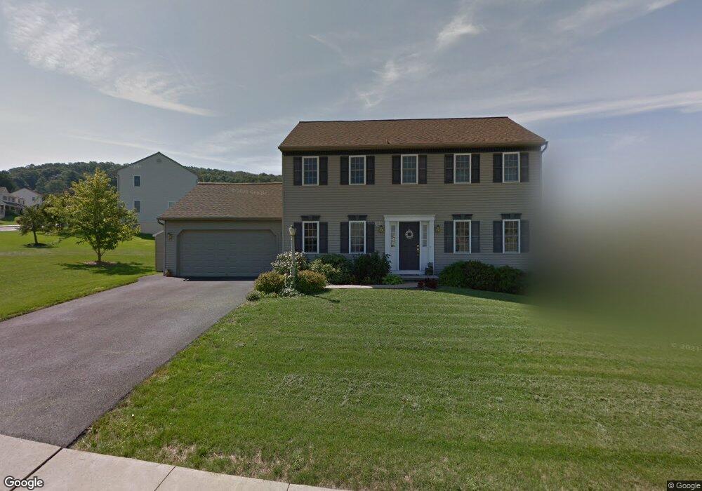
1317 Cedar Ave East Earl, PA 17519
Estimated Value: $435,398 - $500,000
3
Beds
3
Baths
1,976
Sq Ft
$238/Sq Ft
Est. Value
About This Home
This home is located at 1317 Cedar Ave, East Earl, PA 17519 and is currently estimated at $469,850, approximately $237 per square foot. 1317 Cedar Ave is a home located in Lancaster County with nearby schools including Garden Spot Middle School, Garden Spot Senior High School, and Conestoga Parochial School.
Ownership History
Date
Name
Owned For
Owner Type
Purchase Details
Closed on
Jan 30, 2003
Sold by
Weaver Marvin R and Weaver Miriam M
Bought by
Giza Jonathan K and Giza Jessica R
Current Estimated Value
Home Financials for this Owner
Home Financials are based on the most recent Mortgage that was taken out on this home.
Original Mortgage
$155,728
Outstanding Balance
$66,840
Interest Rate
5.98%
Estimated Equity
$403,010
Create a Home Valuation Report for This Property
The Home Valuation Report is an in-depth analysis detailing your home's value as well as a comparison with similar homes in the area
Home Values in the Area
Average Home Value in this Area
Purchase History
| Date | Buyer | Sale Price | Title Company |
|---|---|---|---|
| Giza Jonathan K | $194,661 | First American Title Ins Co |
Source: Public Records
Mortgage History
| Date | Status | Borrower | Loan Amount |
|---|---|---|---|
| Open | Giza Jonathan K | $155,728 | |
| Closed | Giza Jonathan K | $19,466 |
Source: Public Records
Tax History Compared to Growth
Tax History
| Year | Tax Paid | Tax Assessment Tax Assessment Total Assessment is a certain percentage of the fair market value that is determined by local assessors to be the total taxable value of land and additions on the property. | Land | Improvement |
|---|---|---|---|---|
| 2025 | $4,440 | $247,900 | $78,200 | $169,700 |
| 2024 | $4,440 | $247,900 | $78,200 | $169,700 |
| 2023 | $4,376 | $247,900 | $78,200 | $169,700 |
| 2022 | $4,329 | $247,900 | $78,200 | $169,700 |
| 2021 | $4,259 | $247,900 | $78,200 | $169,700 |
| 2020 | $4,259 | $247,900 | $78,200 | $169,700 |
| 2019 | $4,213 | $247,900 | $78,200 | $169,700 |
| 2018 | $6,013 | $247,900 | $78,200 | $169,700 |
| 2017 | $4,003 | $192,200 | $36,500 | $155,700 |
| 2016 | $4,003 | $192,200 | $36,500 | $155,700 |
| 2015 | $1,112 | $192,200 | $36,500 | $155,700 |
| 2014 | $2,706 | $192,200 | $36,500 | $155,700 |
Source: Public Records
Map
Nearby Homes
- 1220 Shetland Cir
- 1215 Shetland Cir
- 1411 Martin St
- 1276 Martin St
- 1145 Brownstone Ridge
- 529 Ranck Rd Unit 6
- 529 Ranck Rd Unit 10
- 529 Ranck Rd Unit 9
- 529 Ranck Rd Unit 8
- 529 Ranck Rd Unit 5
- 529 Ranck Rd Unit 4
- 529 Ranck Rd Unit 3
- 529 Ranck Rd Unit 2
- 529 Ranck Rd Unit 1
- 13 Amber Cir
- 44 Emily Ln
- 404 Jared Way
- 300 Jared Way
- 5210 Honeysuckle Ln
- 113 Windsock Way
- 1325 Cedar Ave
- 1303 Cedar Ave
- 1318 Cedar Ave
- 1300 Poplar St
- 1304 Poplar St
- 1314 Cedar Ave
- 1322 Cedar Ave
- 1326 Cedar Ave
- 1306 Cedar Ave
- 1296 Poplar St
- 1299 Cedar Ave
- 1330 Cedar Ave
- 1302 Cedar Ave
- 1334 Cedar Ave
- 1292 Poplar St
- 1295 Cedar Ave
- 1298 Cedar Ave
- 1339 Cedar Ave
- 1304 Springville Rd
- 1300 Springville Rd