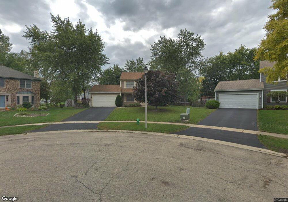
1317 Kline Ct Batavia, IL 60510
Southeast Batavia NeighborhoodEstimated Value: $435,000 - $497,000
4
Beds
3
Baths
1,952
Sq Ft
$233/Sq Ft
Est. Value
About This Home
This home is located at 1317 Kline Ct, Batavia, IL 60510 and is currently estimated at $454,997, approximately $233 per square foot. 1317 Kline Ct is a home located in Kane County with nearby schools including Hoover Wood Elementary School, Sam Rotolo Middle School, and Batavia Sr High School.
Ownership History
Date
Name
Owned For
Owner Type
Purchase Details
Closed on
May 29, 2007
Sold by
Plass Jeffery A and Plass Lori A
Bought by
Follman Kurtis W and Follman Kathy E
Current Estimated Value
Home Financials for this Owner
Home Financials are based on the most recent Mortgage that was taken out on this home.
Original Mortgage
$232,000
Outstanding Balance
$142,190
Interest Rate
6.22%
Mortgage Type
Purchase Money Mortgage
Estimated Equity
$312,807
Create a Home Valuation Report for This Property
The Home Valuation Report is an in-depth analysis detailing your home's value as well as a comparison with similar homes in the area
Home Values in the Area
Average Home Value in this Area
Purchase History
| Date | Buyer | Sale Price | Title Company |
|---|---|---|---|
| Follman Kurtis W | $292,000 | Fox Title Company |
Source: Public Records
Mortgage History
| Date | Status | Borrower | Loan Amount |
|---|---|---|---|
| Open | Follman Kurtis W | $232,000 |
Source: Public Records
Tax History
| Year | Tax Paid | Tax Assessment Tax Assessment Total Assessment is a certain percentage of the fair market value that is determined by local assessors to be the total taxable value of land and additions on the property. | Land | Improvement |
|---|---|---|---|---|
| 2024 | $9,056 | $122,541 | $22,329 | $100,212 |
| 2023 | $8,857 | $111,219 | $20,266 | $90,953 |
| 2022 | $8,552 | $103,943 | $18,940 | $85,003 |
| 2021 | $8,207 | $98,580 | $17,963 | $80,617 |
| 2020 | $8,003 | $96,685 | $17,618 | $79,067 |
| 2019 | $7,870 | $93,262 | $16,994 | $76,268 |
| 2018 | $7,553 | $89,710 | $16,347 | $73,363 |
| 2017 | $7,367 | $86,752 | $15,808 | $70,944 |
| 2016 | $7,208 | $84,226 | $15,348 | $68,878 |
| 2015 | -- | $82,309 | $14,999 | $67,310 |
| 2014 | -- | $79,718 | $14,527 | $65,191 |
| 2013 | -- | $78,163 | $14,244 | $63,919 |
Source: Public Records
Map
Nearby Homes
- 1402 Cherry Dr
- 1206 Beckman Ln
- 2007 Gillenwater St
- 1136 Pine Ct
- 2047 Swan Ln
- 1816 Burnell Ct
- 2049 Stuttle Rd
- 2045 Stuttle Rd
- 527 Ridgelawn Trail
- 1705 South Ct
- 570 Violet Ln
- 694 Hart Rd
- Lot 4 Manchester Ave
- 860 S River St
- 1687 Sauk Dr
- 2940 Arbor Ln
- 121 S Raddant Rd
- 3020 Abbey Cir
- 3075 Mesa Ln
- 3018 Abbey Cir
- 1319 Kline Ct
- 1315 Kline Ct
- 1310 Johnstone Dr
- 1314 Johnstone Dr
- 1306 Johnstone Dr
- 1318 Johnstone Dr
- 1313 Kline Ct
- 1336 Johnstone Dr Unit 2
- 1332 Johnstone Dr Unit 2
- 1340 Johnstone Dr
- 1311 Kline Ct
- 1213 Hillsboro Dr
- 1323 Kline Ct
- 1227 Hillsboro Dr
- 1344 Johnstone Dr
- 1309 Kline Ct
- 1305 Johnstone Dr Unit 2
- 1235 Hillsboro Dr
- 1309 Johnstone Dr
- 1211 Hillsboro Dr
Your Personal Tour Guide
Ask me questions while you tour the home.