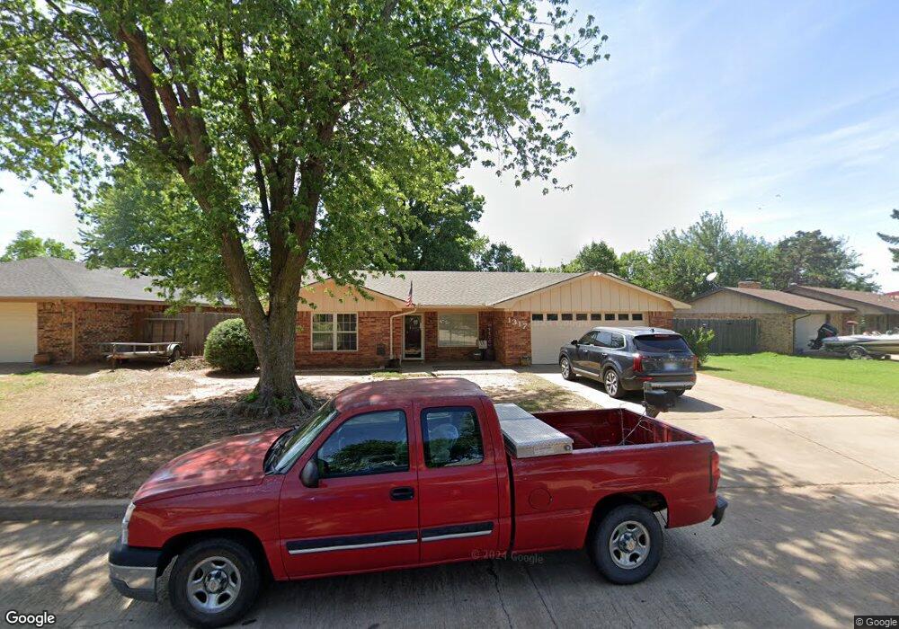
1317 N Adams St Weatherford, OK 73096
Estimated Value: $169,861 - $192,000
3
Beds
2
Baths
1,271
Sq Ft
$146/Sq Ft
Est. Value
About This Home
This home is located at 1317 N Adams St, Weatherford, OK 73096 and is currently estimated at $185,215, approximately $145 per square foot. 1317 N Adams St is a home located in Custer County with nearby schools including Burcham Elementary School, Lt. General Thomas P. Stafford Elementary School, and Weatherford West Elementary School.
Ownership History
Date
Name
Owned For
Owner Type
Purchase Details
Closed on
Dec 27, 2018
Sold by
Melissa Morgan and Melissa Joe
Bought by
Kelley Barry Lynn
Current Estimated Value
Purchase Details
Closed on
Dec 30, 2011
Sold by
Kelley Barry
Bought by
Kelley Barry Lynn Etux Re
Purchase Details
Closed on
Jan 11, 2005
Sold by
Barry Kelley
Bought by
Barry and Cindy Lea Kelley
Purchase Details
Closed on
Jun 29, 2004
Sold by
David A Murray
Bought by
Barry Kelley
Create a Home Valuation Report for This Property
The Home Valuation Report is an in-depth analysis detailing your home's value as well as a comparison with similar homes in the area
Home Values in the Area
Average Home Value in this Area
Purchase History
| Date | Buyer | Sale Price | Title Company |
|---|---|---|---|
| Kelley Barry Lynn | $135,000 | Old Republic Title Co Ok | |
| Kelley Barry Lynn Etux Re | -- | -- | |
| Barry | -- | -- | |
| Barry Kelley | $77,300 | -- |
Source: Public Records
Tax History Compared to Growth
Tax History
| Year | Tax Paid | Tax Assessment Tax Assessment Total Assessment is a certain percentage of the fair market value that is determined by local assessors to be the total taxable value of land and additions on the property. | Land | Improvement |
|---|---|---|---|---|
| 2025 | $1,457 | $15,515 | $1,767 | $13,748 |
| 2024 | $1,457 | $14,334 | $1,325 | $13,009 |
| 2023 | $1,457 | $14,962 | $1,325 | $13,637 |
| 2022 | $1,439 | $14,962 | $1,325 | $13,637 |
| 2021 | $1,410 | $14,543 | $1,306 | $13,237 |
| 2020 | $1,396 | $13,850 | $1,274 | $12,576 |
| 2019 | $1,343 | $13,190 | $1,222 | $11,968 |
| 2018 | $1,162 | $12,562 | $1,191 | $11,371 |
| 2017 | $1,127 | $11,965 | $1,260 | $10,705 |
| 2016 | $1,084 | $11,395 | $1,153 | $10,242 |
| 2015 | $1,047 | $10,852 | $1,205 | $9,647 |
| 2014 | $995 | $10,335 | $1,169 | $9,166 |
Source: Public Records
Map
Nearby Homes
- 0 N Washington Ave
- 1312 Linwood St
- 1535 Mockingbird Ln
- 1316 N Lark St
- 1300 Crimson Dr
- 1016 N Washington Ave
- 1804 Kristie Ln
- 10009 Lark St
- 1509 Steiner Rd
- 1010 Stonegate Dr
- 1400 Rolling Hills St
- 1025 Gartrell Place
- 24130 E 1016 Rd
- 708 Cornerstone Ave
- 24126 E 1016 Rd
- 0 Debra Dr
- 24122 E 1016 Rd
- 1414 Chisholm Trail
- 1805 E Serenade St
- 1230 N Indiana St
- 1321 N Adams St
- 1313 N Adams St
- 1316 N Adams St
- 1316 N Terrace Dr
- 1312 N Adams St
- 1309 N Adams St
- 1312 N Terrace Dr
- 1320 N Terrace Dr
- 1325 N Adams St
- 1324 N Adams St
- 1308 N Adams St
- 1308 N Terrace Dr
- 1305 N Adams St
- 1324 N Terrace Dr
- 1317 Kent St
- 1304 N Adams St
- 1321 Kent St
- 1304 N Terrace Dr
- 1409 Saber Ln
- 1405 Saber Ln