Estimated Value: $113,000 - $170,130
4
Beds
2
Baths
1,056
Sq Ft
$143/Sq Ft
Est. Value
About This Home
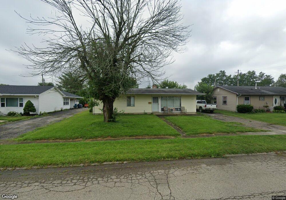
This home is located at 1317 Reid Ave, Xenia, OH 45385 and is currently estimated at $151,283, approximately $143 per square foot. 1317 Reid Ave is a home located in Greene County with nearby schools including Xenia High School, Summit Academy Community School for Alternative Learners - Xenia, and Legacy Christian Academy.
Ownership History
Date
Name
Owned For
Owner Type
Purchase Details
Closed on
Dec 19, 2014
Sold by
Hood Lorrie A and Hood Lonnie G
Bought by
Hood Lorrie A
Current Estimated Value
Purchase Details
Closed on
Mar 15, 2012
Sold by
Mcmanus Effie O and Mcmanus Elwood R
Bought by
Wood Lonnie G
Home Financials for this Owner
Home Financials are based on the most recent Mortgage that was taken out on this home.
Original Mortgage
$43,200
Outstanding Balance
$5,540
Interest Rate
3.9%
Mortgage Type
New Conventional
Estimated Equity
$145,743
Create a Home Valuation Report for This Property
The Home Valuation Report is an in-depth analysis detailing your home's value as well as a comparison with similar homes in the area
Home Values in the Area
Average Home Value in this Area
Purchase History
| Date | Buyer | Sale Price | Title Company |
|---|---|---|---|
| Hood Lorrie A | -- | None Available | |
| Wood Lonnie G | $54,000 | None Available |
Source: Public Records
Mortgage History
| Date | Status | Borrower | Loan Amount |
|---|---|---|---|
| Open | Wood Lonnie G | $43,200 |
Source: Public Records
Tax History Compared to Growth
Tax History
| Year | Tax Paid | Tax Assessment Tax Assessment Total Assessment is a certain percentage of the fair market value that is determined by local assessors to be the total taxable value of land and additions on the property. | Land | Improvement |
|---|---|---|---|---|
| 2024 | $1,661 | $38,810 | $10,050 | $28,760 |
| 2023 | $1,661 | $38,810 | $10,050 | $28,760 |
| 2022 | $1,380 | $27,500 | $7,180 | $20,320 |
| 2021 | $1,398 | $27,500 | $7,180 | $20,320 |
| 2020 | $1,340 | $27,500 | $7,180 | $20,320 |
| 2019 | $1,104 | $21,340 | $4,870 | $16,470 |
| 2018 | $637 | $21,340 | $4,870 | $16,470 |
| 2017 | $582 | $21,340 | $4,870 | $16,470 |
| 2016 | $583 | $20,060 | $4,870 | $15,190 |
| 2015 | $584 | $20,060 | $4,870 | $15,190 |
| 2014 | $559 | $20,060 | $4,870 | $15,190 |
Source: Public Records
Map
Nearby Homes
- 1283 June Dr
- 1233 June Dr
- 1223 June Dr
- 1391 June Dr
- 1342 Kylemore Dr
- 343 Sheelin Rd
- 1351 Omard Dr
- 912 Omard Dr
- 883 Omard Dr
- 1144 Rockwell Dr
- 509 Antrim Rd
- 121 S Progress Dr
- 305-325 Bellbrook Ave
- 1568 Cheyenne Dr
- 1208 Bellbrook Ave
- 453 Walnut St
- 1618 Navajo Dr
- 1272 Bellbrook Ave
- 613 N West St
- 0 W Church St