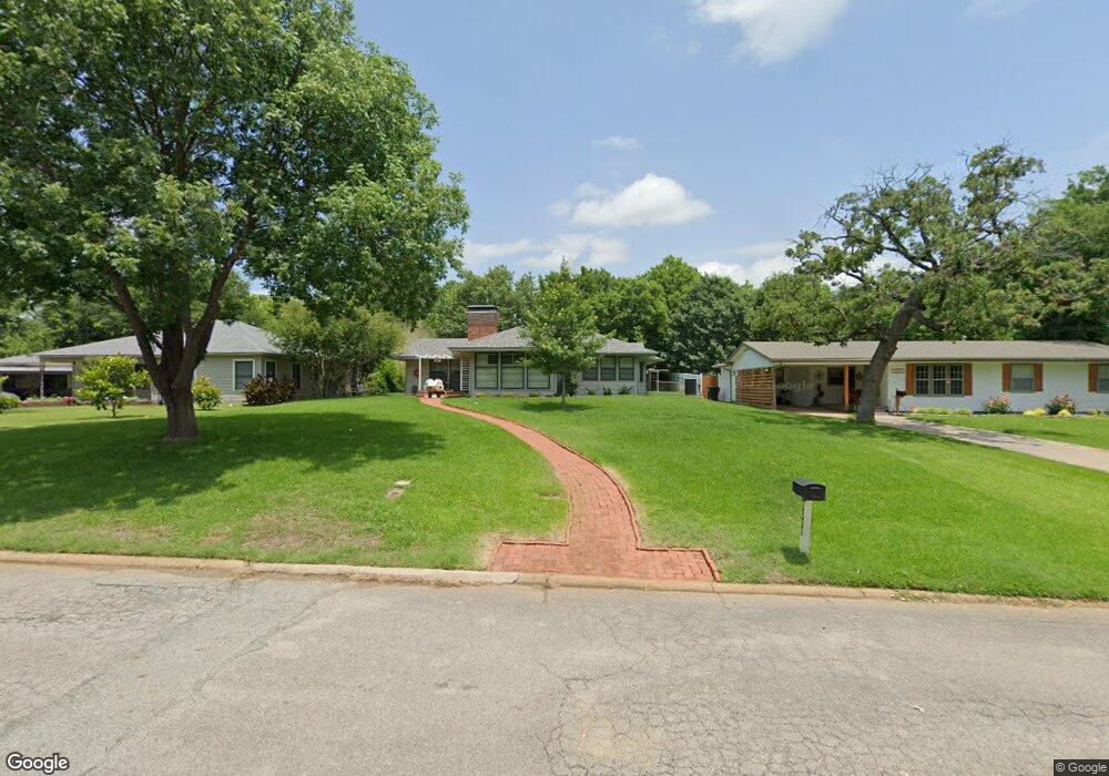
1317 W Munson St Denison, TX 75020
Estimated Value: $210,167 - $260,000
2
Beds
1
Bath
1,904
Sq Ft
$123/Sq Ft
Est. Value
About This Home
This home is located at 1317 W Munson St, Denison, TX 75020 and is currently estimated at $235,084, approximately $123 per square foot. 1317 W Munson St is a home located in Grayson County with nearby schools including Houston Elementary School, Scott Middle School, and Denison High School.
Ownership History
Date
Name
Owned For
Owner Type
Purchase Details
Closed on
May 22, 2014
Sold by
Pyburn William and Pyburn Brittany
Bought by
Work Jim and Work Susan W
Current Estimated Value
Purchase Details
Closed on
May 9, 2014
Sold by
Rowland Nancy Anne
Bought by
Pyburn William
Purchase Details
Closed on
Dec 18, 2013
Sold by
Rowland Nancy Anne and Carder John Wesley
Bought by
Pyburn William
Create a Home Valuation Report for This Property
The Home Valuation Report is an in-depth analysis detailing your home's value as well as a comparison with similar homes in the area
Home Values in the Area
Average Home Value in this Area
Purchase History
| Date | Buyer | Sale Price | Title Company |
|---|---|---|---|
| Work Jim | -- | Red River Title Co | |
| Pyburn William | -- | Red River Title Co | |
| Pyburn William | -- | None Available |
Source: Public Records
Tax History Compared to Growth
Tax History
| Year | Tax Paid | Tax Assessment Tax Assessment Total Assessment is a certain percentage of the fair market value that is determined by local assessors to be the total taxable value of land and additions on the property. | Land | Improvement |
|---|---|---|---|---|
| 2025 | $762 | $195,942 | -- | -- |
| 2024 | $4,139 | $178,129 | $0 | $0 |
| 2023 | $762 | $161,935 | $0 | $0 |
| 2022 | $3,498 | $147,214 | $0 | $0 |
| 2021 | $3,375 | $133,831 | $21,488 | $112,343 |
| 2020 | $3,455 | $130,978 | $21,488 | $109,490 |
| 2019 | $3,367 | $132,880 | $21,488 | $111,392 |
| 2018 | $3,085 | $116,757 | $16,875 | $99,882 |
| 2017 | $2,829 | $114,963 | $13,275 | $101,688 |
| 2016 | $2,572 | $113,919 | $13,043 | $100,876 |
| 2015 | $1,415 | $99,901 | $13,043 | $86,858 |
| 2014 | $2,123 | $75,146 | $13,043 | $62,103 |
Source: Public Records
Map
Nearby Homes
- 1315 W Hull St
- 1224 W Nelson St
- 1131 W Shepherd St
- 1217 W Nelson St
- 1508 W Shepherd St
- 501 S Eddy Ave
- 1109 S Chandler Ave
- 1319 W Morgan St
- 1127 W Morgan St
- 919 W Day St
- 1120 W Owing St
- 1223 W Owing St
- 901 W Munson St
- 904 W Shepherd St
- 1007 S Scullin Ave
- 1326 W Crawford St
- 830 W Shepherd St
- 920 W Morgan St
- 1730 W Hull St
- 1510 W Heron St
- 1311 W Munson St
- 1329 W Munson St
- 1331 W Munson St
- 815 S Eddy Ave
- 1318 W Day St
- 1312 W Day St
- 1322 W Day St
- 1306 W Day St
- 1326 W Munson St
- 1330 W Day St
- 1312 W Munson St
- 1300 W Day St
- 1330 W Munson St
- 1300 W Munson St
- 1231 W Munson St
- 809 S Brown Ave
- 1400 W Day St
- 1230 W Day St
- 1420 W Munson St
- 1227 W Munson St