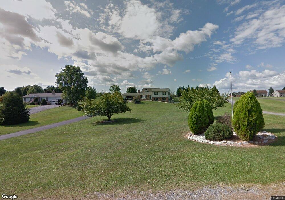
13176 Independence Rd Clear Spring, MD 21722
Estimated Value: $334,373 - $560,000
Studio
2
Baths
2,028
Sq Ft
$212/Sq Ft
Est. Value
About This Home
This home is located at 13176 Independence Rd, Clear Spring, MD 21722 and is currently estimated at $429,593, approximately $211 per square foot. 13176 Independence Rd is a home located in Washington County with nearby schools including Clear Spring Elementary School, Clear Spring Middle School, and Clear Spring High School.
Ownership History
Date
Name
Owned For
Owner Type
Purchase Details
Closed on
Sep 3, 2003
Sold by
Socks Diana L
Bought by
Keyser Richard E and Keyser Diana L
Current Estimated Value
Purchase Details
Closed on
Nov 13, 1998
Sold by
Socks Gregroy L and Socks Diana L
Bought by
Socks Diana L
Purchase Details
Closed on
Apr 19, 1990
Sold by
Gossard Michael W and Gossard Laura S
Bought by
Socks Gregroy L and Socks Diana L
Create a Home Valuation Report for This Property
The Home Valuation Report is an in-depth analysis detailing your home's value as well as a comparison with similar homes in the area
Purchase History
| Date | Buyer | Sale Price | Title Company |
|---|---|---|---|
| Keyser Richard E | -- | -- | |
| Socks Diana L | -- | -- | |
| Socks Gregroy L | $25,000 | -- |
Source: Public Records
Tax History
| Year | Tax Paid | Tax Assessment Tax Assessment Total Assessment is a certain percentage of the fair market value that is determined by local assessors to be the total taxable value of land and additions on the property. | Land | Improvement |
|---|---|---|---|---|
| 2025 | $1,947 | $233,033 | $0 | $0 |
| 2024 | $1,947 | $202,867 | $0 | $0 |
| 2023 | $1,848 | $172,700 | $55,500 | $117,200 |
| 2022 | $1,822 | $170,200 | $0 | $0 |
| 2021 | $975 | $167,700 | $0 | $0 |
| 2020 | $1,803 | $165,200 | $55,500 | $109,700 |
| 2019 | $1,811 | $165,200 | $55,500 | $109,700 |
| 2018 | $1,811 | $165,200 | $55,500 | $109,700 |
| 2017 | $1,962 | $179,400 | $0 | $0 |
| 2016 | -- | $179,400 | $0 | $0 |
| 2015 | $1,676 | $179,400 | $0 | $0 |
| 2014 | $1,676 | $191,500 | $0 | $0 |
Source: Public Records
Map
Nearby Homes
- 15642 Deer Lodge Dr
- 0 Walnut Point W
- 13638 Creek View Dr
- 13643 Creek View Dr
- 0 Pinehill Dr
- 0 Rockdale Rd
- 13726 Hopps Landing Rd
- 13224 Greencastle Pike
- 14312 Gossard Mill Rd
- 16512 National Pike
- 15954 Hosta Dr
- 71 Charlotte St
- 14521 Fairview Hill Ln
- 11701 Walnut Point Rd
- 13100 Saint Paul Rd
- 13824 Broadfording Church Rd
- 11625 Walnut Point Rd
- 13656 Greencastle Pike
- 17038 Broadfording Rd
- 14906 Clear Spring Rd
- 13170 Independence Rd
- 13180 Independence Rd
- 13204 Independence Rd
- 13171 Independence Rd
- 13162 Independence Rd
- 13202 Independence Rd
- 13203 Independence Rd
- 13156 Independence Rd
- 13152 Independence Rd
- 13217 Independence Rd
- 13216 Independence Rd
- 13161 Independence Rd
- 13129 Independence Rd
- 13150 Independence Rd
- 13144 Independence Rd
- 13222 Independence Rd
- 13229 Independence Rd
- 13138 Independence Rd
- 13226 Independence Rd
- 13102 Goldizen Ln
Your Personal Tour Guide
Ask me questions while you tour the home.