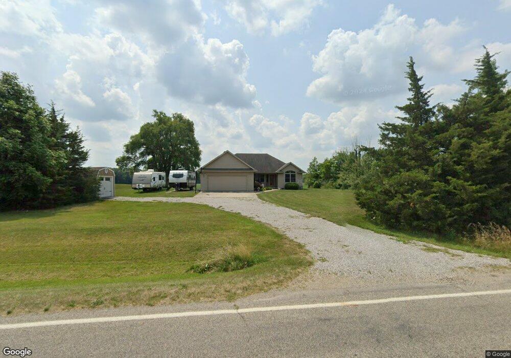
13179 Broom Rd Waldron, MI 49288
Estimated Value: $231,000 - $254,000
3
Beds
2
Baths
1,615
Sq Ft
$151/Sq Ft
Est. Value
About This Home
This home is located at 13179 Broom Rd, Waldron, MI 49288 and is currently estimated at $243,436, approximately $150 per square foot. 13179 Broom Rd is a home located in Hillsdale County with nearby schools including Waldron High School and Waldron Elementary School.
Ownership History
Date
Name
Owned For
Owner Type
Purchase Details
Closed on
Jul 11, 2025
Sold by
Emens Family Trust and Emens Jodi
Bought by
Hahn David and Hahn Pamela
Current Estimated Value
Home Financials for this Owner
Home Financials are based on the most recent Mortgage that was taken out on this home.
Original Mortgage
$176,250
Outstanding Balance
$175,952
Interest Rate
6.85%
Mortgage Type
New Conventional
Estimated Equity
$67,484
Purchase Details
Closed on
Dec 13, 2024
Sold by
Emens Jodi M
Bought by
Emens Family Trust and Emens
Purchase Details
Closed on
Dec 18, 2003
Sold by
Gallippo Nicky D
Bought by
Emens Mathew D and Emens Jodi M
Purchase Details
Closed on
Sep 16, 2002
Sold by
Makula Ed G
Bought by
Gallippo Nicky D
Create a Home Valuation Report for This Property
The Home Valuation Report is an in-depth analysis detailing your home's value as well as a comparison with similar homes in the area
Purchase History
| Date | Buyer | Sale Price | Title Company |
|---|---|---|---|
| Hahn David | $235,000 | None Listed On Document | |
| Hahn David | $235,000 | None Listed On Document | |
| Emens Family Trust | -- | None Listed On Document | |
| Emens Family Trust | -- | None Listed On Document | |
| Emens Mathew D | $14,000 | -- | |
| Gallippo Nicky D | $11,000 | -- |
Source: Public Records
Mortgage History
| Date | Status | Borrower | Loan Amount |
|---|---|---|---|
| Open | Hahn David | $176,250 | |
| Closed | Hahn David | $176,250 |
Source: Public Records
Tax History
| Year | Tax Paid | Tax Assessment Tax Assessment Total Assessment is a certain percentage of the fair market value that is determined by local assessors to be the total taxable value of land and additions on the property. | Land | Improvement |
|---|---|---|---|---|
| 2025 | $471 | $109,700 | $0 | $0 |
| 2024 | $5 | $101,700 | $0 | $0 |
| 2023 | $437 | $79,100 | $0 | $0 |
| 2022 | $1,144 | $62,800 | $0 | $0 |
| 2021 | $1,126 | $60,900 | $0 | $0 |
| 2020 | $1,024 | $45,000 | $0 | $0 |
| 2019 | $986 | $38,600 | $0 | $0 |
| 2018 | $941 | $45,800 | $0 | $0 |
| 2017 | $907 | $47,800 | $0 | $0 |
| 2016 | $900 | $33,600 | $0 | $0 |
| 2015 | $368 | $33,600 | $0 | $0 |
| 2013 | $399 | $36,400 | $0 | $0 |
| 2012 | $404 | $36,880 | $0 | $0 |
Source: Public Records
Map
Nearby Homes
- 0 Lee Rd
- 400 S Main St
- 126 S Main St
- 413 W Center St
- 10800 South Rd
- 14191 Lickley Rd
- 0 Willow Trace Dr Unit 26008895
- 13854 Emens Dr
- 13764 Emens Dr
- 203 College St
- 301 E Spring St
- 310 Irene Ct
- 404 S Fayette St
- 35 Rehn Dr
- Lot 35 of Rehn Dr
- 13151 Tripp Rd
- 21695 US Hwy 20
- 7100 S Waldron Rd
- 14940 Medina Rd
- 645 S Meridian Rd
- 13251 Broom Rd
- 13091 Broom Rd
- 13060 Broom Rd
- 14211 Coman Rd
- 12891 Broom Rd
- 13521 Broom Rd
- 13521 Broom Rd Unit A
- 14511 Coman Rd
- 13655 Broom Rd
- 14751 Coman Rd
- 13703 Broom Rd
- 13800 Broom Rd
- 14071 Lee Rd
- 14160 Lee Rd
- 13911 Broom Rd
- 354 Church St
- 349 Church St
- 345 Church St
- 13511 Seeley Rd
- 14031 Broom Rd
Your Personal Tour Guide
Ask me questions while you tour the home.