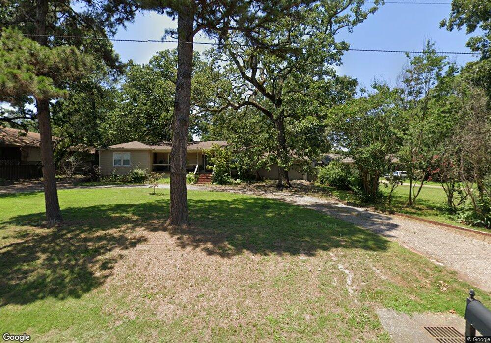
1318 Burnham Rd Fort Smith, AR 72903
Estimated Value: $208,000 - $246,000
About This Home
This home is located at 1318 Burnham Rd, Fort Smith, AR 72903 and is currently estimated at $223,834, approximately $95 per square foot. 1318 Burnham Rd is a home located in Sebastian County with nearby schools including Euper Lane Elementary School, L.A. Chaffin Junior High School, and Southside High School.
Ownership History
We collect this data history from publicly available records. To have your information removed, we recommend requesting removal directly through your county’s website.
Purchase Details
Home Financials for this Owner
Home Financials are based on the most recent Mortgage that was taken out on this home.Purchase Details
Home Values in the Area
Average Home Value in this Area
Purchase History
We collect this data history from publicly available records. To have your information removed, we recommend requesting removal directly through your county’s website.
| Date | Buyer | Sale Price | Title Company |
|---|---|---|---|
| $230,000 | Guaranty Abstract | ||
| -- | None Available |
Mortgage History
We collect this data history from publicly available records. To have your information removed, we recommend requesting removal directly through your county’s website.
| Date | Status | Borrower | Loan Amount |
|---|---|---|---|
| Closed | $110,000 |
Tax History
We collect this data history from publicly available records. To have your information removed, we recommend requesting removal directly through your county’s website.
| Year | Tax Paid | Tax Assessment Tax Assessment Total Assessment is a certain percentage of the fair market value that is determined by local assessors to be the total taxable value of land and additions on the property. | Land | Improvement |
|---|---|---|---|---|
| 2025 | $1,906 | $41,854 | $5,280 | $36,574 |
| 2024 | $1,641 | $31,260 | $3,840 | $27,420 |
| 2023 | $1,390 | $31,260 | $3,840 | $27,420 |
| 2022 | $1,440 | $31,260 | $3,840 | $27,420 |
| 2021 | $1,440 | $31,260 | $3,840 | $27,420 |
| 2020 | $1,362 | $31,260 | $3,840 | $27,420 |
| 2019 | $1,280 | $28,500 | $3,840 | $24,660 |
| 2018 | $1,305 | $28,500 | $3,840 | $24,660 |
| 2017 | $993 | $25,580 | $3,840 | $21,740 |
| 2016 | $1,343 | $25,580 | $3,840 | $21,740 |
| 2015 | $1,343 | $25,580 | $3,840 | $21,740 |
| 2014 | $1,090 | $27,420 | $5,280 | $22,140 |
Map
- 6001 Bolton Rd
- 5600 Elmwood Place
- 6000 Euper Ln
- 5701 Free Ferry Rd Unit 34
- 5701 Free Ferry Rd Unit 12
- 5324 Labelle Ct
- 215 N 57th St
- 5325 Free Ferry Rd
- 6912 Duncan Cir
- 901 S 68th Ln
- 12 Eastwood Dr
- 2213 S 66th St
- 5717 Park Ave
- 6004 S Y St
- 2100 S 70th St
- 5112 Park Ave
- 1112 Autumn Oaks Ln
- 6501 Rogers Ave
- 2606 S 57th St
- 7215 Kensington Ct
- 1401 Burnham Ct
- 1405 Burnham Ct
- 1409 Burnham Ct
- 1400 Burnham Ct
- 1404 Burnham Ct
- 1310 Burnham Rd
- 1413 Burnham Ct
- 1408 Burnham Ct
- 1421 Burnham Rd
- 1317 Burnham Rd
- 1300 Burnham Rd
- 1412 Burnham Ct
- 5824 Gordon Ln
- 1309 Burnham Rd
- 1523 Burnham Rd
- 5920 Gordon Ln
- 5823 Duncan Rd
- 5822 Gordon Ln
- 1301 Burnham Rd
- 5820 Gordon Ln
Ask me questions while you tour the home.