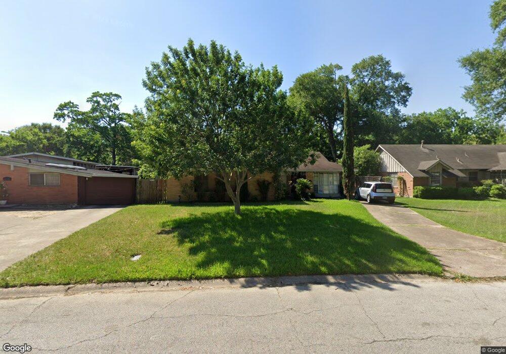
1318 W 31st St Houston, TX 77018
Oak Forest-Garden Oaks NeighborhoodEstimated Value: $419,000 - $499,609
3
Beds
2
Baths
1,437
Sq Ft
$323/Sq Ft
Est. Value
About This Home
This home is located at 1318 W 31st St, Houston, TX 77018 and is currently estimated at $464,652, approximately $323 per square foot. 1318 W 31st St is a home located in Harris County with nearby schools including Garden Oaks Montessori, Frank Black Middle School, and Waltrip High School.
Ownership History
Date
Name
Owned For
Owner Type
Purchase Details
Closed on
Jun 15, 1999
Sold by
Bradshaw Everett W and Bradshaw Kathryn D
Bought by
Salinas Aaron
Current Estimated Value
Home Financials for this Owner
Home Financials are based on the most recent Mortgage that was taken out on this home.
Original Mortgage
$77,418
Outstanding Balance
$21,176
Interest Rate
7.5%
Mortgage Type
VA
Estimated Equity
$443,476
Purchase Details
Closed on
Mar 24, 1994
Sold by
Bradshaw Everett and Bradshaw Georgia Dale
Bought by
Bradshaw Everett W and Bradshaw Kathryn D
Create a Home Valuation Report for This Property
The Home Valuation Report is an in-depth analysis detailing your home's value as well as a comparison with similar homes in the area
Home Values in the Area
Average Home Value in this Area
Purchase History
| Date | Buyer | Sale Price | Title Company |
|---|---|---|---|
| Salinas Aaron | -- | Regency Title | |
| Bradshaw Everett W | -- | -- |
Source: Public Records
Mortgage History
| Date | Status | Borrower | Loan Amount |
|---|---|---|---|
| Open | Salinas Aaron | $77,418 |
Source: Public Records
Tax History Compared to Growth
Tax History
| Year | Tax Paid | Tax Assessment Tax Assessment Total Assessment is a certain percentage of the fair market value that is determined by local assessors to be the total taxable value of land and additions on the property. | Land | Improvement |
|---|---|---|---|---|
| 2025 | $6,424 | $503,284 | $441,720 | $61,564 |
| 2024 | $6,424 | $461,172 | $441,720 | $19,452 |
| 2023 | $6,424 | $403,182 | $386,505 | $16,677 |
| 2022 | $7,914 | $359,413 | $331,290 | $28,123 |
| 2021 | $8,173 | $350,660 | $276,075 | $74,585 |
| 2020 | $7,991 | $330,000 | $276,075 | $53,925 |
| 2019 | $8,267 | $326,706 | $276,075 | $50,631 |
| 2018 | $6,137 | $357,033 | $276,075 | $80,958 |
| 2017 | $7,275 | $357,033 | $276,075 | $80,958 |
| 2016 | $6,613 | $357,033 | $276,075 | $80,958 |
| 2015 | $4,289 | $348,000 | $276,075 | $71,925 |
| 2014 | $4,289 | $239,668 | $165,645 | $74,023 |
Source: Public Records
Map
Nearby Homes
- 1235 Ansbury Dr
- 1226 Stonecrest Dr
- 2634 Couch St
- 1413 W 26th St
- 2609 Bevis St
- 2667 Shady Acres Landing
- 1119 W 30th St
- 2505 Couch St Unit A
- 1635 Wilde Rock Way
- 2543 Bevis St
- 1427 W 25th St
- 2623 Shady Woods Ln
- 1348 W 25th St
- 1240 W 26th St
- 1360 W 25th St
- 1115 Gardendale Dr
- The Austin Plan at Park View
- The Bennett Plan at Park View
- 1424 W 34th 1/2 St
- 1414 W 34th 1/2 St
- 1314 W 31st St
- 1322 W 31st St
- 1310 W 31st St
- 1326 W 31st St
- 1319 Ansbury Dr
- 1315 Ansbury Dr
- 1323 Ansbury Dr
- 1311 Ansbury Dr
- 1306 W 31st St
- 1403 Ansbury Dr
- 1307 Ansbury Dr
- 1321 W 31st St
- 1315 W 31st St
- 1407 Ansbury Dr
- 1303 Ansbury Dr
- 1242 W 30th St
- 1302 W 31st St
- 1243 W 30th St
- 1402 Wilde Rock Way
- 1411 Ansbury Dr
