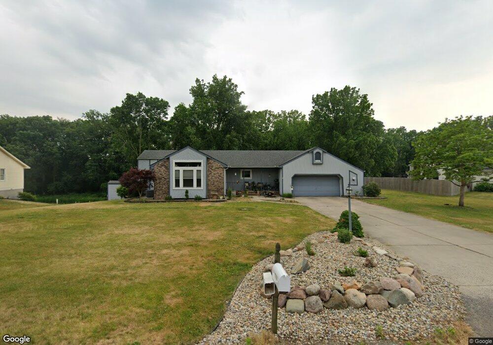
13183 Nutmeg Ridge Dr Plymouth, IN 46563
Estimated Value: $273,000 - $352,000
3
Beds
3
Baths
1,236
Sq Ft
$257/Sq Ft
Est. Value
About This Home
This home is located at 13183 Nutmeg Ridge Dr, Plymouth, IN 46563 and is currently estimated at $317,942, approximately $257 per square foot. 13183 Nutmeg Ridge Dr is a home located in Marshall County with nearby schools including Plymouth High School, St. Michael School, and St. Michael's Catholic School.
Ownership History
Date
Name
Owned For
Owner Type
Purchase Details
Closed on
Mar 16, 2006
Sold by
Cendant Mobility Relocation Co
Bought by
Hill Marla M
Current Estimated Value
Home Financials for this Owner
Home Financials are based on the most recent Mortgage that was taken out on this home.
Original Mortgage
$133,000
Outstanding Balance
$75,875
Interest Rate
6.33%
Mortgage Type
New Conventional
Estimated Equity
$242,067
Purchase Details
Closed on
Mar 16, 2005
Sold by
Boudreau Thomas E and Boudreau Deborah A
Bought by
Cendant Mobility Relocation Co
Create a Home Valuation Report for This Property
The Home Valuation Report is an in-depth analysis detailing your home's value as well as a comparison with similar homes in the area
Home Values in the Area
Average Home Value in this Area
Purchase History
| Date | Buyer | Sale Price | Title Company |
|---|---|---|---|
| Hill Marla M | -- | None Available | |
| Cendant Mobility Relocation Co | -- | None Available |
Source: Public Records
Mortgage History
| Date | Status | Borrower | Loan Amount |
|---|---|---|---|
| Open | Hill Marla M | $133,000 |
Source: Public Records
Tax History Compared to Growth
Tax History
| Year | Tax Paid | Tax Assessment Tax Assessment Total Assessment is a certain percentage of the fair market value that is determined by local assessors to be the total taxable value of land and additions on the property. | Land | Improvement |
|---|---|---|---|---|
| 2024 | $1,730 | $238,400 | $47,000 | $191,400 |
| 2022 | $1,730 | $225,500 | $44,400 | $181,100 |
| 2021 | $1,517 | $186,000 | $36,400 | $149,600 |
| 2020 | $1,432 | $170,600 | $33,100 | $137,500 |
| 2019 | $1,324 | $163,700 | $31,800 | $131,900 |
| 2018 | $1,267 | $159,800 | $30,600 | $129,200 |
| 2017 | $1,149 | $160,600 | $30,600 | $130,000 |
| 2016 | $1,067 | $164,000 | $31,200 | $132,800 |
| 2014 | $1,020 | $152,500 | $29,800 | $122,700 |
Source: Public Records
Map
Nearby Homes
- 13163 Nutmeg Ridge Dr
- 13221 Nutmeg Ridge Dr
- 13184 Nutmeg Ridge Dr
- 13156 Nutmeg Ridge Dr
- 13145 Nutmeg Ridge Dr
- 10665 Kings Ct
- 13129 Nutmeg Ridge Dr
- 13122 Nutmeg Ridge Dr
- 13250 Nutmeg Ridge Dr
- 13245 Nutmeg Ridge Dr
- 10649 Kings Ct
- 10630 Kings Ct
- 13276 Nutmeg Ridge Dr
- 10600 Kings Ct
- 13101 Nutmeg Ridge Dr
- 10771 Muckshaw Rd
- 13298 Nutmeg Ridge Dr
- 10715 Muckshaw Rd
- 13073 Nutmeg Ridge Dr
- 10591 Kings Ct