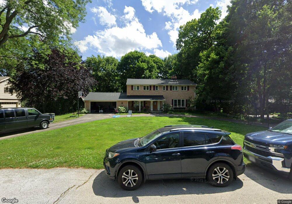
13185 Caroline Ct Elm Grove, WI 53122
Estimated Value: $815,000 - $1,079,000
4
Beds
2
Baths
3,139
Sq Ft
$288/Sq Ft
Est. Value
About This Home
This home is located at 13185 Caroline Ct, Elm Grove, WI 53122 and is currently estimated at $905,210, approximately $288 per square foot. 13185 Caroline Ct is a home located in Waukesha County with nearby schools including Tonawanda Elementary School, Pilgrim Park Middle School, and Brookfield East High School.
Ownership History
Date
Name
Owned For
Owner Type
Purchase Details
Closed on
Oct 21, 2024
Sold by
Coleman Jeffrey Edward and Coleman Meg Louise
Bought by
Coleman Family Trust and Coleman
Current Estimated Value
Purchase Details
Closed on
Mar 12, 2008
Sold by
Edward F & Elizabeth J Hanlon Revocable
Bought by
Coleman Jeff E and Coleman Meg L
Purchase Details
Closed on
May 17, 2001
Sold by
Hanlon Edward F and Hanlon Betty J
Bought by
Edward F & Elizabeth J Hanlon Revocable
Create a Home Valuation Report for This Property
The Home Valuation Report is an in-depth analysis detailing your home's value as well as a comparison with similar homes in the area
Home Values in the Area
Average Home Value in this Area
Purchase History
| Date | Buyer | Sale Price | Title Company |
|---|---|---|---|
| Coleman Family Trust | -- | None Listed On Document | |
| Coleman Jeff E | $550,000 | None Available | |
| Edward F & Elizabeth J Hanlon Revocable | -- | -- |
Source: Public Records
Tax History Compared to Growth
Tax History
| Year | Tax Paid | Tax Assessment Tax Assessment Total Assessment is a certain percentage of the fair market value that is determined by local assessors to be the total taxable value of land and additions on the property. | Land | Improvement |
|---|---|---|---|---|
| 2024 | $9,555 | $738,900 | $145,900 | $593,000 |
| 2023 | $8,823 | $624,600 | $115,400 | $509,200 |
| 2022 | $9,271 | $624,600 | $115,400 | $509,200 |
| 2021 | $9,067 | $538,100 | $115,400 | $422,700 |
| 2020 | $9,435 | $538,100 | $115,400 | $422,700 |
| 2019 | $9,035 | $491,300 | $115,400 | $375,900 |
| 2018 | $8,576 | $491,300 | $115,400 | $375,900 |
| 2017 | $8,430 | $449,000 | $112,000 | $337,000 |
| 2016 | $8,365 | $449,000 | $112,000 | $337,000 |
| 2015 | $7,723 | $415,000 | $112,000 | $303,000 |
| 2014 | $8,606 | $500,700 | $128,300 | $372,400 |
| 2013 | $8,606 | $461,200 | $132,100 | $329,100 |
Source: Public Records
Map
Nearby Homes
- 1660 Lindhurst Ct
- 1920 Fairhaven Blvd
- 13130 Watertown Plank Rd Unit 312
- 12855 Stephen Place
- 12675 W North Ave
- 14220 Hillside Rd
- 1239 N 122nd St
- 14625 Club Dr
- 13050 W Bluemound Rd Unit 303
- 13485 Braemar Dr
- 1409 N 116th St
- 12990 W Bluemound Rd Unit 205
- 11722 W Diane Dr
- 2415 Walnut Grove Ct Unit B
- 12455 W Center St
- 12207 W Bluemound Rd
- 12000 W Bluemound Rd Unit 111
- 13145 Kittridge Ct
- 540 Crystal Ln
- 744 N 115th St
- 13155 Caroline Ct
- 13205 Caroline Ct
- 13200 Oakhurst Dr
- 13240 Oakhurst Dr
- 13150 Oakhurst Dr
- 1635 Notre Dame Blvd
- 13220 Caroline Ct
- 13180 Caroline Ct
- 13150 Caroline Ct
- 1625 Notre Dame Blvd
- 13300 Oakhurst Dr
- 13200 Caroline Ct
- 1655 Notre Dame Blvd
- 1640 Lindhurst Ct
- 13330 Oakhurst Dr
- 13205 Oakhurst Dr
- 13155 Oakhurst Dr
- 13245 Oakhurst Dr
- 1650 Lindhurst Ct
- 1630 Notre Dame Blvd