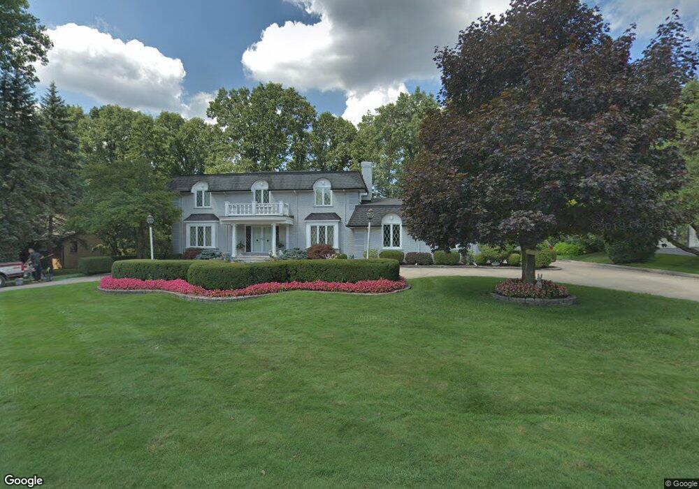
1319 Charrington Rd Bloomfield Hills, MI 48301
Estimated Value: $1,235,737 - $1,503,000
5
Beds
7
Baths
3,970
Sq Ft
$344/Sq Ft
Est. Value
About This Home
This home is located at 1319 Charrington Rd, Bloomfield Hills, MI 48301 and is currently estimated at $1,365,434, approximately $343 per square foot. 1319 Charrington Rd is a home located in Oakland County with nearby schools including Quarton Elementary, Ernest W. Seaholm High School, and Cranbrook School.
Ownership History
Date
Name
Owned For
Owner Type
Purchase Details
Closed on
Feb 20, 2025
Sold by
Morris William John and Mishura Irina
Bought by
William J Morris Ii Trust and Morris
Current Estimated Value
Purchase Details
Closed on
Mar 30, 1998
Sold by
Morris Ii William John
Bought by
Morris Ii William John
Home Financials for this Owner
Home Financials are based on the most recent Mortgage that was taken out on this home.
Original Mortgage
$357,800
Interest Rate
7.27%
Purchase Details
Closed on
Apr 15, 1997
Sold by
Household Finance Corp I
Bought by
Morris William John
Purchase Details
Closed on
Aug 30, 1994
Sold by
Shrf Edgardo L Perez Pr
Bought by
First Federal Of Michigan
Create a Home Valuation Report for This Property
The Home Valuation Report is an in-depth analysis detailing your home's value as well as a comparison with similar homes in the area
Home Values in the Area
Average Home Value in this Area
Purchase History
| Date | Buyer | Sale Price | Title Company |
|---|---|---|---|
| William J Morris Ii Trust | -- | None Listed On Document | |
| William J Morris Ii Trust | -- | None Listed On Document | |
| Morris Ii William John | -- | -- | |
| Morris William John | $400,000 | -- | |
| First Federal Of Michigan | $230,453 | -- |
Source: Public Records
Mortgage History
| Date | Status | Borrower | Loan Amount |
|---|---|---|---|
| Previous Owner | Morris Ii William John | $357,800 |
Source: Public Records
Tax History Compared to Growth
Tax History
| Year | Tax Paid | Tax Assessment Tax Assessment Total Assessment is a certain percentage of the fair market value that is determined by local assessors to be the total taxable value of land and additions on the property. | Land | Improvement |
|---|---|---|---|---|
| 2024 | $6,325 | $435,750 | $0 | $0 |
| 2023 | $6,070 | $377,650 | $0 | $0 |
| 2022 | $10,275 | $336,020 | $0 | $0 |
| 2021 | $10,361 | $323,180 | $0 | $0 |
| 2020 | $5,831 | $319,590 | $0 | $0 |
| 2019 | $10,344 | $339,930 | $0 | $0 |
| 2018 | $10,267 | $343,920 | $0 | $0 |
| 2017 | $10,262 | $335,000 | $0 | $0 |
| 2016 | $10,316 | $331,030 | $0 | $0 |
| 2015 | -- | $280,830 | $0 | $0 |
| 2014 | -- | $289,520 | $0 | $0 |
| 2011 | -- | $224,230 | $0 | $0 |
Source: Public Records
Map
Nearby Homes
- 1287 Charrington Rd
- 1348 Charrington Rd
- 5825 Lahser Rd
- 3546 Bloomfield Club Dr
- 596 Rudgate Rd
- 692 Bennington Dr
- 3320 Morningview Terrace
- 270 Martell Dr
- 2579 Amberly Rd
- 100 Overhill Rd
- 1019 N Cranbrook Rd
- 5741 Snowshoe Cir
- 231 Wadsworth Ln
- 6580 Red Maple Ln
- 6560 Red Maple Ln
- 956 Westwood Dr
- 4650 Lahser Rd
- 3627 Middlebury Ln
- 6727 Lahser Rd
- 1120 Lyonhurst St
- 3501 Maxwell Ct
- 1349 Charrington Rd
- 3500 Maxwell Ct
- 1318 Charrington Rd
- 3515 Maxwell Ct
- 3500 Darcy Dr
- 1286 Charrington Rd
- 3427 Sutton Place
- 3514 Darcy Dr
- 3522 Maxwell Ct
- 1315 Stuyvessant Rd
- 1379 Stuyvessant Rd
- 3467 Sutton Place Unit Bldg-Unit
- 3467 Sutton Place
- 3467 Sutton Place
- 1198 Hill Line Trail
- 1440 Stuyvessant Rd
- 3525 Maxwell Ct
- 1256 Charrington Rd
- 1285 Stuyvessant Rd