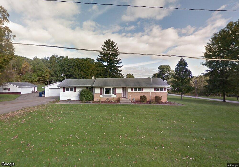
1319 Chew Rd Mansfield, OH 44903
Estimated Value: $220,000 - $292,000
3
Beds
2
Baths
2,160
Sq Ft
$121/Sq Ft
Est. Value
About This Home
This home is located at 1319 Chew Rd, Mansfield, OH 44903 and is currently estimated at $261,058, approximately $120 per square foot. 1319 Chew Rd is a home located in Richland County.
Ownership History
Date
Name
Owned For
Owner Type
Purchase Details
Closed on
Feb 1, 2018
Sold by
Remy Linda D and Remy Linda
Bought by
Stapleton Kristi A
Current Estimated Value
Purchase Details
Closed on
Jan 16, 2018
Sold by
Remy Linda and Hilborn Lois A
Bought by
Remy Linda
Purchase Details
Closed on
Dec 28, 2005
Sold by
Hilborn Lois A
Bought by
Remy Linda and Hilborn Robert F
Create a Home Valuation Report for This Property
The Home Valuation Report is an in-depth analysis detailing your home's value as well as a comparison with similar homes in the area
Home Values in the Area
Average Home Value in this Area
Purchase History
| Date | Buyer | Sale Price | Title Company |
|---|---|---|---|
| Stapleton Kristi A | $60,000 | Chicago Title | |
| Remy Linda | -- | None Available | |
| Remy Linda | -- | None Available |
Source: Public Records
Tax History Compared to Growth
Tax History
| Year | Tax Paid | Tax Assessment Tax Assessment Total Assessment is a certain percentage of the fair market value that is determined by local assessors to be the total taxable value of land and additions on the property. | Land | Improvement |
|---|---|---|---|---|
| 2024 | $2,906 | $59,880 | $8,940 | $50,940 |
| 2023 | $2,906 | $59,880 | $8,940 | $50,940 |
| 2022 | $2,553 | $46,710 | $7,990 | $38,720 |
| 2021 | $2,553 | $46,710 | $7,990 | $38,720 |
| 2020 | $2,572 | $46,710 | $7,990 | $38,720 |
| 2019 | $2,478 | $40,000 | $6,770 | $33,230 |
| 2018 | $1,811 | $40,000 | $6,770 | $33,230 |
| 2017 | $1,701 | $37,710 | $4,480 | $33,230 |
| 2016 | $1,758 | $38,670 | $4,250 | $34,420 |
| 2015 | $1,758 | $38,670 | $4,250 | $34,420 |
| 2014 | $1,670 | $38,670 | $4,250 | $34,420 |
| 2012 | $842 | $40,710 | $4,480 | $36,230 |
Source: Public Records
Map
Nearby Homes
- 1875 Mansfield Lucas Rd
- 929 Antionette Dr
- 0 State Route 39 & I-71 Southeast Quadrant
- 0 State Route 39 & I-71 Northeast Quadrant
- 1679 Pulver Rd
- 0 Woodville Rd Unit Lot 14952, 14953
- 0 Woodville Rd Unit Lot 14954, 14955
- 0 Woodville Rd Unit Lot 14956, 14957,
- 2061 Washington North Rd
- 794 Mansfield Washington Rd
- 716 Mansfield Washington Rd
- 36 Ridge Rd S
- 1135 E Hanley Rd
- 369 Davidson St
- 405 Plainview Ave
- 419 Pearl Ave
- 0 Mcelroy Rd
- 413 Ruby Ave
- 953 Park Ave E
- 76 Ford Rd N