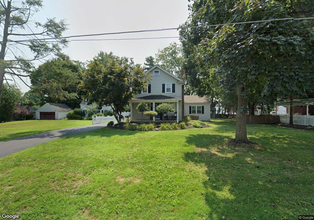
1319 Dill Rd Havertown, PA 19083
Estimated Value: $581,008 - $691,000
4
Beds
2
Baths
1,800
Sq Ft
$351/Sq Ft
Est. Value
About This Home
This home is located at 1319 Dill Rd, Havertown, PA 19083 and is currently estimated at $631,502, approximately $350 per square foot. 1319 Dill Rd is a home located in Delaware County with nearby schools including Manoa Elementary School, Haverford Middle School, and Haverford Senior High School.
Ownership History
Date
Name
Owned For
Owner Type
Purchase Details
Closed on
Jul 8, 2009
Sold by
Buongiorno Michael J and Buongiorno Linda S
Bought by
Buckton Thomas and Buckton Kelly A
Current Estimated Value
Home Financials for this Owner
Home Financials are based on the most recent Mortgage that was taken out on this home.
Original Mortgage
$250,001
Outstanding Balance
$164,159
Interest Rate
5.43%
Mortgage Type
New Conventional
Estimated Equity
$467,343
Create a Home Valuation Report for This Property
The Home Valuation Report is an in-depth analysis detailing your home's value as well as a comparison with similar homes in the area
Home Values in the Area
Average Home Value in this Area
Purchase History
| Date | Buyer | Sale Price | Title Company |
|---|---|---|---|
| Buckton Thomas | $359,000 | None Available |
Source: Public Records
Mortgage History
| Date | Status | Borrower | Loan Amount |
|---|---|---|---|
| Open | Buckton Thomas | $250,001 |
Source: Public Records
Tax History Compared to Growth
Tax History
| Year | Tax Paid | Tax Assessment Tax Assessment Total Assessment is a certain percentage of the fair market value that is determined by local assessors to be the total taxable value of land and additions on the property. | Land | Improvement |
|---|---|---|---|---|
| 2025 | $9,193 | $357,520 | $112,050 | $245,470 |
| 2024 | $9,193 | $357,520 | $112,050 | $245,470 |
| 2023 | $8,932 | $357,520 | $112,050 | $245,470 |
| 2022 | $8,723 | $357,520 | $112,050 | $245,470 |
| 2021 | $12,524 | $315,080 | $112,050 | $203,030 |
| 2020 | $7,156 | $153,960 | $153,960 | $0 |
| 2019 | $7,024 | $153,960 | $153,960 | $0 |
| 2018 | $6,903 | $153,960 | $0 | $0 |
| 2017 | $6,757 | $153,960 | $0 | $0 |
| 2016 | $845 | $153,960 | $0 | $0 |
| 2015 | $862 | $153,960 | $0 | $0 |
| 2014 | $845 | $153,960 | $0 | $0 |
Source: Public Records
Map
Nearby Homes
- 1311 Steel Rd
- 137 Friendship Rd
- 141 Friendship Rd
- 181 Friendship Rd
- 505 Glendale Rd
- 1208 Belfield Ave
- 541 Glendale Rd
- 5053 Sylvia Rd
- 5042 Sylvia Rd
- 555 Grand Ave
- 5015 Smithfield Rd
- 1372 Dermond Rd
- 400 Glendale Rd Unit K52
- 400 Glendale Rd Unit E 13
- 635 Grand Ave
- 1102 Childs Ave
- 1113 Drexel Ave
- 5265 Apache Ln
- 1005 Belfield Ave
- 914 Anderson Ave