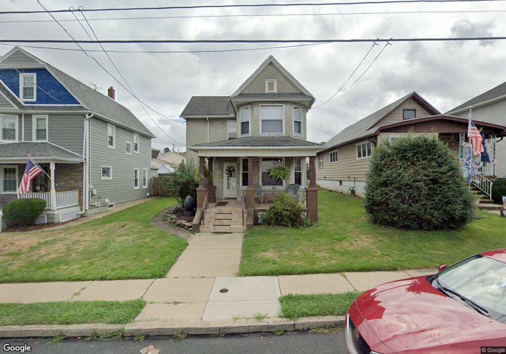
1319 Dorothy St Scranton, PA 18504
Hyde Park NeighborhoodEstimated Value: $162,474 - $209,000
3
Beds
1
Bath
1,400
Sq Ft
$138/Sq Ft
Est. Value
About This Home
This home is located at 1319 Dorothy St, Scranton, PA 18504 and is currently estimated at $192,619, approximately $137 per square foot. 1319 Dorothy St is a home located in Lackawanna County with nearby schools including Longan Elementary School, Adams Elementary School, and Isaac Tripp Elementary School.
Ownership History
Date
Name
Owned For
Owner Type
Purchase Details
Closed on
Aug 20, 2008
Sold by
Barrasse Michael J and Barrasse Linda
Bought by
Salvaggio Patrick J and Salvaggio Carla M
Current Estimated Value
Home Financials for this Owner
Home Financials are based on the most recent Mortgage that was taken out on this home.
Original Mortgage
$98,948
Outstanding Balance
$65,165
Interest Rate
6.4%
Mortgage Type
FHA
Estimated Equity
$127,454
Create a Home Valuation Report for This Property
The Home Valuation Report is an in-depth analysis detailing your home's value as well as a comparison with similar homes in the area
Home Values in the Area
Average Home Value in this Area
Purchase History
| Date | Buyer | Sale Price | Title Company |
|---|---|---|---|
| Salvaggio Patrick J | $100,750 | None Available |
Source: Public Records
Mortgage History
| Date | Status | Borrower | Loan Amount |
|---|---|---|---|
| Open | Salvaggio Patrick J | $98,948 |
Source: Public Records
Tax History Compared to Growth
Tax History
| Year | Tax Paid | Tax Assessment Tax Assessment Total Assessment is a certain percentage of the fair market value that is determined by local assessors to be the total taxable value of land and additions on the property. | Land | Improvement |
|---|---|---|---|---|
| 2025 | $3,130 | $10,000 | $1,150 | $8,850 |
| 2024 | $2,855 | $10,000 | $1,150 | $8,850 |
| 2023 | $2,855 | $10,000 | $1,150 | $8,850 |
| 2022 | $2,792 | $10,000 | $1,150 | $8,850 |
| 2021 | $2,792 | $10,000 | $1,150 | $8,850 |
| 2020 | $2,738 | $10,000 | $1,150 | $8,850 |
| 2019 | $2,574 | $10,000 | $1,150 | $8,850 |
| 2018 | $2,574 | $10,000 | $1,150 | $8,850 |
| 2017 | $2,527 | $10,000 | $1,150 | $8,850 |
| 2016 | $715 | $10,000 | $1,150 | $8,850 |
| 2015 | $1,552 | $10,000 | $1,150 | $8,850 |
| 2014 | -- | $10,000 | $1,150 | $8,850 |
Source: Public Records
Map
Nearby Homes
- 1431 Dorothy St
- 991 N Sumner Ave Unit 1/2 L 13
- 1425 Bulwer St
- 1126 W Gibson St
- 1501 Farr St
- 1008 Mount Vernon Ave
- 1727 Dorothy St
- 833 Powderly Ct
- 1327 Oram St
- 1235 N Sumner Ave
- 116 Little Spike Way Unit L 40
- 638 N Lincoln Ave
- 942 Providence Rd
- 1227 Providence Rd
- 938 Providence Rd
- 0 Philo St Unit GSBSC4763
- 602 604 N Lincoln Ave
- 1102 Pettibone St
- 656 Philo St
- 2133 Dorothy St
- 1321 Dorothy St
- 1313 Dorothy St
- 1323 Dorothy St
- 1309 Dorothy St
- 1307 Dorothy St
- 1327 Dorothy St
- 1318 Farr St
- 1314 Farr St
- 1318 Dorothy St
- 1322 Farr St
- 1303 Dorothy St
- 1312 Farr St
- 1326 Farr St
- 1312 Dorothy St
- 1310 Farr St
- 1340 Dorothy St Unit 42
- 1138 Farr St
- 1328 Farr St Unit 1330
- 1344 Dorothy St
- 1401 Dorothy St Unit 1403