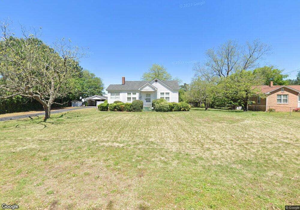
1319 Omarest Dr Columbia, SC 29210
Saint Andrews NeighborhoodEstimated Value: $195,615
2
Beds
2
Baths
1,760
Sq Ft
$111/Sq Ft
Est. Value
About This Home
This home is located at 1319 Omarest Dr, Columbia, SC 29210 and is currently estimated at $195,615, approximately $111 per square foot. 1319 Omarest Dr is a home located in Richland County with nearby schools including H. B. Rhame Elementary School, St. Andrews Middle School, and Columbia High School.
Ownership History
Date
Name
Owned For
Owner Type
Purchase Details
Closed on
May 12, 2022
Sold by
Munn James F
Bought by
Harvey Uyless O
Current Estimated Value
Home Financials for this Owner
Home Financials are based on the most recent Mortgage that was taken out on this home.
Original Mortgage
$8,000
Outstanding Balance
$7,555
Interest Rate
5.09%
Estimated Equity
$188,060
Purchase Details
Closed on
Apr 25, 2022
Sold by
Munn Jean A
Bought by
Munn James F
Home Financials for this Owner
Home Financials are based on the most recent Mortgage that was taken out on this home.
Original Mortgage
$8,000
Outstanding Balance
$7,555
Interest Rate
5.09%
Estimated Equity
$188,060
Purchase Details
Closed on
Sep 4, 2001
Sold by
Amick Ruby B
Bought by
Munn James F and Munn Jean A
Home Financials for this Owner
Home Financials are based on the most recent Mortgage that was taken out on this home.
Original Mortgage
$95,000
Interest Rate
7.02%
Mortgage Type
Commercial
Purchase Details
Closed on
Jan 31, 2001
Sold by
Smith Margaret C
Bought by
Amick Ruby A
Create a Home Valuation Report for This Property
The Home Valuation Report is an in-depth analysis detailing your home's value as well as a comparison with similar homes in the area
Home Values in the Area
Average Home Value in this Area
Purchase History
| Date | Buyer | Sale Price | Title Company |
|---|---|---|---|
| Harvey Uyless O | $165,000 | None Listed On Document | |
| Munn James F | -- | None Listed On Document | |
| Munn James F | $117,000 | -- | |
| Amick Ruby A | -- | -- |
Source: Public Records
Mortgage History
| Date | Status | Borrower | Loan Amount |
|---|---|---|---|
| Open | Harvey Uyless O | $8,000 | |
| Open | Harvey Uyless O | $162,011 | |
| Previous Owner | Munn James F | $95,000 |
Source: Public Records
Tax History
| Year | Tax Paid | Tax Assessment Tax Assessment Total Assessment is a certain percentage of the fair market value that is determined by local assessors to be the total taxable value of land and additions on the property. | Land | Improvement |
|---|---|---|---|---|
| 2024 | $1,649 | $189,800 | $0 | $0 |
| 2023 | $1,582 | $0 | $0 | $0 |
| 2022 | $732 | $107,900 | $15,800 | $92,100 |
| 2021 | $717 | $4,320 | $0 | $0 |
| 2020 | $725 | $4,320 | $0 | $0 |
| 2019 | $694 | $4,320 | $0 | $0 |
| 2018 | $616 | $4,040 | $0 | $0 |
| 2017 | $606 | $4,040 | $0 | $0 |
| 2016 | $604 | $4,040 | $0 | $0 |
| 2015 | $591 | $4,040 | $0 | $0 |
| 2014 | $578 | $101,000 | $0 | $0 |
| 2013 | -- | $4,040 | $0 | $0 |
Source: Public Records
Map
Nearby Homes
- 112 Gateway Ln
- 201 Burbank St
- 1540 Romain Dr
- 1707 Carl Rd
- 1127 Shirlington Rd
- 1650 Omarest Dr
- 116 Leyden Ln
- 1727 Omarest Dr
- 1613 Ashford Ln
- 1510 Canal Dr
- 946 Bakersfield Rd
- 137 Arrowwood Rd
- 924 Bakersfield Rd
- 529 Cambout St
- 0 Marley Dr Unit 623584
- 1908 Grays Inn Rd
- 1913 Grays Inn Rd
- 506 Menlo Dr
- 906 Brantley St
- 517 Menlo Dr
- 1325 Omarest Dr
- 1722 Broad River Rd
- 141 Wynfield Ct
- 128 Wynfield Ct
- 139 Wynfield Ct
- 133 Wynfield Ct
- 221 Gateway Ln
- 124 Wynfield Ct
- 220 Gateway Ln
- 129 Wynfield Ct
- 217 Gateway Ln
- 120 Wynfield Ct
- 125 Wynfield Ct
- 1620 Broad River Rd
- 1344 Omarest Dr
- 116 Wynfield Ct
- 121 Wynfield Ct
- 213 Gateway Ln
- 212 Gateway Ln
- 117 Wynfield Ct
Your Personal Tour Guide
Ask me questions while you tour the home.