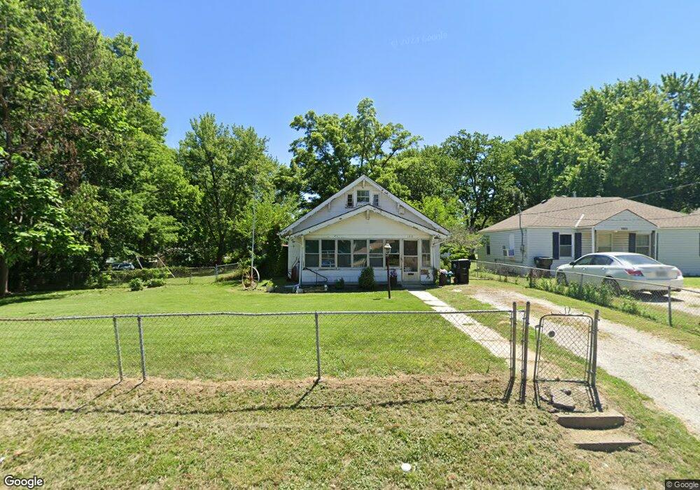
1319 S Dodgion Ave Independence, MO 64055
Hanthorn NeighborhoodEstimated Value: $157,000 - $190,000
3
Beds
1
Bath
1,352
Sq Ft
$128/Sq Ft
Est. Value
About This Home
This home is located at 1319 S Dodgion Ave, Independence, MO 64055 and is currently estimated at $172,554, approximately $127 per square foot. 1319 S Dodgion Ave is a home located in Jackson County with nearby schools including Sycamore Hills Elementary School, Bridger Middle School, and Pioneer Ridge Middle School.
Ownership History
Date
Name
Owned For
Owner Type
Purchase Details
Closed on
Jan 15, 2026
Sold by
Darrington Tevin
Bought by
Jou Pro Construction Llc
Current Estimated Value
Home Financials for this Owner
Home Financials are based on the most recent Mortgage that was taken out on this home.
Original Mortgage
$135,000
Outstanding Balance
$135,000
Interest Rate
6.21%
Mortgage Type
Credit Line Revolving
Estimated Equity
$37,554
Purchase Details
Closed on
Oct 4, 2021
Sold by
Burris Deborah Alice
Bought by
Darrington Tevin
Purchase Details
Closed on
Jun 9, 2000
Sold by
Esler George H and Esler Carmen
Bought by
Burris Carl Edwin and Burris Deborah Alice
Home Financials for this Owner
Home Financials are based on the most recent Mortgage that was taken out on this home.
Original Mortgage
$41,000
Interest Rate
8.13%
Mortgage Type
Purchase Money Mortgage
Create a Home Valuation Report for This Property
The Home Valuation Report is an in-depth analysis detailing your home's value as well as a comparison with similar homes in the area
Home Values in the Area
Average Home Value in this Area
Purchase History
| Date | Buyer | Sale Price | Title Company |
|---|---|---|---|
| Jou Pro Construction Llc | -- | Atc | |
| Darrington Tevin | -- | None Available | |
| Burris Carl Edwin | -- | Stewart Title |
Source: Public Records
Mortgage History
| Date | Status | Borrower | Loan Amount |
|---|---|---|---|
| Open | Jou Pro Construction Llc | $135,000 | |
| Previous Owner | Burris Carl Edwin | $41,000 |
Source: Public Records
Tax History
| Year | Tax Paid | Tax Assessment Tax Assessment Total Assessment is a certain percentage of the fair market value that is determined by local assessors to be the total taxable value of land and additions on the property. | Land | Improvement |
|---|---|---|---|---|
| 2025 | $1,530 | $17,087 | $5,966 | $11,121 |
| 2024 | $1,495 | $22,078 | $3,882 | $18,196 |
| 2023 | $1,495 | $22,078 | $1,448 | $20,630 |
| 2022 | $954 | $12,920 | $4,513 | $8,407 |
| 2021 | $954 | $12,920 | $4,513 | $8,407 |
| 2020 | $979 | $12,889 | $4,513 | $8,376 |
| 2019 | $964 | $12,889 | $4,513 | $8,376 |
| 2018 | $853 | $10,888 | $2,123 | $8,765 |
| 2017 | $853 | $10,888 | $2,123 | $8,765 |
| 2016 | $840 | $10,615 | $2,740 | $7,875 |
| 2014 | $798 | $10,306 | $2,660 | $7,646 |
Source: Public Records
Map
Nearby Homes
- 1309 S Main St
- 1339 S Hocker Ave
- 1340 S Emery Ave
- 421 E Angus St
- 603 E Myrtle St
- 1100 S Noland Rd
- 1530 S Pearl St
- 1120 S Leslie St
- 921 S Noland Rd
- 1211 S Osage St
- 925 S Emery St
- 904 S Pearl St
- 913 S Hocker Ave
- 930 S Leslie St
- 324 W Southside Blvd
- 1209 S Spring St
- 735 E Devon St
- 903 S Pope Ave
- 1815 & 1719 S Osage St
- 1215 S Pleasant St
- 1323 S Dodgion Ave
- 1325 S Dodgion Ave
- 1316 S Dodgion Ave
- 1312 S Dodgion Ave
- 1304 S Dodgion Ave
- 303 E Fair St
- 305 E Fair St
- 1331 S Dodgion Ave
- 1330 S Dodgion Ave
- 1302 S Dodgion Ave
- 1320 S Pearl St
- 1335 S Dodgion Ave
- 1322 S Pearl St
- 1334 S Dodgion Ave
- 1328 S Pearl St
- 1312 S Pearl St
- 1318 S Pearl St
- 1339 S Dodgion Ave
- 1310 S Pearl St
- 1306 S Pearl St
Your Personal Tour Guide
Ask me questions while you tour the home.