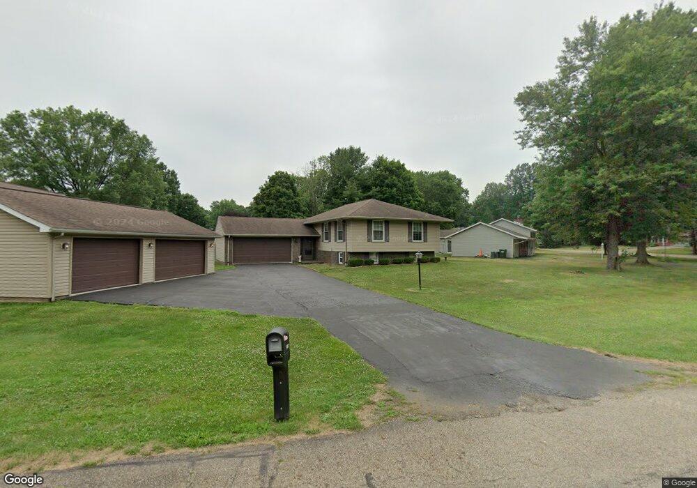
13194 Meadow St NE Alliance, OH 44601
Estimated Value: $245,000 - $275,000
3
Beds
2
Baths
1,238
Sq Ft
$212/Sq Ft
Est. Value
About This Home
This home is located at 13194 Meadow St NE, Alliance, OH 44601 and is currently estimated at $261,854, approximately $211 per square foot. 13194 Meadow St NE is a home located in Stark County with nearby schools including Marlington High School and Regina Coeli/St Joseph School.
Ownership History
Date
Name
Owned For
Owner Type
Purchase Details
Closed on
Sep 21, 2003
Sold by
Gould Kenneth E and Gould Debra K
Bought by
Pilla John A
Current Estimated Value
Home Financials for this Owner
Home Financials are based on the most recent Mortgage that was taken out on this home.
Original Mortgage
$91,500
Outstanding Balance
$42,913
Interest Rate
6.4%
Mortgage Type
Purchase Money Mortgage
Estimated Equity
$218,941
Create a Home Valuation Report for This Property
The Home Valuation Report is an in-depth analysis detailing your home's value as well as a comparison with similar homes in the area
Home Values in the Area
Average Home Value in this Area
Purchase History
| Date | Buyer | Sale Price | Title Company |
|---|---|---|---|
| Pilla John A | $120,500 | -- |
Source: Public Records
Mortgage History
| Date | Status | Borrower | Loan Amount |
|---|---|---|---|
| Open | Pilla John A | $91,500 |
Source: Public Records
Tax History Compared to Growth
Tax History
| Year | Tax Paid | Tax Assessment Tax Assessment Total Assessment is a certain percentage of the fair market value that is determined by local assessors to be the total taxable value of land and additions on the property. | Land | Improvement |
|---|---|---|---|---|
| 2025 | -- | $91,140 | $24,570 | $66,570 |
| 2024 | -- | $91,140 | $24,570 | $66,570 |
| 2023 | $2,306 | $65,390 | $13,060 | $52,330 |
| 2022 | $2,314 | $65,390 | $13,060 | $52,330 |
| 2021 | $2,330 | $65,630 | $13,060 | $52,570 |
| 2020 | $2,275 | $57,090 | $11,240 | $45,850 |
| 2019 | $2,260 | $57,100 | $11,240 | $45,860 |
| 2018 | $2,263 | $57,100 | $11,240 | $45,860 |
| 2017 | $2,187 | $51,630 | $10,710 | $40,920 |
| 2016 | $2,188 | $51,630 | $10,710 | $40,920 |
| 2015 | $2,084 | $51,630 | $10,710 | $40,920 |
| 2014 | $1,851 | $41,900 | $8,930 | $32,970 |
| 2013 | $921 | $41,900 | $8,930 | $32,970 |
Source: Public Records
Map
Nearby Homes
- 0 Meadow St NE
- 13334 Cindy St NE
- 13061 Beeson St NE
- 10666 Wilma Ave NE
- 11480 Aebi Ave NE
- 0 W Main St Unit 5090123
- 11940 Freshley Ave NE
- 11960 Freshley Ave NE
- 000 Klinger Ave
- 13109 Edison St NE
- 0 Klinger Ave NE
- 432 Johnson Ave
- 12355 Edison St NE
- 14422 Sturbridge Rd NE
- 0 Johnson Ave NE Unit 5142926
- 1430 Westwood Ave
- 0 Homestead Ave NE
- 0 Meadowbrook Ave
- 2081 Marwood Cir
- 14723 Bolton St NE
- 10877 Julie St NE
- 13166 Meadow St NE
- 13191 Meadow St NE
- 10919 Julie St NE
- 10855 Julie St NE
- 13154 Meadow St NE
- 10837 Julie St NE
- 10939 Julie St NE
- 13146 Meadow St NE
- 10876 Julie St NE
- 10906 Julie St NE
- 10854 Julie St NE
- 10922 Julie St NE
- 10815 Julie St NE
- 13138 Meadow St NE
- 13155 Meadow St NE
- 10955 Julie St NE
- 10940 Julie St NE
- 10836 Julie St NE
- 13147 Meadow St NE