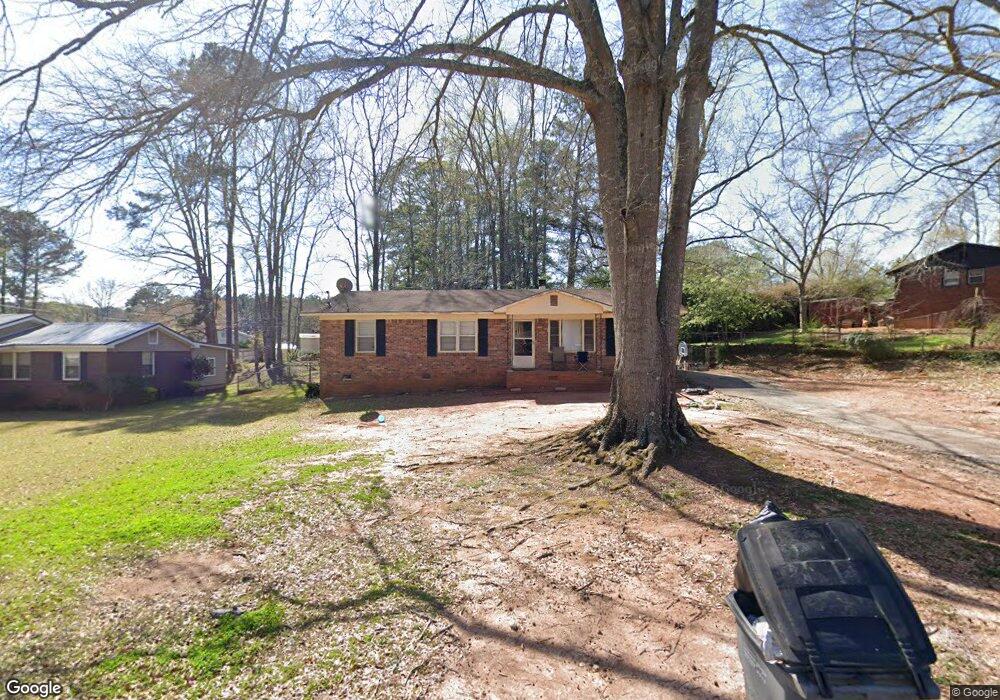
132 Alton Dr Lagrange, GA 30241
Estimated Value: $178,000 - $208,000
3
Beds
2
Baths
1,275
Sq Ft
$148/Sq Ft
Est. Value
About This Home
This home is located at 132 Alton Dr, Lagrange, GA 30241 and is currently estimated at $189,064, approximately $148 per square foot. 132 Alton Dr is a home located in Troup County with nearby schools including Franklin Forest Elementary School, Hollis Hand Elementary School, and Ethel W. Kight Elementary School.
Ownership History
Date
Name
Owned For
Owner Type
Purchase Details
Closed on
Apr 6, 1991
Sold by
Holstun Lane A and Holstun Kimberly M
Bought by
Banks Billy G and Banks Minna
Current Estimated Value
Purchase Details
Closed on
Oct 10, 1986
Sold by
Smith Janet H Nbr Hudmon Janet
Bought by
Holstun Lane A and Holstun Kimberly M
Purchase Details
Closed on
Jun 27, 1979
Sold by
Robinson Mrs John N Aka Robin-
Bought by
Smith Janet H Nbr Hudmon Janet
Purchase Details
Closed on
Jan 4, 1979
Sold by
Baggett Richard G and Baggett Miwes R
Bought by
Robinson Mrs John N Aka Robin-
Purchase Details
Closed on
Dec 20, 1976
Sold by
Corcoran Daniel J
Bought by
Baggett Richard G and Baggett Miwes R
Purchase Details
Closed on
Aug 15, 1974
Sold by
Tew Jerry J
Bought by
Corcoran Daniel J
Purchase Details
Closed on
Jan 1, 1973
Sold by
Lambeth James E
Bought by
Tew Jerry J
Purchase Details
Closed on
Nov 1, 1970
Sold by
Shelnutt Reed and Shelnutt Patricia A
Bought by
Lambeth James E
Purchase Details
Closed on
Oct 1, 1968
Sold by
Jenkins Donald R
Bought by
Shelnutt Reed and Shelnutt Patricia A
Create a Home Valuation Report for This Property
The Home Valuation Report is an in-depth analysis detailing your home's value as well as a comparison with similar homes in the area
Home Values in the Area
Average Home Value in this Area
Purchase History
| Date | Buyer | Sale Price | Title Company |
|---|---|---|---|
| Banks Billy G | -- | -- | |
| Holstun Lane A | $50,000 | -- | |
| Smith Janet H Nbr Hudmon Janet | $35,000 | -- | |
| Robinson Mrs John N Aka Robin- | $34,000 | -- | |
| Baggett Richard G | $30,000 | -- | |
| Corcoran Daniel J | $27,800 | -- | |
| Tew Jerry J | $23,000 | -- | |
| Lambeth James E | $18,500 | -- | |
| Shelnutt Reed | $14,300 | -- |
Source: Public Records
Tax History Compared to Growth
Tax History
| Year | Tax Paid | Tax Assessment Tax Assessment Total Assessment is a certain percentage of the fair market value that is determined by local assessors to be the total taxable value of land and additions on the property. | Land | Improvement |
|---|---|---|---|---|
| 2024 | $1,311 | $48,080 | $10,000 | $38,080 |
| 2023 | $1,197 | $43,880 | $10,000 | $33,880 |
| 2022 | $1,173 | $42,040 | $10,000 | $32,040 |
| 2021 | $931 | $30,880 | $8,000 | $22,880 |
| 2020 | $931 | $30,880 | $8,000 | $22,880 |
| 2019 | $796 | $26,400 | $5,760 | $20,640 |
| 2018 | $769 | $25,504 | $5,184 | $20,320 |
| 2017 | $769 | $25,504 | $5,184 | $20,320 |
| 2016 | $748 | $24,814 | $5,184 | $19,630 |
| 2015 | $735 | $24,321 | $5,756 | $18,565 |
| 2014 | $706 | $23,344 | $5,756 | $17,588 |
| 2013 | -- | $24,834 | $5,756 | $19,078 |
Source: Public Records
Map
Nearby Homes
- 114 Briarcliff Rd
- 134 S Page St
- 400 S Page St
- 806 New Franklin Rd
- 204 Colonial St
- 110 Russell St
- 109 Dogwood Dr
- 900 North St
- 210 Hearthstone Dr
- 129 Celebration Blvd
- 121 Ct
- 517 Tradition Place
- 519 Tradition Place
- 117 Celebration Blvd
- 793 Celebration Blvd
- 109 Thomas St
- 112 Celebration Blvd
- 106 Ewing St
- 706 N Harlem Cir
- 106 S Chilton Crescent
- 133 Alton Dr
- 134 Alton Dr
- 127 Alton Dr
- 123 Melrose Dr
- 129 Alton Dr
- 135 Alton Dr
- 135 Alton Dr Unit Lot 7
- 0 Melrose Dr Unit 8515686
- 0 Melrose Dr Unit 3173087
- 0 Melrose Dr Unit 3214180
- 0 Melrose Dr Unit 3269343
- 0 Melrose Dr Unit 7116169
- 0 Melrose Dr Unit 8261484
- 131 Preston Place
- 121 Melrose Dr Unit 5
- 121 Melrose Dr
- 137 Alton Dr
- 126 Preston Place
- 133 Preston Place
- 133 Preston Place Unit 11