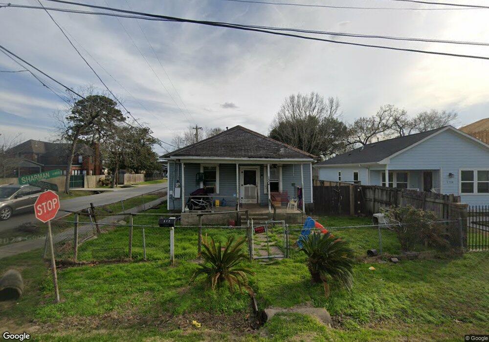
132 Amundsen St Houston, TX 77009
Northside Village NeighborhoodEstimated Value: $225,785 - $569,000
3
Beds
2
Baths
1,092
Sq Ft
$301/Sq Ft
Est. Value
About This Home
This home is located at 132 Amundsen St, Houston, TX 77009 and is currently estimated at $328,446, approximately $300 per square foot. 132 Amundsen St is a home located in Harris County with nearby schools including Jefferson Elementary School, Marshall Middle, and Northside High School.
Ownership History
Date
Name
Owned For
Owner Type
Purchase Details
Closed on
Aug 15, 2002
Sold by
Houston Heights Development Inc
Bought by
Flores Francisco P and Flores Alfredo C
Current Estimated Value
Home Financials for this Owner
Home Financials are based on the most recent Mortgage that was taken out on this home.
Original Mortgage
$52,082
Interest Rate
6.2%
Mortgage Type
Seller Take Back
Create a Home Valuation Report for This Property
The Home Valuation Report is an in-depth analysis detailing your home's value as well as a comparison with similar homes in the area
Home Values in the Area
Average Home Value in this Area
Purchase History
| Date | Buyer | Sale Price | Title Company |
|---|---|---|---|
| Flores Francisco P | -- | -- |
Source: Public Records
Mortgage History
| Date | Status | Borrower | Loan Amount |
|---|---|---|---|
| Previous Owner | Flores Francisco P | $52,082 |
Source: Public Records
Tax History Compared to Growth
Tax History
| Year | Tax Paid | Tax Assessment Tax Assessment Total Assessment is a certain percentage of the fair market value that is determined by local assessors to be the total taxable value of land and additions on the property. | Land | Improvement |
|---|---|---|---|---|
| 2025 | $24 | $177,072 | $126,045 | $51,027 |
| 2024 | $24 | $192,162 | $126,045 | $66,117 |
| 2023 | $24 | $195,076 | $126,045 | $69,031 |
| 2022 | $3,616 | $165,553 | $108,745 | $56,808 |
| 2021 | $3,480 | $157,315 | $108,745 | $48,570 |
| 2020 | $3,287 | $147,707 | $108,745 | $38,962 |
| 2019 | $3,122 | $139,773 | $108,745 | $31,028 |
| 2018 | $252 | $121,050 | $88,973 | $32,077 |
| 2017 | $2,578 | $121,050 | $88,973 | $32,077 |
| 2016 | $2,344 | $121,050 | $84,030 | $37,020 |
| 2015 | $371 | $111,458 | $71,673 | $39,785 |
| 2014 | $371 | $76,616 | $49,429 | $27,187 |
Source: Public Records
Map
Nearby Homes
- 123 Amundsen St Unit B
- 418 Coronado St
- 2834 North Fwy
- 225 Royder St
- 4608 Bristol St
- 111 Coronado St
- 214 Fulton Station Dr
- 4727 Glen Isle Dr
- 4701 Fulton St
- 612 Pittman St
- 1006 Archer St
- 1108 Archer St
- 809 Vincent St
- 611 Mathis St
- 4512 Siegel St
- 0000 W Cavalcade St
- Cordell Street Plan at Cordell Estates
- 4317 Beggs St
- 1207 Archer St
- 4307 Beggs St
- 128 Amundsen St
- 202 Amundsen St
- 312 Coronado St
- 314 Coronado St
- 126 Amundsen St Unit B
- 126 Amundsen St Unit A
- 126 Amundsen St
- 318 Coronado St
- 127 Amundsen St
- 206 Amundsen St
- 122 Amundsen St
- 210 Coronado St
- 125 Amundsen St
- 206 1/2 Amundsen St
- 320 Coronado St
- 320 Coronado St Unit A
- 320 Coronado St Unit B
- 201 Amundsen St
- 118 Amundsen St
- 210 Amundsen St