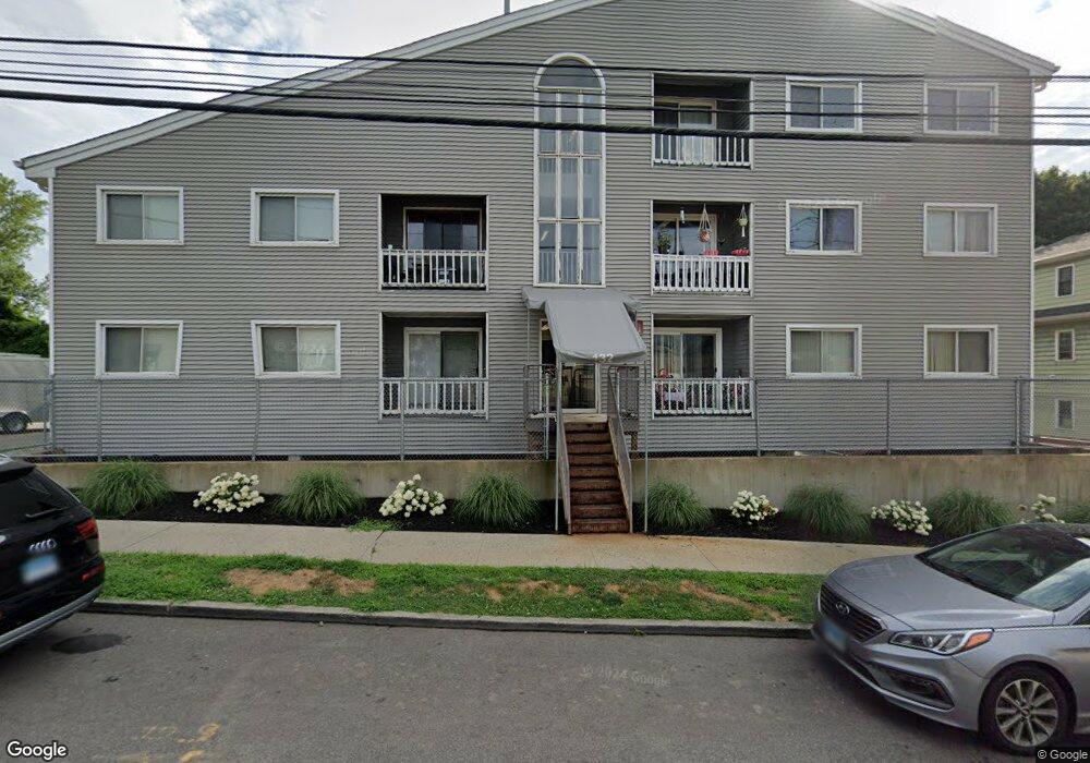
132 Bennett St Unit 104 Bridgeport, CT 06605
Black Rock NeighborhoodEstimated Value: $195,000 - $402,000
3
Beds
2
Baths
1,018
Sq Ft
$278/Sq Ft
Est. Value
About This Home
This home is located at 132 Bennett St Unit 104, Bridgeport, CT 06605 and is currently estimated at $282,782, approximately $277 per square foot. 132 Bennett St Unit 104 is a home located in Fairfield County with nearby schools including Holland Hill Elementary, Fairfield Ludlowe High School, and Great Oaks Charter School Bridgeport.
Ownership History
Date
Name
Owned For
Owner Type
Purchase Details
Closed on
Aug 4, 2000
Sold by
Kydes Craig
Bought by
Virgile Frantz H
Current Estimated Value
Home Financials for this Owner
Home Financials are based on the most recent Mortgage that was taken out on this home.
Original Mortgage
$67,500
Interest Rate
8.1%
Purchase Details
Closed on
Sep 23, 1994
Sold by
Teamsters New England
Bought by
Kydes Craig
Create a Home Valuation Report for This Property
The Home Valuation Report is an in-depth analysis detailing your home's value as well as a comparison with similar homes in the area
Home Values in the Area
Average Home Value in this Area
Purchase History
| Date | Buyer | Sale Price | Title Company |
|---|---|---|---|
| Virgile Frantz H | $75,400 | -- | |
| Virgile Frantz H | $75,400 | -- | |
| Kydes Craig | $25,000 | -- | |
| Kydes Craig | $25,000 | -- |
Source: Public Records
Mortgage History
| Date | Status | Borrower | Loan Amount |
|---|---|---|---|
| Open | Kydes Craig | $108,000 | |
| Closed | Kydes Craig | $67,500 |
Source: Public Records
Tax History Compared to Growth
Tax History
| Year | Tax Paid | Tax Assessment Tax Assessment Total Assessment is a certain percentage of the fair market value that is determined by local assessors to be the total taxable value of land and additions on the property. | Land | Improvement |
|---|---|---|---|---|
| 2025 | $2,730 | $62,840 | $0 | $62,840 |
| 2024 | $2,730 | $62,840 | $0 | $62,840 |
| 2023 | $2,730 | $62,840 | $0 | $62,840 |
| 2022 | $2,730 | $62,840 | $0 | $62,840 |
| 2021 | $2,730 | $62,840 | $0 | $62,840 |
| 2020 | $2,886 | $53,450 | $0 | $53,450 |
| 2019 | $2,886 | $53,450 | $0 | $53,450 |
| 2018 | $2,906 | $53,450 | $0 | $53,450 |
| 2017 | $2,906 | $53,450 | $0 | $53,450 |
| 2016 | $2,906 | $53,450 | $0 | $53,450 |
| 2015 | $5,441 | $128,940 | $0 | $128,940 |
| 2014 | $5,441 | $128,940 | $0 | $128,940 |
Source: Public Records
Map
Nearby Homes
- 165 Bennett St
- 105 Fox St Unit 107
- 855 Brewster St Unit 857
- 39 Jetland Place Unit 41
- 554 Brewster St Unit 4
- 37 Rowsley St Unit 6
- 132 Gilman St
- 26 Rowsley St Unit 3
- 3250 Fairfield Ave Unit 302
- 167 Scofield Ave
- 75 Homestead Ave Unit 77
- 317 Brewster St
- 188 Monroe St Unit 190
- 82 Waldorf Ave
- 31 Whittier St
- 25 Whittier St
- 361 Riverside Dr
- 130 Brentwood Ave
- 145 Brentwood Ave
- 118 Berwick Ave
- 132 Bennett St Unit 204
- 132 Bennett St Unit 102
- 132 Bennett St Unit 202
- 132 Bennett St Unit 203
- 132 Bennett St Unit 205
- 132 Bennett St Unit 206
- 132 Bennett St Unit 303
- 132 Bennett St Unit 302
- 132 Bennett St Unit 301
- 132 Bennett St Unit 201
- 132 Bennett St Unit 106
- 132 Bennett St Unit 105
- 132 Bennett St Unit 103
- 132 Bennett St Unit 101
- 132 Bennett St Unit Bennett
- 132 Bennett St Unit 204 204
- 116 Bennett St Unit 120
- 116 Bennett St Unit 1st Floor
- 116 Bennett St Unit 2nd Floor
- 116 Bennett St Unit 3rd Floor