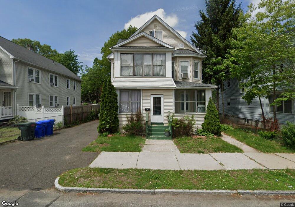
132 Bloomfield St Unit 134 Springfield, MA 01108
Forest Park NeighborhoodEstimated Value: $252,000 - $366,000
7
Beds
2
Baths
2,172
Sq Ft
$142/Sq Ft
Est. Value
About This Home
This home is located at 132 Bloomfield St Unit 134, Springfield, MA 01108 and is currently estimated at $308,797, approximately $142 per square foot. 132 Bloomfield St Unit 134 is a home located in Hampden County with nearby schools including White Street Elementary School, Forest Park Middle School, and High School Of Commerce.
Ownership History
Date
Name
Owned For
Owner Type
Purchase Details
Closed on
Feb 24, 2011
Sold by
Martinez-Chacon Betsy
Bought by
Rodriguez Raul
Current Estimated Value
Purchase Details
Closed on
Oct 1, 2001
Sold by
132 Bloomfield St Rt and Veilette Louis M
Bought by
Martinez Betsy
Home Financials for this Owner
Home Financials are based on the most recent Mortgage that was taken out on this home.
Original Mortgage
$73,625
Interest Rate
6.91%
Mortgage Type
Purchase Money Mortgage
Purchase Details
Closed on
Aug 11, 1988
Sold by
Patterson Bonnie
Bought by
Price Douglas A
Home Financials for this Owner
Home Financials are based on the most recent Mortgage that was taken out on this home.
Original Mortgage
$100,800
Interest Rate
10.34%
Mortgage Type
Purchase Money Mortgage
Create a Home Valuation Report for This Property
The Home Valuation Report is an in-depth analysis detailing your home's value as well as a comparison with similar homes in the area
Home Values in the Area
Average Home Value in this Area
Purchase History
| Date | Buyer | Sale Price | Title Company |
|---|---|---|---|
| Rodriguez Raul | -- | -- | |
| Martinez Betsy | $77,500 | -- | |
| Price Douglas A | $126,000 | -- |
Source: Public Records
Mortgage History
| Date | Status | Borrower | Loan Amount |
|---|---|---|---|
| Previous Owner | Price Douglas A | $25,000 | |
| Previous Owner | Price Douglas A | $73,625 | |
| Previous Owner | Price Douglas A | $4,000 | |
| Previous Owner | Price Douglas A | $100,800 |
Source: Public Records
Tax History Compared to Growth
Tax History
| Year | Tax Paid | Tax Assessment Tax Assessment Total Assessment is a certain percentage of the fair market value that is determined by local assessors to be the total taxable value of land and additions on the property. | Land | Improvement |
|---|---|---|---|---|
| 2025 | $3,244 | $206,900 | $31,100 | $175,800 |
| 2024 | $3,421 | $213,000 | $31,100 | $181,900 |
| 2023 | $2,994 | $175,600 | $28,300 | $147,300 |
| 2022 | $2,979 | $158,300 | $26,400 | $131,900 |
| 2021 | $2,941 | $155,600 | $24,000 | $131,600 |
| 2020 | $2,781 | $142,400 | $24,000 | $118,400 |
| 2019 | $2,710 | $137,700 | $24,000 | $113,700 |
| 2018 | $2,570 | $130,600 | $24,000 | $106,600 |
| 2017 | $2,290 | $116,500 | $22,500 | $94,000 |
| 2016 | $1,978 | $100,600 | $22,500 | $78,100 |
| 2015 | $2,028 | $103,100 | $22,500 | $80,600 |
Source: Public Records
Map
Nearby Homes
- 292-294 Orange St
- 327 Orange St
- 242-244 Orange St
- 177 Johnson St
- 52 Wilmont St
- 93 Wilmont St
- 29 Wareham St
- 127-129 Ranney St
- 209 White St
- 8 Wilmont St
- 29 Gordon St
- 106 Malden St
- 298 Oakland St
- 20 Vermont St
- 78-80 Shamrock St
- 427 Orange St
- 22-24 Ainsworth St
- 125 Oakland St
- 31 Burton St
- 371-373 Oakland St
- 138 Bloomfield St
- 128 Bloomfield St Unit 130
- 142 Bloomfield St Unit 144
- 122 Bloomfield St Unit 124
- 119 Kensington Ave
- 109 Kensington Ave Unit 111
- 121 Kensington Ave Unit 123
- 107 Kensington Ave Unit 3L
- 107 Kensington Ave Unit 3R
- 107 Kensington Ave Unit 2L
- 107 Kensington Ave Unit 4R
- 107 Kensington Ave
- 107 Kensington Ave Unit 1R
- 116 Bloomfield St Unit 118
- 109-111 Kensington Ave
- 52 Ranney St
- 141-143 Bloomfield St
- 56 Ranney St Unit 58
- 44 Ranney St Unit 46
- 44-46 Ranney St