Estimated Value: $418,000 - $488,000
About This Home
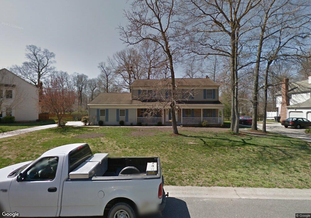
This home is located at 132 Burning Tree Rd, Dover, DE 19904 and is currently estimated at $452,436, approximately $169 per square foot. 132 Burning Tree Rd is a home located in Kent County with nearby schools including Booker T. Washington Elementary School, William Henry Middle School, and Central Middle School.
Ownership History
We collect this data history from publicly available records. To have your information removed, we recommend requesting removal directly through your county’s website.
Purchase Details
Purchase Details
Home Financials for this Owner
Home Financials are based on the most recent Mortgage that was taken out on this home.Home Values in the Area
Average Home Value in this Area
Purchase History
We collect this data history from publicly available records. To have your information removed, we recommend requesting removal directly through your county’s website.
| Date | Buyer | Sale Price | Title Company |
|---|---|---|---|
| -- | Attorney | ||
| $4,350 | None Available |
Mortgage History
We collect this data history from publicly available records. To have your information removed, we recommend requesting removal directly through your county’s website.
| Date | Status | Borrower | Loan Amount |
|---|---|---|---|
| Closed | $29,000 |
Tax History
We collect this data history from publicly available records. To have your information removed, we recommend requesting removal directly through your county’s website.
| Year | Tax Paid | Tax Assessment Tax Assessment Total Assessment is a certain percentage of the fair market value that is determined by local assessors to be the total taxable value of land and additions on the property. | Land | Improvement |
|---|---|---|---|---|
| 2025 | $2,529 | $429,400 | $117,700 | $311,700 |
| 2024 | $2,442 | $429,400 | $117,700 | $311,700 |
| 2023 | $2,174 | $73,700 | $15,300 | $58,400 |
| 2022 | $2,103 | $73,700 | $15,300 | $58,400 |
| 2021 | $2,025 | $73,700 | $15,300 | $58,400 |
| 2020 | $1,956 | $73,700 | $15,300 | $58,400 |
| 2019 | $1,850 | $73,700 | $15,300 | $58,400 |
| 2018 | $1,689 | $73,700 | $15,300 | $58,400 |
| 2017 | $1,661 | $73,700 | $0 | $0 |
| 2016 | $1,667 | $73,700 | $0 | $0 |
| 2015 | $1,665 | $73,700 | $0 | $0 |
| 2014 | $1,670 | $73,700 | $0 | $0 |
Map
- 164 Burning Tree Rd
- 69 S Turnberry Dr
- 100 Sweetgum Dr
- 13 Valhalla Ct
- 209 N Caroline Place
- 74 Par Haven Dr
- 200 Falmouth Way
- 20 Gleneagles Ct
- 0 Forrest Ave
- 1546 Forrest Ave
- 1354 College Rd
- 264 Green Blade Dr
- 134 Red Oak Dr
- 242 Green Blade Dr
- 104 Red Oak Dr
- 133 Red Oak Dr
- 1501 Fawn St
- 7 Pin Oak Dr
- 28 Baltray Rd
- 11 Tanzanite Ct
- 128 Burning Tree Rd
- 136 Burning Tree Rd
- 129 Burning Tree Rd
- 124 Burning Tree Rd
- 140 Burning Tree Rd
- 202 Pebble Valley Dr
- 125 Burning Tree Rd
- 139 Burning Tree Rd
- 204 Pebble Valley Dr
- 37 Arbor Dr
- 144 Burning Tree Rd
- 35 Arbor Dr
- 121 Burning Tree Rd
- 206 Pebble Valley Dr
- 129 Hazeltine Rd
- 33 Arbor Dr
- 116 Burning Tree Rd
- 145 Burning Tree Rd
- 13 Arbor Dr
- 116 Hazeltine Rd
Ask me questions while you tour the home.