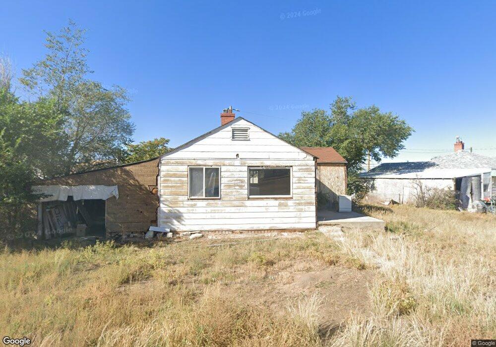
132 Cedar Rd Unit 7 East Carbon, UT 84520
Estimated Value: $44,000 - $56,000
3
Beds
1
Bath
840
Sq Ft
$61/Sq Ft
Est. Value
About This Home
This home is located at 132 Cedar Rd Unit 7, East Carbon, UT 84520 and is currently estimated at $51,288, approximately $61 per square foot. 132 Cedar Rd Unit 7 is a home located in Carbon County with nearby schools including Wellington School, Mont Harmon Junior High School, and Carbon High School.
Ownership History
Date
Name
Owned For
Owner Type
Purchase Details
Closed on
May 28, 2025
Sold by
Pack Development Llc
Bought by
Rickos Enterprise Llc
Current Estimated Value
Purchase Details
Closed on
Mar 15, 2024
Sold by
Moss Paden
Bought by
Pack Development Llc
Home Financials for this Owner
Home Financials are based on the most recent Mortgage that was taken out on this home.
Original Mortgage
$36,000
Interest Rate
6.63%
Mortgage Type
New Conventional
Purchase Details
Closed on
Sep 6, 2019
Sold by
Finance Now Llc
Bought by
Moss Paden
Purchase Details
Closed on
May 24, 2019
Sold by
Gonzalez Juan
Bought by
Finance Now Llc
Purchase Details
Closed on
Jun 15, 2009
Sold by
Gonzalez Padro
Bought by
Gonzalez Juan
Purchase Details
Closed on
Jul 25, 2007
Sold by
Paitsel Nora
Bought by
Gonzalez Padro
Purchase Details
Closed on
Nov 17, 2004
Sold by
Milsap Schirlene J
Bought by
Paitsel Nora
Create a Home Valuation Report for This Property
The Home Valuation Report is an in-depth analysis detailing your home's value as well as a comparison with similar homes in the area
Home Values in the Area
Average Home Value in this Area
Purchase History
| Date | Buyer | Sale Price | Title Company |
|---|---|---|---|
| Rickos Enterprise Llc | -- | Metro National Title | |
| Rickos Enterprise Llc | -- | Metro National Title | |
| Pack Development Llc | -- | Stewart Title | |
| Moss Paden | -- | South Eastern Utah Title Co | |
| Finance Now Llc | -- | South Easter Utah Ttl Compa | |
| Gonzalez Juan | -- | South Eastern Utah Title Co | |
| Gonzalez Padro | -- | South Eastern Utah Title Co | |
| Paitsel Nora | -- | South Eastern Utah Title Co |
Source: Public Records
Mortgage History
| Date | Status | Borrower | Loan Amount |
|---|---|---|---|
| Previous Owner | Pack Development Llc | $36,000 |
Source: Public Records
Tax History Compared to Growth
Tax History
| Year | Tax Paid | Tax Assessment Tax Assessment Total Assessment is a certain percentage of the fair market value that is determined by local assessors to be the total taxable value of land and additions on the property. | Land | Improvement |
|---|---|---|---|---|
| 2024 | $558 | $31,785 | $10,752 | $21,033 |
| 2023 | $541 | $21,010 | $3,764 | $17,246 |
| 2022 | $507 | $17,458 | $2,805 | $14,653 |
| 2021 | $424 | $24,129 | $5,100 | $19,029 |
| 2020 | $369 | $18,204 | $0 | $0 |
| 2019 | $362 | $18,204 | $0 | $0 |
| 2018 | $356 | $18,204 | $0 | $0 |
| 2017 | $353 | $18,204 | $0 | $0 |
| 2016 | $318 | $18,204 | $0 | $0 |
| 2015 | $318 | $18,204 | $0 | $0 |
| 2014 | $312 | $18,174 | $0 | $0 |
| 2013 | $300 | $18,174 | $0 | $0 |
Source: Public Records
Map
Nearby Homes
- 121 2nd W
- 100 Whitmore Dr
- 138 W Geneva Dr
- 130 2nd W
- 154 W Geneva
- 117 Grassy Trail Dr
- 127 Grassy Trail Dr
- 217 Wilkins St
- 302 W Hwy 123
- 176 Grassy Trail Dr
- 207 N Rawlins St
- 141 Denver Ave
- 169 Carson Ave
- 607 E Geneva Dr
- 346 Columbia Dr
- 138 Valley View Dr
- 431 Pinion St
- 419 Edgehill Dr
- 429 Edgehill Dr
- 590 Parkway St