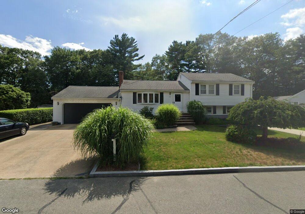
132 Dean Rd Stoughton, MA 02072
Estimated Value: $538,000 - $656,000
3
Beds
2
Baths
1,148
Sq Ft
$524/Sq Ft
Est. Value
About This Home
This home is located at 132 Dean Rd, Stoughton, MA 02072 and is currently estimated at $601,612, approximately $524 per square foot. 132 Dean Rd is a home located in Norfolk County with nearby schools including South Elementary School, Dr. Robert G. O'Donnell Middle School, and Stoughton High School.
Ownership History
Date
Name
Owned For
Owner Type
Purchase Details
Closed on
Jan 29, 1999
Sold by
Gallant Norman F and Gallant Rose
Bought by
Gallant Stephen F
Current Estimated Value
Home Financials for this Owner
Home Financials are based on the most recent Mortgage that was taken out on this home.
Original Mortgage
$151,200
Outstanding Balance
$35,573
Interest Rate
6.67%
Mortgage Type
Purchase Money Mortgage
Estimated Equity
$566,039
Create a Home Valuation Report for This Property
The Home Valuation Report is an in-depth analysis detailing your home's value as well as a comparison with similar homes in the area
Home Values in the Area
Average Home Value in this Area
Purchase History
| Date | Buyer | Sale Price | Title Company |
|---|---|---|---|
| Gallant Stephen F | $189,000 | -- |
Source: Public Records
Mortgage History
| Date | Status | Borrower | Loan Amount |
|---|---|---|---|
| Open | Gallant Stephen F | $151,200 |
Source: Public Records
Tax History Compared to Growth
Tax History
| Year | Tax Paid | Tax Assessment Tax Assessment Total Assessment is a certain percentage of the fair market value that is determined by local assessors to be the total taxable value of land and additions on the property. | Land | Improvement |
|---|---|---|---|---|
| 2025 | $6,492 | $524,400 | $222,200 | $302,200 |
| 2024 | $6,308 | $495,500 | $203,000 | $292,500 |
| 2023 | $6,373 | $470,300 | $185,500 | $284,800 |
| 2022 | $6,381 | $442,800 | $178,500 | $264,300 |
| 2021 | $6,158 | $407,800 | $157,500 | $250,300 |
| 2020 | $6,072 | $407,800 | $157,500 | $250,300 |
| 2019 | $5,973 | $389,400 | $157,500 | $231,900 |
| 2018 | $5,317 | $359,000 | $150,500 | $208,500 |
| 2017 | $4,798 | $331,100 | $148,700 | $182,400 |
| 2016 | $4,805 | $321,000 | $134,700 | $186,300 |
| 2015 | $4,500 | $297,400 | $127,700 | $169,700 |
| 2014 | $4,250 | $270,000 | $117,200 | $152,800 |
Source: Public Records
Map
Nearby Homes