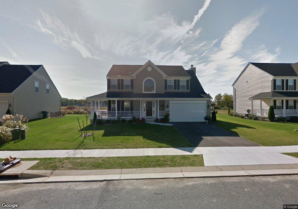
132 E Meadow Dr Centreville, MD 21617
Estimated Value: $490,000 - $578,000
3
Beds
3
Baths
1,600
Sq Ft
$330/Sq Ft
Est. Value
About This Home
This home is located at 132 E Meadow Dr, Centreville, MD 21617 and is currently estimated at $527,653, approximately $329 per square foot. 132 E Meadow Dr is a home located in Queen Anne's County with nearby schools including Centreville Elementary School, Kennard Elementary School, and Centreville Middle School.
Ownership History
Date
Name
Owned For
Owner Type
Purchase Details
Closed on
Nov 16, 2012
Sold by
Jse Investment Properties Llc
Bought by
Efland Adam S and Oleary Heather A
Current Estimated Value
Home Financials for this Owner
Home Financials are based on the most recent Mortgage that was taken out on this home.
Original Mortgage
$262,317
Outstanding Balance
$181,352
Interest Rate
3.4%
Mortgage Type
New Conventional
Estimated Equity
$346,301
Create a Home Valuation Report for This Property
The Home Valuation Report is an in-depth analysis detailing your home's value as well as a comparison with similar homes in the area
Home Values in the Area
Average Home Value in this Area
Purchase History
| Date | Buyer | Sale Price | Title Company |
|---|---|---|---|
| Efland Adam S | $80,000 | None Available |
Source: Public Records
Mortgage History
| Date | Status | Borrower | Loan Amount |
|---|---|---|---|
| Open | Efland Adam S | $262,317 |
Source: Public Records
Tax History
| Year | Tax Paid | Tax Assessment Tax Assessment Total Assessment is a certain percentage of the fair market value that is determined by local assessors to be the total taxable value of land and additions on the property. | Land | Improvement |
|---|---|---|---|---|
| 2025 | $5,591 | $426,333 | $0 | $0 |
| 2024 | $5,223 | $390,300 | $110,500 | $279,800 |
| 2023 | $4,971 | $371,167 | $0 | $0 |
| 2022 | $4,724 | $352,033 | $0 | $0 |
| 2021 | $4,150 | $332,900 | $95,500 | $237,400 |
| 2020 | $4,150 | $332,900 | $95,500 | $237,400 |
| 2019 | $4,126 | $332,900 | $95,500 | $237,400 |
| 2018 | $4,041 | $334,400 | $90,800 | $243,600 |
| 2017 | $3,856 | $315,033 | $0 | $0 |
| 2016 | -- | $295,667 | $0 | $0 |
| 2015 | $1,172 | $276,300 | $0 | $0 |
| 2014 | $1,172 | $261,467 | $0 | $0 |
Source: Public Records
Map
Nearby Homes
- 614 Brookfield Dr
- 138 Cool Meadow Dr
- 209 N Brook Dr
- 422 N Brook Dr
- 126 Meadowcroft Dr
- 120 Brook Knoll Way
- 107 Meadowcroft Dr
- 217 Elm St
- 208 Elm St
- 708 Church Hill Rd
- 704 Church Hill Rd
- 241 White Marsh Rd
- 262 White Marsh Rd
- 266 White Marsh Rd
- 122 Lently Farm Ln
- 112 S Commerce St
- 104 Windsor Ave
- 331 Kidwell Ave
- 126 S Commerce St
- 104 Kidwell Ave
- 126 E Meadow Dr
- 138 E Meadow Dr
- 127 Long Creek Way
- 133 Long Creek Way
- 121 Long Creek Way
- 144 E Meadow Dr
- 120 E Meadow Dr
- 131 E Meadow Dr
- 137 E Meadow Dr
- 125 E Meadow Dr
- 117 Long Creek Way
- 137 Long Creek Way
- 143 E Meadow Dr
- 119 E Meadow Dr
- 148 E Meadow Dr
- 116 E Meadow Dr
- 111 Long Creek Way
- 126 Long Creek Way
- 147 E Meadow Dr
- 142 Meadow Brook Way
Your Personal Tour Guide
Ask me questions while you tour the home.