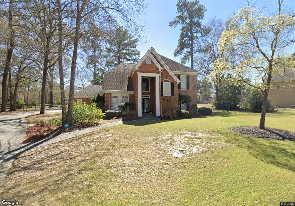
132 Falcon Crest Warner Robins, GA 31088
Estimated Value: $382,673 - $405,000
--
Bed
1
Bath
3,020
Sq Ft
$131/Sq Ft
Est. Value
About This Home
This home is located at 132 Falcon Crest, Warner Robins, GA 31088 and is currently estimated at $396,668, approximately $131 per square foot. 132 Falcon Crest is a home located in Houston County with nearby schools including Bonaire Elementary School, Huntington Middle School, and Warner Robins High School.
Ownership History
Date
Name
Owned For
Owner Type
Purchase Details
Closed on
Jan 14, 2022
Sold by
Melissa Odom
Bought by
Sipps Michael P and Sipps Jodi Lynn
Current Estimated Value
Home Financials for this Owner
Home Financials are based on the most recent Mortgage that was taken out on this home.
Original Mortgage
$352,240
Outstanding Balance
$325,098
Interest Rate
3.22%
Mortgage Type
VA
Estimated Equity
$71,570
Purchase Details
Closed on
Aug 17, 2000
Bought by
Odom Phillip
Purchase Details
Closed on
Mar 6, 1989
Create a Home Valuation Report for This Property
The Home Valuation Report is an in-depth analysis detailing your home's value as well as a comparison with similar homes in the area
Home Values in the Area
Average Home Value in this Area
Purchase History
| Date | Buyer | Sale Price | Title Company |
|---|---|---|---|
| Sipps Michael P | $340,000 | Cook & James Llc | |
| Odom Phillip | $232,000 | -- | |
| -- | $24,000 | -- |
Source: Public Records
Mortgage History
| Date | Status | Borrower | Loan Amount |
|---|---|---|---|
| Open | Sipps Michael P | $352,240 |
Source: Public Records
Tax History Compared to Growth
Tax History
| Year | Tax Paid | Tax Assessment Tax Assessment Total Assessment is a certain percentage of the fair market value that is determined by local assessors to be the total taxable value of land and additions on the property. | Land | Improvement |
|---|---|---|---|---|
| 2024 | $3,295 | $137,760 | $16,000 | $121,760 |
| 2023 | $3,261 | $134,920 | $16,000 | $118,920 |
| 2022 | $2,742 | $113,440 | $16,000 | $97,440 |
| 2021 | $2,468 | $101,600 | $16,000 | $85,600 |
| 2020 | $2,282 | $95,480 | $16,000 | $79,480 |
| 2019 | $2,282 | $95,480 | $16,000 | $79,480 |
| 2018 | $2,282 | $95,480 | $16,000 | $79,480 |
| 2017 | $2,284 | $95,480 | $16,000 | $79,480 |
| 2016 | $2,287 | $95,480 | $16,000 | $79,480 |
| 2015 | $2,292 | $95,480 | $16,000 | $79,480 |
| 2014 | -- | $100,160 | $16,000 | $84,160 |
| 2013 | -- | $100,160 | $16,000 | $84,160 |
Source: Public Records
Map
Nearby Homes
- 215 Falcon Crest
- 256 Falcon Crest Unit STATHAMS LANDING
- 215 Falcon Crest Unit Stathams Landing
- 256 Falcon Crest
- 104 Bunkers Trail
- 216 Stathams Way
- 107 Shadowood Dr
- 100 Deerwood Dr
- 109 Harmony Path
- 308 Piedmont Ln
- 204 Thornton Dr
- 100 Huxley Terrace
- 307 Apalachee Way
- 310 Davids Place Dr
- 312 Davids Place Dr
- 203 Virginia Dare Dr
- 104 Old Perry Rd
- 106 Mulligan Ct
- 206,208,210&212 Virginia Dare Dr
- 115 Virginia Dare Dr Unit MH
- 130 Falcon Crest
- 134 Falcon Crest
- 133 Falcon Crescent
- 135 Falcon Crescent
- 128 Falcon Crest
- 136 Falcon Crest
- 131 Falcon Crest
- 137 Falcon Crescent
- 126 Falcon Crest
- 126 Falcon Crest Unit SUITE 800
- 129 Falcon Crest
- 102 Crest Pointe
- 138 Falcon Crest
- 104 Crest Pointe
- 104 Crest
- 0 Crest Point Unit 7205583
- 139 Falcon Crest
- 106 Crest Point
- 106 Crest Pointe
- 124 Falcon Crest