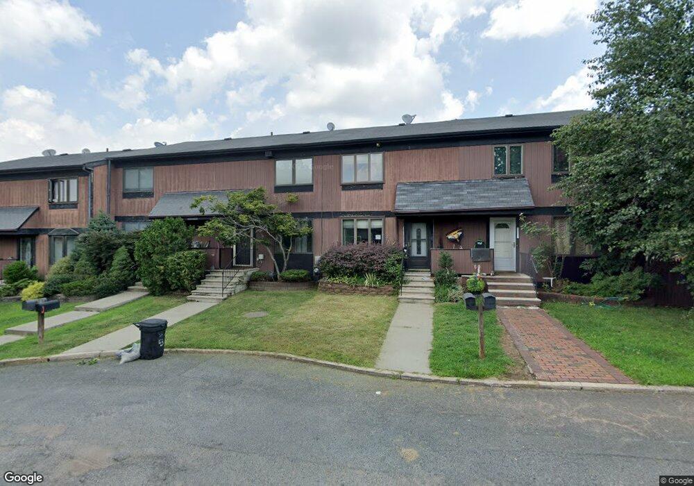
132 Hampton Place Unit 182 Staten Island, NY 10309
Rossville NeighborhoodEstimated Value: $526,506 - $631,000
3
Beds
1
Bath
1,118
Sq Ft
$510/Sq Ft
Est. Value
About This Home
This home is located at 132 Hampton Place Unit 182, Staten Island, NY 10309 and is currently estimated at $569,877, approximately $509 per square foot. 132 Hampton Place Unit 182 is a home located in Richmond County with nearby schools including P.S. 56 - The Louis Desario School, Is 34 Tottenville, and Tottenville High School.
Ownership History
Date
Name
Owned For
Owner Type
Purchase Details
Closed on
Jun 28, 2001
Sold by
Serota Barbara
Bought by
Wigren Maria
Current Estimated Value
Home Financials for this Owner
Home Financials are based on the most recent Mortgage that was taken out on this home.
Original Mortgage
$186,800
Outstanding Balance
$72,197
Interest Rate
7.18%
Estimated Equity
$497,680
Create a Home Valuation Report for This Property
The Home Valuation Report is an in-depth analysis detailing your home's value as well as a comparison with similar homes in the area
Home Values in the Area
Average Home Value in this Area
Purchase History
| Date | Buyer | Sale Price | Title Company |
|---|---|---|---|
| Wigren Maria | $193,000 | Old Republic Natl Title Ins |
Source: Public Records
Mortgage History
| Date | Status | Borrower | Loan Amount |
|---|---|---|---|
| Open | Wigren Maria | $186,800 |
Source: Public Records
Tax History Compared to Growth
Tax History
| Year | Tax Paid | Tax Assessment Tax Assessment Total Assessment is a certain percentage of the fair market value that is determined by local assessors to be the total taxable value of land and additions on the property. | Land | Improvement |
|---|---|---|---|---|
| 2025 | $4,719 | $35,823 | $2,481 | $33,342 |
| 2024 | $4,731 | $32,189 | $2,605 | $29,584 |
| 2023 | $4,772 | $24,895 | $2,796 | $22,099 |
| 2022 | $4,484 | $23,897 | $3,368 | $20,529 |
| 2021 | $4,603 | $23,897 | $3,368 | $20,529 |
| 2020 | $4,359 | $23,843 | $3,368 | $20,475 |
| 2019 | $4,047 | $20,746 | $3,368 | $17,378 |
| 2018 | $4,968 | $25,830 | $3,288 | $22,542 |
| 2017 | $4,668 | $24,368 | $3,368 | $21,000 |
| 2016 | $3,309 | $18,102 | $3,367 | $14,735 |
| 2015 | $2,926 | $17,335 | $2,836 | $14,499 |
| 2014 | $2,926 | $16,836 | $3,320 | $13,516 |
Source: Public Records
Map
Nearby Homes
- 22 Charleston Ave Unit 168
- 39 Hemlock Ct Unit 152
- 5 Wirt Ave
- 87 Cypress Loop Unit 243
- 85 Cypress Loop
- 37 Charleston Ave
- 38 Cypress Loop
- 76 Lucille Ave
- 97 Bower Ct Unit 1
- 97 Bower Ct Unit 74
- 40 Bower Ct
- 45 Redwood Loop
- 28 Berry Ct Unit 576
- 62 Arrowood Ct Unit 601
- 27 Berry Ct Unit 565
- 24 Berry Ct Unit 574
- 494 Winant Ave
- 591 Correll Ave Unit 146
- 125 Wirt Ave
- 132 Gervil St Unit 2ndFl
- 138 Hampton Place Unit 185
- 126 Hampton Place Unit 179
- 32 Charleston Ave
- 36 Charleston Ave Unit 162
- 38 Charleston Ave Unit 161
- 40 Charleston Ave Unit 160
- 42 Charleston Ave Unit 159
- 29 Hemlock Ct
- 31 Hemlock Ct Unit 156
- 35 Hemlock Ct Unit 154
- 37 Hemlock Ct Unit 153
- 41 Hemlock Ct Unit 151
- 45 Hemlock Ct Unit 149
- 47 Hemlock Ct
- 33 Hemlock Ct Unit 155
- 43 Hemlock Ct
- 128 Hampton Place Unit 180
- 130 Hampton Place
- 124 Hampton Place
- 122 Hampton Place Unit 177