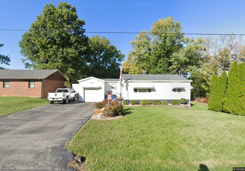
132 Kingsbury Ct Collinsville, IL 62234
Estimated Value: $137,000 - $163,076
2
Beds
1
Bath
1,096
Sq Ft
$137/Sq Ft
Est. Value
About This Home
This home is located at 132 Kingsbury Ct, Collinsville, IL 62234 and is currently estimated at $149,769, approximately $136 per square foot. 132 Kingsbury Ct is a home located in Madison County with nearby schools including John A Renfro Elementary School, Dorris Intermediate School, and Collinsville Middle School.
Ownership History
Date
Name
Owned For
Owner Type
Purchase Details
Closed on
Jul 31, 2008
Sold by
Way Larry E and Way Christy Lynn
Bought by
Brumm Gregory L
Current Estimated Value
Home Financials for this Owner
Home Financials are based on the most recent Mortgage that was taken out on this home.
Original Mortgage
$118,237
Outstanding Balance
$78,285
Interest Rate
6.51%
Mortgage Type
FHA
Estimated Equity
$71,484
Create a Home Valuation Report for This Property
The Home Valuation Report is an in-depth analysis detailing your home's value as well as a comparison with similar homes in the area
Home Values in the Area
Average Home Value in this Area
Purchase History
| Date | Buyer | Sale Price | Title Company |
|---|---|---|---|
| Brumm Gregory L | $119,500 | Abstracts & Titles Inc |
Source: Public Records
Mortgage History
| Date | Status | Borrower | Loan Amount |
|---|---|---|---|
| Open | Brumm Gregory L | $118,237 |
Source: Public Records
Tax History Compared to Growth
Tax History
| Year | Tax Paid | Tax Assessment Tax Assessment Total Assessment is a certain percentage of the fair market value that is determined by local assessors to be the total taxable value of land and additions on the property. | Land | Improvement |
|---|---|---|---|---|
| 2024 | $2,537 | $45,680 | $11,640 | $34,040 |
| 2023 | $2,537 | $42,280 | $10,770 | $31,510 |
| 2022 | $2,388 | $39,100 | $9,960 | $29,140 |
| 2021 | $2,087 | $36,210 | $9,170 | $27,040 |
| 2020 | $1,993 | $34,550 | $8,750 | $25,800 |
| 2019 | $1,926 | $33,370 | $8,450 | $24,920 |
| 2018 | $1,869 | $31,600 | $8,000 | $23,600 |
| 2017 | $2,545 | $40,170 | $8,840 | $31,330 |
| 2016 | $2,670 | $40,170 | $8,840 | $31,330 |
| 2015 | $2,480 | $39,130 | $8,610 | $30,520 |
| 2014 | $2,480 | $39,130 | $8,610 | $30,520 |
| 2013 | $2,480 | $39,130 | $8,610 | $30,520 |
Source: Public Records
Map
Nearby Homes
- 10 White Lily Dr
- 414 Bunker Hill Dr
- 22 Brookwood Dr
- 0 N Keebler Ave
- 5 Brookwood Dr
- 1224 Cedar Ridge Ct
- 203 Greenfield Dr
- 2007 Belt Line Rd
- 1120 Williams St
- 625 W Country Ln
- 1121 Carraway Ct
- 308 Brown Ave
- 1210 Constance St
- 1059 Lafayette Ct Unit A
- 1035 Lafayette Ct Unit B
- 1051 Lafayette Ct Unit A
- 123 Elliot St
- 617 N Morrison Ave
- 102 Toni Ct
- 0 Strong Ave
- 134 Kingsbury Ct
- 136 Kingsbury Ct
- 128 Kingsbury Ct
- 115 Kingsbury Ct
- 138 Kingsbury Ct
- 126 Kingsbury Ct
- 121 Kingsbury Ct
- 1403 Belt Line Rd
- 123 Kingsbury Ct
- 140 Kingsbury Ct
- 125 Kingsbury Ct
- 124 Kingsbury Ct
- 40 Carnation Dr
- 1405 Belt Line Rd
- 127 Kingsbury Ct
- 122 Kingsbury Ct
- 113 Kingsbury Ct
- 111 Kingsbury Ct
- 109 Kingsbury Ct
- 107 Kingsbury Ct