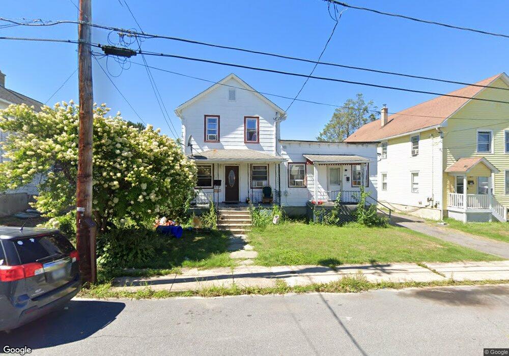
132 Lincoln St Taylor, PA 18517
Estimated Value: $140,731 - $194,000
5
Beds
2
Baths
1,900
Sq Ft
$85/Sq Ft
Est. Value
About This Home
This home is located at 132 Lincoln St, Taylor, PA 18517 and is currently estimated at $161,183, approximately $84 per square foot. 132 Lincoln St is a home located in Lackawanna County with nearby schools including Willard Middle School, Riverside Junior/Senior High School, and Triboro Christian Academy.
Ownership History
Date
Name
Owned For
Owner Type
Purchase Details
Closed on
Sep 6, 2022
Sold by
Angelo Torres
Bought by
Willoox Christopher
Current Estimated Value
Home Financials for this Owner
Home Financials are based on the most recent Mortgage that was taken out on this home.
Original Mortgage
$114,000
Outstanding Balance
$108,957
Interest Rate
5.3%
Mortgage Type
New Conventional
Estimated Equity
$52,226
Purchase Details
Closed on
Oct 24, 2013
Sold by
Kasa Elaine O Donovan
Bought by
Torres Angelo
Home Financials for this Owner
Home Financials are based on the most recent Mortgage that was taken out on this home.
Original Mortgage
$44,500
Interest Rate
4.36%
Mortgage Type
New Conventional
Create a Home Valuation Report for This Property
The Home Valuation Report is an in-depth analysis detailing your home's value as well as a comparison with similar homes in the area
Home Values in the Area
Average Home Value in this Area
Purchase History
| Date | Buyer | Sale Price | Title Company |
|---|---|---|---|
| Willoox Christopher | $120,000 | -- | |
| Torres Angelo | $77,500 | None Available |
Source: Public Records
Mortgage History
| Date | Status | Borrower | Loan Amount |
|---|---|---|---|
| Open | Willoox Christopher | $114,000 | |
| Previous Owner | Torres Angelo | $44,500 |
Source: Public Records
Tax History Compared to Growth
Tax History
| Year | Tax Paid | Tax Assessment Tax Assessment Total Assessment is a certain percentage of the fair market value that is determined by local assessors to be the total taxable value of land and additions on the property. | Land | Improvement |
|---|---|---|---|---|
| 2025 | $1,567 | $6,500 | $0 | $6,500 |
| 2024 | $1,397 | $6,500 | $0 | $6,500 |
| 2023 | $1,397 | $6,500 | $0 | $6,500 |
| 2022 | $1,397 | $6,500 | $0 | $6,500 |
| 2021 | $1,397 | $6,500 | $0 | $6,500 |
| 2020 | $1,370 | $6,500 | $0 | $6,500 |
| 2019 | $1,305 | $6,500 | $0 | $6,500 |
| 2018 | $1,282 | $6,500 | $0 | $6,500 |
| 2017 | $1,245 | $6,500 | $0 | $6,500 |
| 2016 | $740 | $6,500 | $0 | $0 |
| 2015 | -- | $6,500 | $0 | $0 |
| 2014 | -- | $6,500 | $0 | $0 |
Source: Public Records
Map
Nearby Homes
- 701-703 Union St
- 0 Union St Unit GSBSC251501
- Parcel B Davis Ct
- 115 W High St
- 112 E Taylor St
- 136 E Grove St
- 0 Cooper St Unit GSBSC255606
- Lot 02 Sibley Ave
- 0 Oak St Unit GSBSC255768
- 736 Oak St
- Lot 02 Casey Ave
- 448-450 N Main St
- 103 Davis St
- 2932 Penman St
- 0 William St Unit GSBSC253642
- 133 Corcoran St
- 170 2nd St
- 307 Charles St
- 3742 Laurel Ave
- 710 Maple St
- 136 Lincoln St
- 128 Lincoln St
- 126 Lincoln St Unit 128
- 124 Lincoln St
- 130 Lincoln St
- 120 Lincoln St
- 127 Lincoln St
- 708 W Grove St
- 131 Jefferson St
- 702 W Grove St
- 135 Jefferson St
- 712 W Grove St
- 127 Jefferson St
- 716 W Grove St
- 121 Jefferson St
- 135 Lincoln St
- 125 Lincoln St
- 135 -137 Jefferson St
- 114 Lincoln St
- 123 Lincoln St
