Estimated Value: $2,163,000 - $2,653,642
2
Beds
2
Baths
1,531
Sq Ft
$1,578/Sq Ft
Est. Value
About This Home
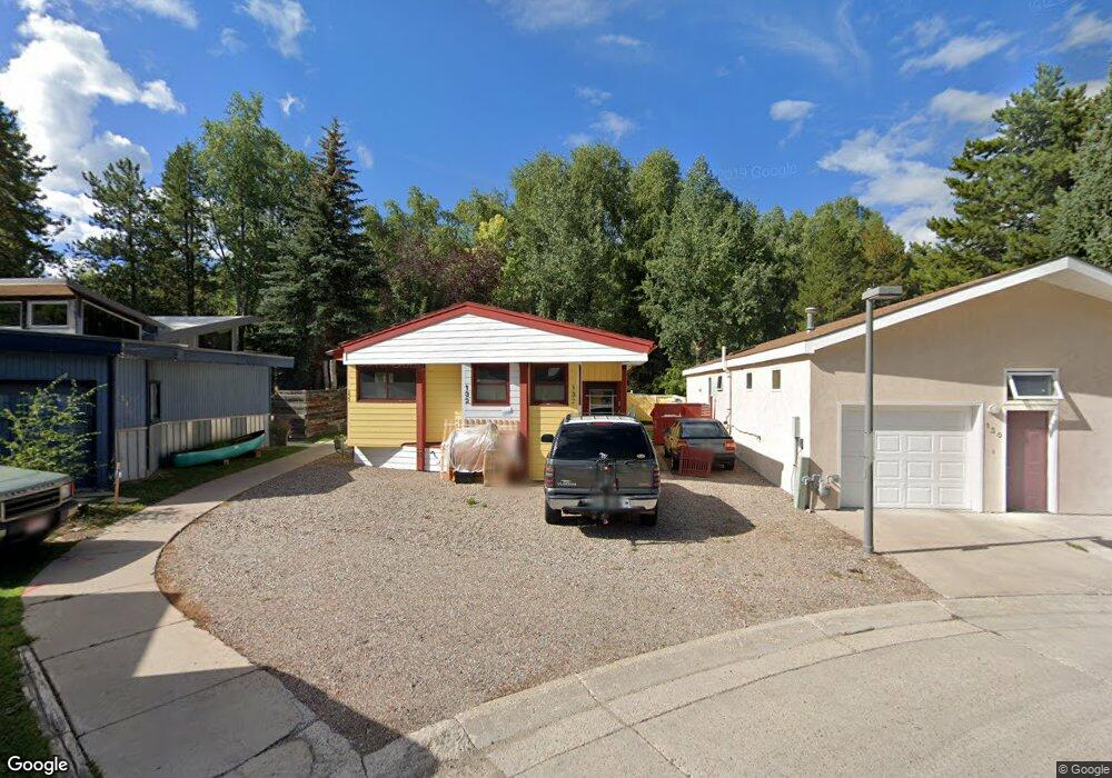
This home is located at 132 Maple Ln Unit 132, Aspen, CO 81611 and is currently estimated at $2,416,661, approximately $1,578 per square foot. 132 Maple Ln Unit 132 is a home located in Pitkin County with nearby schools including Aspen Elementary School, Aspen Middle School, and Aspen High School.
Ownership History
Date
Name
Owned For
Owner Type
Purchase Details
Closed on
Oct 18, 2023
Sold by
Wagar Rich
Bought by
Ndw Aspen Homes Llc
Current Estimated Value
Purchase Details
Closed on
Feb 18, 2004
Sold by
Archuleta Keith
Bought by
Wagar Rich
Home Financials for this Owner
Home Financials are based on the most recent Mortgage that was taken out on this home.
Original Mortgage
$360,000
Interest Rate
4.25%
Mortgage Type
Purchase Money Mortgage
Create a Home Valuation Report for This Property
The Home Valuation Report is an in-depth analysis detailing your home's value as well as a comparison with similar homes in the area
Home Values in the Area
Average Home Value in this Area
Purchase History
| Date | Buyer | Sale Price | Title Company |
|---|---|---|---|
| Ndw Aspen Homes Llc | -- | None Listed On Document | |
| Wagar Rich | $476,000 | Pct |
Source: Public Records
Mortgage History
| Date | Status | Borrower | Loan Amount |
|---|---|---|---|
| Previous Owner | Wagar Rich | $360,000 |
Source: Public Records
Tax History Compared to Growth
Tax History
| Year | Tax Paid | Tax Assessment Tax Assessment Total Assessment is a certain percentage of the fair market value that is determined by local assessors to be the total taxable value of land and additions on the property. | Land | Improvement |
|---|---|---|---|---|
| 2024 | $4,255 | $129,420 | $52,120 | $77,300 |
| 2023 | $4,255 | $133,370 | $53,710 | $79,660 |
| 2022 | $2,759 | $82,210 | $43,440 | $38,770 |
| 2021 | $2,747 | $84,580 | $44,690 | $39,890 |
| 2020 | $2,258 | $63,210 | $33,610 | $29,600 |
| 2019 | $2,003 | $63,210 | $33,610 | $29,600 |
| 2018 | $1,799 | $63,650 | $33,840 | $29,810 |
| 2017 | $1,587 | $57,100 | $32,400 | $24,700 |
| 2016 | $1,642 | $58,540 | $35,820 | $22,720 |
| 2015 | $1,876 | $58,540 | $35,820 | $22,720 |
| 2014 | $1,872 | $55,820 | $35,820 | $20,000 |
Source: Public Records
Map
Nearby Homes
- 140 Maple Ln Unit 140
- 415 Park Cir Unit 5
- 306 Oak Ln
- City Tdr
- 515 Park Cir
- 117 Neale Ave
- 979 Queen St
- 536 Spruce St
- 534 Spruce St
- 1024 E Hopkins Ave Unit 16
- 566 Race St
- 322 Park Ave Unit 2
- 326 Midland Ave Unit 306
- 326 Midland Ave Unit 302
- 311 Midland Ave
- 1212 E Hopkins Ave
- 800 E Hopkins Ave Unit A1
- 800 E Hopkins Ave Unit A3
- 950 Vine St Unit 950
- 1034 E Cooper Ave Unit 19A
- 130 Maple Ln Unit 130
- 134 Maple Ln Unit 134
- 136 Maple Ln Unit 136
- 126 Maple Ln Unit 126
- 930 Matchless Dr
- 910 Gibson Ave Unit B
- 910 Gibson Ave Unit Appartment
- 129 Maple Ln Unit 129
- 138 Maple Ln
- 920 Matchless Dr
- 124 Maple Ln Unit 124
- 127 Maple Ln Unit 127
- 940 Matchless Dr
- 125 Maple Ln
- 931 Gibson Ave
- 122 Maple Ln Unit 122
- 228 Cottonwood Ln Unit 228
- 142 Maple Ln
- 226 Cottonwood Ln Unit 226
- 123 Maple Ln Unit 123