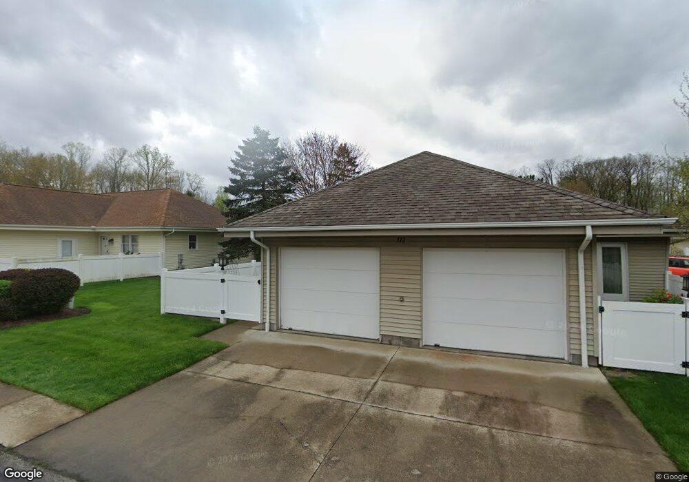
132 Michael Ln Unit 132 Cuyahoga Falls, OH 44223
High Hampton NeighborhoodEstimated Value: $163,000 - $203,000
2
Beds
2
Baths
1,124
Sq Ft
$160/Sq Ft
Est. Value
About This Home
This home is located at 132 Michael Ln Unit 132, Cuyahoga Falls, OH 44223 and is currently estimated at $179,916, approximately $160 per square foot. 132 Michael Ln Unit 132 is a home located in Summit County with nearby schools including Woodridge Middle School, Woodridge High School, and Immaculate Heart Of Mary School.
Ownership History
Date
Name
Owned For
Owner Type
Purchase Details
Closed on
Jan 4, 2006
Sold by
Lautenbach Frank
Bought by
Leisner Katharina
Current Estimated Value
Purchase Details
Closed on
Sep 17, 1998
Sold by
Mary C Tawney Trst
Bought by
Lautenbach Frank and Lautenbach Katarina
Home Financials for this Owner
Home Financials are based on the most recent Mortgage that was taken out on this home.
Original Mortgage
$92,000
Interest Rate
7.02%
Mortgage Type
New Conventional
Create a Home Valuation Report for This Property
The Home Valuation Report is an in-depth analysis detailing your home's value as well as a comparison with similar homes in the area
Home Values in the Area
Average Home Value in this Area
Purchase History
| Date | Buyer | Sale Price | Title Company |
|---|---|---|---|
| Leisner Katharina | $62,500 | Wigley Title Agency Inc | |
| Lautenbach Frank | $115,000 | -- |
Source: Public Records
Mortgage History
| Date | Status | Borrower | Loan Amount |
|---|---|---|---|
| Previous Owner | Lautenbach Frank | $92,000 |
Source: Public Records
Tax History Compared to Growth
Tax History
| Year | Tax Paid | Tax Assessment Tax Assessment Total Assessment is a certain percentage of the fair market value that is determined by local assessors to be the total taxable value of land and additions on the property. | Land | Improvement |
|---|---|---|---|---|
| 2025 | $2,094 | $44,912 | $3,962 | $40,950 |
| 2024 | $2,094 | $44,912 | $3,962 | $40,950 |
| 2023 | $2,094 | $44,912 | $3,962 | $40,950 |
| 2022 | $1,696 | $34,549 | $3,049 | $31,500 |
| 2021 | $1,711 | $34,549 | $3,049 | $31,500 |
| 2020 | $1,690 | $34,550 | $3,050 | $31,500 |
| 2019 | $1,348 | $27,770 | $2,990 | $24,780 |
| 2018 | $1,372 | $27,770 | $2,990 | $24,780 |
| 2017 | $1,400 | $27,770 | $2,990 | $24,780 |
| 2016 | $1,394 | $29,040 | $2,990 | $26,050 |
| 2015 | $1,400 | $29,040 | $2,990 | $26,050 |
| 2014 | $1,319 | $29,040 | $2,990 | $26,050 |
| 2013 | $1,441 | $30,960 | $3,760 | $27,200 |
Source: Public Records
Map
Nearby Homes
- 154 Michael Ln
- 1977 Fox Trace Trail
- 3164 Old Mill Dr
- 1983 Fox Trace Trail
- 2694 High Hampton Trail
- 3254 Cherie Cercle
- 419 W Bath Rd
- 374 Timber Ridge
- 2885 Valley Rd
- 2180 Stone Creek Trail Unit 2180
- 1531 Silver Lake Ave
- 2800 Norma St
- 2195 Pinebrook Trail Unit 2195
- 3429 Brookpoint Ln
- 595 Meredith Ln
- 609 Meredith Ln
- 1032 Foxglove Cir
- 2022 Schiller Ave
- 336 Graham Rd
- 2152 Pinebrook Trail Unit 2152
- 158 Michael Ln Unit 158
- 157 Michael Ln
- 172 Michael Ln
- 162 Michael Ln
- 171 Christy Dr Unit 171
- 169 Michael Ln Unit 169
- 104 Christy Dr
- 79 Christy Dr
- 153 Michael Ln
- 145 Michael Ln Unit 145
- 124 Christy Dr
- 120 Christy Dr Unit 120
- 116 Christy Dr
- 160 Christy Dr
- 177 Michael Ln Unit 177
- 141 Michael Ln Unit 141
- 137 Michael Ln
- 129 Michael Ln
- 108 Christy Dr
- 121 Michael Ln Unit 121