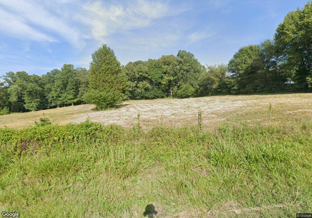
132 Mike Ledford Rd Kings Mountain, NC 28086
Estimated Value: $336,000 - $562,559
--
Bed
--
Bath
1,282
Sq Ft
$356/Sq Ft
Est. Value
About This Home
This home is located at 132 Mike Ledford Rd, Kings Mountain, NC 28086 and is currently estimated at $456,520, approximately $356 per square foot. 132 Mike Ledford Rd is a home located in Cleveland County with nearby schools including Bethware Elementary School, Kings Mountain Middle, and Kings Mountain Intermediate School.
Ownership History
Date
Name
Owned For
Owner Type
Purchase Details
Closed on
Feb 21, 2022
Sold by
Lee Camp John and Lee Earleen
Bought by
Camp John Lee and Camp John Lee
Current Estimated Value
Purchase Details
Closed on
Feb 21, 2021
Sold by
Lee Camp John and Lee Earleen
Bought by
Dulin Amy C and Crocker Lisa
Purchase Details
Closed on
Jan 25, 2006
Sold by
Plummer Addie B and Camp Earleen L
Bought by
Camp John L and Camp Earleen E
Create a Home Valuation Report for This Property
The Home Valuation Report is an in-depth analysis detailing your home's value as well as a comparison with similar homes in the area
Home Values in the Area
Average Home Value in this Area
Purchase History
| Date | Buyer | Sale Price | Title Company |
|---|---|---|---|
| Camp John Lee | -- | Bridges R | |
| Camp John Lee | -- | None Listed On Document | |
| Dulin Amy C | -- | Bridges R John | |
| Mckinney Jill D | -- | None Listed On Document | |
| Camp John L | $50,000 | None Available |
Source: Public Records
Tax History Compared to Growth
Tax History
| Year | Tax Paid | Tax Assessment Tax Assessment Total Assessment is a certain percentage of the fair market value that is determined by local assessors to be the total taxable value of land and additions on the property. | Land | Improvement |
|---|---|---|---|---|
| 2025 | $1,790 | $507,924 | $328,087 | $179,837 |
| 2024 | $1,755 | $375,317 | $254,400 | $120,917 |
| 2023 | $1,746 | $375,317 | $254,400 | $120,917 |
| 2022 | $1,746 | $375,317 | $254,400 | $120,917 |
| 2021 | $1,752 | $375,317 | $254,400 | $120,917 |
| 2020 | $1,483 | $327,845 | $242,730 | $85,115 |
| 2019 | $1,483 | $327,845 | $242,730 | $85,115 |
| 2018 | $1,478 | $327,845 | $242,730 | $85,115 |
| 2017 | $1,471 | $327,845 | $242,730 | $85,115 |
| 2016 | $1,407 | $327,845 | $242,730 | $85,115 |
| 2015 | $1,291 | $274,734 | $177,487 | $97,247 |
| 2014 | $1,291 | $274,734 | $177,487 | $97,247 |
Source: Public Records
Map
Nearby Homes
- 507 Bethlehem Rd
- 131 Sam Smith Dr
- 117 Remington Dr
- 310 Yarbro Rd
- 802 Bethlehem Rd Unit 5
- 2167 Vestibule Church Rd Unit 5U, 16U
- 813 Bethlehem Rd
- 5067 E Dixon Blvd
- 5139 E Dixon Blvd
- 907 Bethlehem Rd
- 716 Mcdaniel Rd
- 411 El Bethel Rd
- 143 Yarbro Rd Unit 2
- 143 Yarbro Rd Unit 4
- 2207 David Baptist Ch Rd
- 132 Yarbro Rd Unit 13
- 132 Yarbro Rd Unit 17
- 111 High Ridge Ct
- 105 High Ridge Ct
- 600 Ginger Dr
- 119 Mike Ledford Rd
- 112 Mike Ledford Rd
- 150 Mike Ledford Rd
- 514 Bethlehem Rd
- 503 Bethlehem Rd
- 511 Bethlehem Rd
- 161 Mike Ledford Rd
- 435 Bethlehem Rd
- 516 Bethlehem Rd
- 447 Bethlehem Rd
- 429 Bethlehem Rd
- 335 Range Rd
- 341 Range Rd
- 538 Bethlehem Rd
- 410 Bethlehem Rd
- 425 Bethlehem Rd
- 130 Larch Ln
- 416 Bethlehem Rd
- 323 Range Rd Unit 1
- 323 Range Rd
