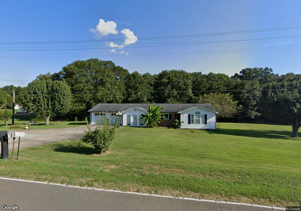
132 Mullinax Dr Grover, NC 28073
Estimated Value: $240,000 - $294,695
3
Beds
2
Baths
1,613
Sq Ft
$165/Sq Ft
Est. Value
About This Home
This home is located at 132 Mullinax Dr, Grover, NC 28073 and is currently estimated at $266,424, approximately $165 per square foot. 132 Mullinax Dr is a home located in Cleveland County with nearby schools including Grover Elementary School, Kings Mountain Middle, and Kings Mountain Intermediate School.
Ownership History
Date
Name
Owned For
Owner Type
Purchase Details
Closed on
Mar 23, 2012
Sold by
Hamrick Jake Earnest and Hamrick Elizabeth L
Bought by
Dellinger Michael J and Hyde Dellinger Dyrenda
Current Estimated Value
Home Financials for this Owner
Home Financials are based on the most recent Mortgage that was taken out on this home.
Original Mortgage
$86,734
Outstanding Balance
$59,637
Interest Rate
3.89%
Mortgage Type
New Conventional
Estimated Equity
$206,787
Create a Home Valuation Report for This Property
The Home Valuation Report is an in-depth analysis detailing your home's value as well as a comparison with similar homes in the area
Home Values in the Area
Average Home Value in this Area
Purchase History
| Date | Buyer | Sale Price | Title Company |
|---|---|---|---|
| Dellinger Michael J | $85,000 | None Available |
Source: Public Records
Mortgage History
| Date | Status | Borrower | Loan Amount |
|---|---|---|---|
| Open | Dellinger Michael J | $86,734 |
Source: Public Records
Tax History Compared to Growth
Tax History
| Year | Tax Paid | Tax Assessment Tax Assessment Total Assessment is a certain percentage of the fair market value that is determined by local assessors to be the total taxable value of land and additions on the property. | Land | Improvement |
|---|---|---|---|---|
| 2025 | $1,283 | $202,023 | $18,892 | $183,131 |
| 2024 | $1,209 | $148,884 | $15,457 | $133,427 |
| 2023 | $1,181 | $146,170 | $15,457 | $130,713 |
| 2022 | $1,181 | $146,170 | $15,457 | $130,713 |
| 2021 | $1,187 | $146,170 | $15,457 | $130,713 |
| 2020 | $996 | $117,642 | $14,186 | $103,456 |
| 2019 | $996 | $117,642 | $14,186 | $103,456 |
| 2018 | $994 | $117,642 | $14,186 | $103,456 |
| 2017 | $989 | $117,642 | $14,186 | $103,456 |
| 2016 | $948 | $117,642 | $14,186 | $103,456 |
| 2015 | $895 | $110,965 | $12,022 | $98,943 |
| 2014 | $895 | $110,965 | $12,022 | $98,943 |
Source: Public Records
Map
Nearby Homes
- 132 Hicks Rd Unit 1
- 203 Bethlehem Church Rd
- 00 Bethlehem Church Rd
- 101 Melvin Ct
- 111 Hicks Rd Unit 9
- 811 Cleveland Ave
- 303 Hardin Cir
- 105 Elm Rd
- 308 M H Camp Hwy
- 210 Roy Bell Rd
- 101 Park Ln
- 219 Watterson Rd
- 764 S Battleground Ave
- 129 Lakeview Dr
- 164 Blackburn Dr
- 238 Lakeview Dr
- 131 Sam Smith Dr
- 00 Bunny Run
- 00 Mill Creek Rd
- 716 Mcdaniel Rd
- 130 Mullinax Dr
- 136 Mullinax Dr
- 133 Mullinax Dr
- 128 Mullinax Dr
- 135 Mullinax Dr
- 131 Mullinax Dr
- 138 Mullinax Dr
- 139 Mullinax Dr
- 129 Mullinax Dr
- 104 Mullinax Dr
- 127 Mullinax Dr
- 141 Mullinax Dr
- 109 Yoda Dr
- 124 Mullinax Dr
- 107 Yoda Dr
- 113 Yoda Dr
- 125 Mullinax Dr
- 142 Mullinax Dr
- 115 Yoda Dr
- 143 Mullinax Dr