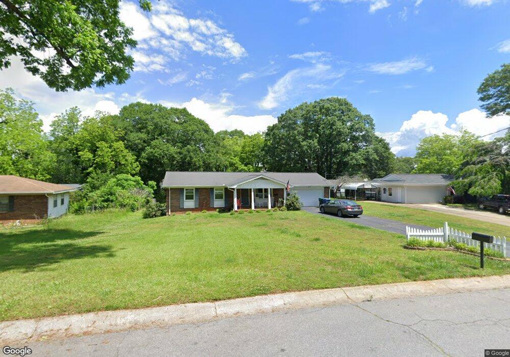
132 North Ave Carrollton, GA 30117
Estimated Value: $248,000 - $266,000
3
Beds
2
Baths
1,208
Sq Ft
$211/Sq Ft
Est. Value
About This Home
This home is located at 132 North Ave, Carrollton, GA 30117 and is currently estimated at $254,830, approximately $210 per square foot. 132 North Ave is a home with nearby schools including Carrollton Elementary School, Carrollton Upper Elementary School, and Carrollton Middle School.
Ownership History
Date
Name
Owned For
Owner Type
Purchase Details
Closed on
Apr 18, 2019
Sold by
Driver Garey Morgan
Bought by
Russell William A
Current Estimated Value
Home Financials for this Owner
Home Financials are based on the most recent Mortgage that was taken out on this home.
Original Mortgage
$112,000
Outstanding Balance
$72,512
Interest Rate
4.2%
Mortgage Type
New Conventional
Estimated Equity
$182,318
Purchase Details
Closed on
Aug 10, 2009
Sold by
Driver Roy A
Bought by
Driver Garey Morgan
Purchase Details
Closed on
May 23, 1970
Bought by
Driver Roy A
Create a Home Valuation Report for This Property
The Home Valuation Report is an in-depth analysis detailing your home's value as well as a comparison with similar homes in the area
Home Values in the Area
Average Home Value in this Area
Purchase History
| Date | Buyer | Sale Price | Title Company |
|---|---|---|---|
| Russell William A | $140,000 | -- | |
| Driver Garey Morgan | $64,674 | -- | |
| Driver Garey Morgan | $64,674 | -- | |
| Driver Roy A | -- | -- |
Source: Public Records
Mortgage History
| Date | Status | Borrower | Loan Amount |
|---|---|---|---|
| Open | Russell William A | $112,000 |
Source: Public Records
Tax History Compared to Growth
Tax History
| Year | Tax Paid | Tax Assessment Tax Assessment Total Assessment is a certain percentage of the fair market value that is determined by local assessors to be the total taxable value of land and additions on the property. | Land | Improvement |
|---|---|---|---|---|
| 2024 | $2,499 | $91,455 | $36,144 | $55,311 |
| 2023 | $2,499 | $89,056 | $36,144 | $52,912 |
| 2022 | $1,480 | $57,630 | $24,081 | $33,549 |
| 2021 | $1,229 | $46,714 | $17,846 | $28,868 |
| 2020 | $1,164 | $43,824 | $17,846 | $25,978 |
| 2019 | $1,243 | $42,155 | $17,846 | $24,309 |
| 2018 | $1,190 | $39,774 | $17,609 | $22,165 |
| 2017 | $1,197 | $39,774 | $17,609 | $22,165 |
| 2016 | $1,077 | $41,866 | $20,101 | $21,765 |
| 2015 | $799 | $25,869 | $7,200 | $18,670 |
| 2014 | $803 | $25,870 | $7,200 | $18,670 |
Source: Public Records
Map
Nearby Homes
- 777 College St
- 541 N White St Unit 12
- 541 N White St
- 103 W Chandler St
- 123 Cedar Park Way
- 110 Town Walk Ln
- 201 Stewart St
- 0 Ward St Unit 10390499
- 108 Springwood Dr
- 405 N Park St
- 205 Johnson Ave Unit 231
- 120 Stewart St
- 322 Cedar St
- 123 Autumn Glen Dr
- TRACT1-7 Us Highway 27
- 111 Lakeview Dr
- 119 Oxford Square
- 654 King St
- 114 Green Point Way
- 325 Almon Rd
- 702 College St
- 130 North Ave
- 203 Winchester Dr
- 407 North Unit E6
- 407 North Unit E2
- 135 North Ave
- 104 Colt Dr
- 131 North Ave
- 126 North Ave
- 612 College St
- 106 Colt Dr
- 127 North Ave
- 0 North Ave Unit 7506185
- 0 North Ave Unit 8228395
- 0 North Ave Unit 8053940
- 0 North Ave Unit 8798857
- 0 North Ave Unit 8496021
- N North Ave
- 0 North Ave
- 201 Winchester Dr