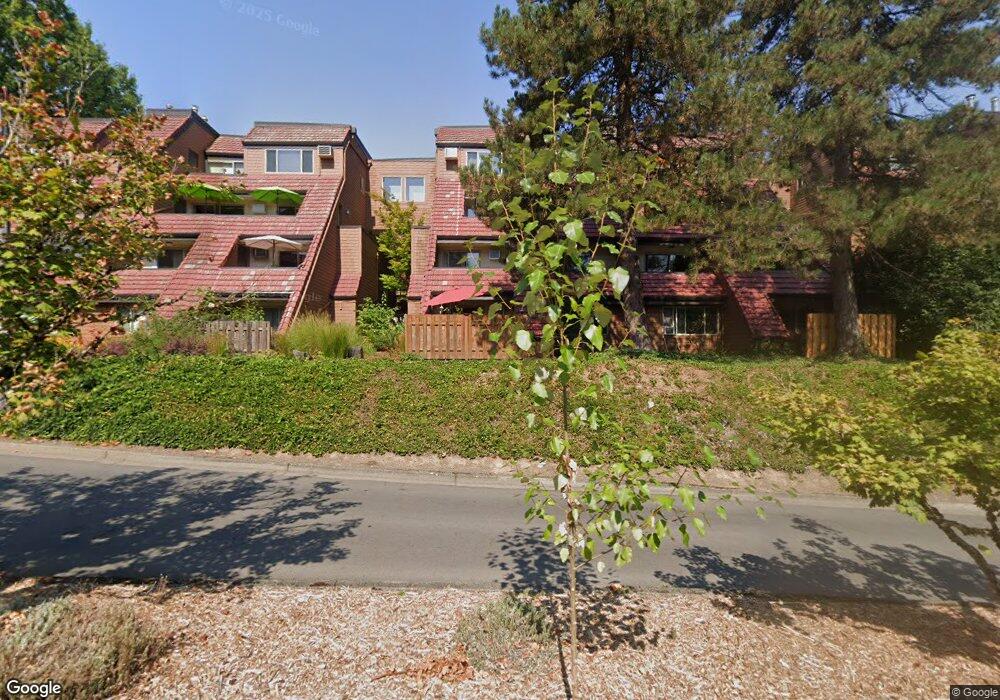
132 Oswego Summit Unit 132 Lake Oswego, OR 97035
Mountain Park NeighborhoodEstimated Value: $261,000 - $317,000
2
Beds
2
Baths
1,140
Sq Ft
$246/Sq Ft
Est. Value
About This Home
This home is located at 132 Oswego Summit Unit 132, Lake Oswego, OR 97035 and is currently estimated at $280,699, approximately $246 per square foot. 132 Oswego Summit Unit 132 is a home located in Multnomah County with nearby schools including Stephenson Elementary School, Jackson Middle School, and Ida B. Wells-Barnett High School.
Ownership History
Date
Name
Owned For
Owner Type
Purchase Details
Closed on
May 16, 2007
Sold by
Heitzman Robert E
Bought by
Landreville Gene H
Current Estimated Value
Home Financials for this Owner
Home Financials are based on the most recent Mortgage that was taken out on this home.
Original Mortgage
$27,750
Outstanding Balance
$16,797
Interest Rate
6.17%
Mortgage Type
Credit Line Revolving
Estimated Equity
$263,902
Purchase Details
Closed on
Jul 8, 1997
Sold by
Lamb Dorothy Jean
Bought by
Heitzman Robert E
Home Financials for this Owner
Home Financials are based on the most recent Mortgage that was taken out on this home.
Original Mortgage
$89,600
Interest Rate
7.93%
Purchase Details
Closed on
May 8, 1995
Sold by
Pettibone Kristine L and Pettibone Michael D
Bought by
Lamb Dorothy Jean
Create a Home Valuation Report for This Property
The Home Valuation Report is an in-depth analysis detailing your home's value as well as a comparison with similar homes in the area
Home Values in the Area
Average Home Value in this Area
Purchase History
| Date | Buyer | Sale Price | Title Company |
|---|---|---|---|
| Landreville Gene H | $185,000 | Transnation Title Agency Or | |
| Heitzman Robert E | $112,000 | Ticor Title Insurance | |
| Lamb Dorothy Jean | $99,900 | Fidelity National Title Co |
Source: Public Records
Mortgage History
| Date | Status | Borrower | Loan Amount |
|---|---|---|---|
| Open | Landreville Gene H | $27,750 | |
| Open | Landreville Gene H | $148,000 | |
| Previous Owner | Heitzman Robert E | $89,600 |
Source: Public Records
Tax History Compared to Growth
Tax History
| Year | Tax Paid | Tax Assessment Tax Assessment Total Assessment is a certain percentage of the fair market value that is determined by local assessors to be the total taxable value of land and additions on the property. | Land | Improvement |
|---|---|---|---|---|
| 2025 | $3,781 | $167,510 | -- | $167,510 |
| 2024 | $3,645 | $162,640 | -- | $162,640 |
| 2023 | $3,546 | $157,910 | $0 | $157,910 |
| 2022 | $3,432 | $153,320 | $0 | $0 |
| 2021 | $3,301 | $148,860 | $0 | $0 |
| 2020 | $2,910 | $144,530 | $0 | $0 |
| 2019 | $2,896 | $140,330 | $0 | $0 |
| 2018 | $2,742 | $136,250 | $0 | $0 |
| 2017 | $2,610 | $132,290 | $0 | $0 |
| 2016 | $2,185 | $128,440 | $0 | $0 |
| 2015 | $2,211 | $128,440 | $0 | $0 |
| 2014 | $2,251 | $124,700 | $0 | $0 |
Source: Public Records
Map
Nearby Homes
- 71 Summit
- 59 Oswego Summit Unit 59
- 54 Oswego Summit Unit 54
- 213 Oswego Summit Unit BLDG25
- 159 Oswego Summit Unit 159
- 168 Oswego Summit Unit 168
- 12 Morningview Ln
- 27 Partridge Ln
- 3101 Mcnary Pkwy Unit 12
- 38 Morningview Cir
- 12 Monticello Dr
- 45 Eagle Crest Dr Unit 219
- 45 Eagle Crest Dr Unit 405
- 45 Eagle Crest Dr Unit 206
- 45 Eagle Crest Dr Unit 407
- 20 Summit Ridge Ct
- 47 Eagle Crest Dr Unit 13
- 47 Eagle Crest Dr Unit 59
- 47 Eagle Crest Dr Unit 53
- 48 Eagle Crest Dr Unit 2C
- 131 Oswego Summit Unit 131
- 130 Oswego Summit Unit 130
- 127 Oswego Summit Unit 127
- 129 Oswego Summit Unit BLDG
- 129 Oswego Summit Unit 129
- 126 Oswego Summit Unit 126
- 125 Oswego Summit Unit 125
- 25 Oswego Summit Unit 25
- 25 Oswego Summit Unit 2
- 135 Oswego Summit Unit 135
- 27 Oswego Summit Unit 27
- 26 Oswego Summit Unit 26
- 122 Oswego Summit Unit 122
- 134 Oswego Summit Unit 134
- 28 Oswego Summit Unit 28
- 121 Oswego Summit Unit 121
- 138 Oswego Summit Unit 138
- 119 Oswego Summit Unit 119
- 120 Oswego Summit Unit 120
- 30 Oswego Summit Unit 30