Estimated Value: $307,149 - $330,000
2
Beds
1
Bath
842
Sq Ft
$377/Sq Ft
Est. Value
About This Home
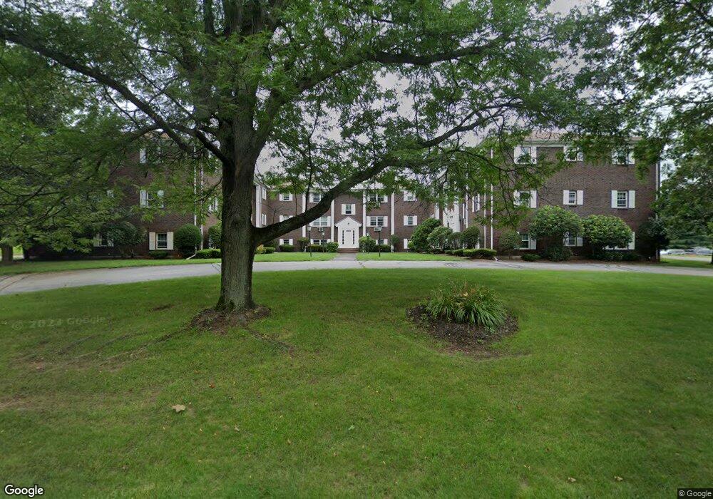
This home is located at 132 Parker St Unit I-6, Acton, MA 01720 and is currently estimated at $317,287, approximately $376 per square foot. 132 Parker St Unit I-6 is a home located in Middlesex County with nearby schools including Acton-Boxborough Regional High School, Maynard Knowledge Beginnings, and The Imago School.
Ownership History
Date
Name
Owned For
Owner Type
Purchase Details
Closed on
Nov 24, 2015
Sold by
Lehman Rachel
Bought by
Zabaruk Michael and Zabaruk Masha
Current Estimated Value
Home Financials for this Owner
Home Financials are based on the most recent Mortgage that was taken out on this home.
Original Mortgage
$116,250
Outstanding Balance
$91,436
Interest Rate
3.79%
Mortgage Type
New Conventional
Estimated Equity
$225,851
Purchase Details
Closed on
Oct 17, 2006
Sold by
Sweet Kathleen
Bought by
Lehman Rachel
Home Financials for this Owner
Home Financials are based on the most recent Mortgage that was taken out on this home.
Original Mortgage
$140,000
Interest Rate
6.47%
Mortgage Type
Purchase Money Mortgage
Purchase Details
Closed on
Dec 8, 2003
Sold by
Romeo Donald J
Bought by
Sweet Kathleen
Create a Home Valuation Report for This Property
The Home Valuation Report is an in-depth analysis detailing your home's value as well as a comparison with similar homes in the area
Home Values in the Area
Average Home Value in this Area
Purchase History
| Date | Buyer | Sale Price | Title Company |
|---|---|---|---|
| Zabaruk Michael | $155,000 | -- | |
| Lehman Rachel | $175,000 | -- | |
| Sweet Kathleen | $174,900 | -- |
Source: Public Records
Mortgage History
| Date | Status | Borrower | Loan Amount |
|---|---|---|---|
| Open | Zabaruk Michael | $116,250 | |
| Previous Owner | Lehman Rachel | $140,000 |
Source: Public Records
Tax History Compared to Growth
Tax History
| Year | Tax Paid | Tax Assessment Tax Assessment Total Assessment is a certain percentage of the fair market value that is determined by local assessors to be the total taxable value of land and additions on the property. | Land | Improvement |
|---|---|---|---|---|
| 2025 | $4,696 | $273,800 | $0 | $273,800 |
| 2024 | $4,061 | $243,600 | $0 | $243,600 |
| 2023 | $4,158 | $236,800 | $0 | $236,800 |
| 2022 | $3,960 | $203,600 | $0 | $203,600 |
| 2021 | $4,032 | $199,300 | $0 | $199,300 |
| 2020 | $3,496 | $181,700 | $0 | $181,700 |
| 2019 | $3,357 | $173,300 | $0 | $173,300 |
| 2018 | $3,219 | $166,100 | $0 | $166,100 |
| 2017 | $2,991 | $156,900 | $0 | $156,900 |
| 2016 | $2,738 | $142,400 | $0 | $142,400 |
| 2015 | $2,522 | $132,400 | $0 | $132,400 |
| 2014 | $2,227 | $114,500 | $0 | $114,500 |
Source: Public Records
Map
Nearby Homes
- 132 Parker St Unit G5
- 128 Parker St Unit 3B
- 118 Parker St Unit 16
- 2 Clover Hill Rd
- 1 Maillet Dr
- 12 Brewster Ln
- 70 River St
- 128 Audubon Dr
- 40 High St
- 86 School St
- 8 Laurel Ct
- 71 School St
- 80 N Branch Rd
- 96 Forest Ridge Rd Unit 96
- 5 Oakwood Rd
- 25 Main St
- 9 Black Birch Ln Unit 9
- 8 High St Unit G1
- 65 Summit St
- 1844 Main St Unit 1844
- 132 Parker St Unit I6
- 132 Parker St Unit I5
- 132 Parker St Unit I4
- 132 Parker St Unit I3
- 132 Parker St Unit I2
- 132 Parker St Unit I1
- 132 Parker St Unit H6
- 132 Parker St Unit H5
- 132 Parker St Unit H3
- 132 Parker St Unit H2
- 132 Parker St Unit H1
- 132 Parker St Unit G6
- 132 Parker St Unit G5
- 132 Parker St Unit G3
- 132 Parker St Unit G2
- 132 Parker St Unit G1
- 132 Parker St Unit I-2
- 132 Parker St Unit H-3
- 132 Parker St Unit I 13
- 132 Parker St Unit G-2,132