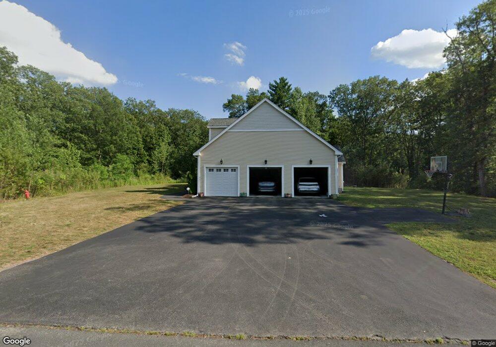
132 Paul Lizotte Rd North Attleboro, MA 02760
North Attleboro NeighborhoodEstimated Value: $961,268 - $1,109,000
4
Beds
3
Baths
2,917
Sq Ft
$353/Sq Ft
Est. Value
About This Home
This home is located at 132 Paul Lizotte Rd, North Attleboro, MA 02760 and is currently estimated at $1,028,317, approximately $352 per square foot. 132 Paul Lizotte Rd is a home with nearby schools including North Attleboro High School.
Ownership History
Date
Name
Owned For
Owner Type
Purchase Details
Closed on
Dec 28, 2017
Sold by
Ledge Hill Development
Bought by
Kotipalli Lavanya
Current Estimated Value
Home Financials for this Owner
Home Financials are based on the most recent Mortgage that was taken out on this home.
Original Mortgage
$576,000
Outstanding Balance
$480,500
Interest Rate
3.5%
Mortgage Type
New Conventional
Estimated Equity
$547,817
Create a Home Valuation Report for This Property
The Home Valuation Report is an in-depth analysis detailing your home's value as well as a comparison with similar homes in the area
Home Values in the Area
Average Home Value in this Area
Purchase History
| Date | Buyer | Sale Price | Title Company |
|---|---|---|---|
| Kotipalli Lavanya | $720,000 | -- |
Source: Public Records
Mortgage History
| Date | Status | Borrower | Loan Amount |
|---|---|---|---|
| Open | Kotipalli Lavanya | $576,000 |
Source: Public Records
Tax History Compared to Growth
Tax History
| Year | Tax Paid | Tax Assessment Tax Assessment Total Assessment is a certain percentage of the fair market value that is determined by local assessors to be the total taxable value of land and additions on the property. | Land | Improvement |
|---|---|---|---|---|
| 2025 | $10,676 | $905,500 | $154,100 | $751,400 |
| 2024 | $10,751 | $931,600 | $154,100 | $777,500 |
| 2023 | $10,283 | $804,000 | $160,800 | $643,200 |
| 2022 | $9,442 | $677,800 | $154,100 | $523,700 |
| 2021 | $9,198 | $644,600 | $154,100 | $490,500 |
| 2020 | $9,046 | $630,400 | $154,100 | $476,300 |
| 2019 | $8,847 | $621,300 | $140,200 | $481,100 |
| 2018 | $3,048 | $56,100 | $56,100 | $0 |
| 2017 | $644 | $48,700 | $48,700 | $0 |
| 2016 | $717 | $54,200 | $54,200 | $0 |
| 2015 | $748 | $56,900 | $56,900 | $0 |
| 2014 | $696 | $52,600 | $52,600 | $0 |
Source: Public Records
Map
Nearby Homes
- 447 Cumberland Ave
- 135 Cumberland Ave
- 1 Frederick a Nittel Dr
- 0 Mendon Rd
- 48 May St
- 23 Cumberland Ave
- 276 Newport Ave
- 543 Newport Ave
- 96 Autumn Dr
- 664 Old Post Rd
- 9 Mount Hope St
- 11 Howarth Ave
- 8 Whineys Way
- 740 Allen Ave
- 0 Middle St
- 457 Bryant St
- 17 Lockwood Ave
- 73 Vineyard Ave
- 176 Read St
- 73 Grandview Dr
- 132 Lakewood Dr Unit 13
- 150 Paul Lizotte Dr Unit 8
- 150 Paul Lizotte Rd
- 56 Delphis A Monast Jr Way Unit 22
- 56 Delphis A Monast Jr Way
- 49 Delphis A Monast Jr Way Unit 16
- 49 Delphis A Monast Junior Way
- 30 Owen Dolan Rd Unit 26
- 162 Paul Lizotte Rd
- 162 Paul Lizotte Rd Unit 9
- 29 Owen Dolan Rd Unit 7
- 29 Owen Dolan Rd
- 35 Delphis A Monast Junior Way
- 35 Delphis A Monast Jr Way Unit 17
- 35 Delphis A Monast Jr Way
- 40 Delphis A Monast Jr Way
- 170 Paul Lizotte Rd Unit 10
- 21 Delphis A Monast Jr Way Unit 18
- 21 Delphis A Monast Jr Way
- 21 Delphis A Monast Junior Way