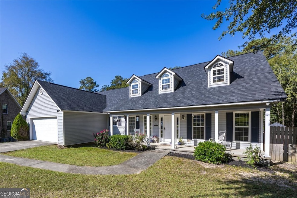
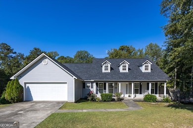
132 Pineworth Pointe Dr Macon, GA 31216
Estimated payment $1,845/month
Highlights
- Traditional Architecture
- Bonus Room
- Walk-In Closet
- 1 Fireplace
- No HOA
- 1-Story Property
About This Home
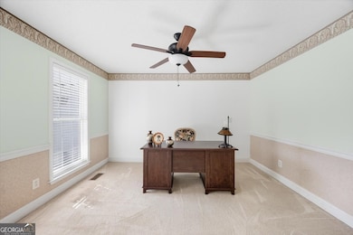
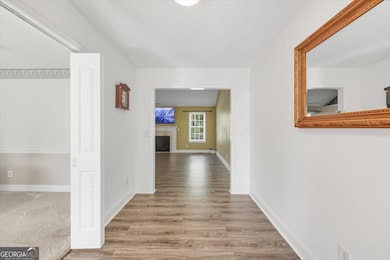
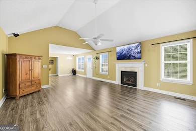
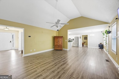
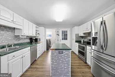
Owner financing available. This comfortable 3-bedroom, 2-bath home sits on nearly 3 private acres in Pineworth Pointe and offers plenty of room to spread out, relax, and enjoy the outdoors. Nestled on a spacious lot with wooded trails and creek access, just minutes from Lake Tobesofkee! Inside, you'll find a well-maintained and move-in-ready home, with all major appliances included - even the washer, dryer, and TV. A versatile bonus room at the front of the house can be used as a home office, study, or formal living area. There's also a large attic with the potential to be finished out for extra living space, adding long-term value and flexibility. Outside is where this home truly shines. Entertain in style on the expansive double deck with a hot tub, or unwind in the covered patio area featuring outdoor furniture and a mounted TV - perfect for hosting friends or enjoying a quiet evening under the stars. The wooded backyard includes walking trails that lead to Lake Tobesofkee Creek, offering a scenic space for outdoor fun and recreation. The garage is outfitted with a mini-split HVAC system and an insulated door, making it ideal for a workshop, gym, or extra living space.
Home Details
Home Type
- Single Family
Est. Annual Taxes
- $2,643
Year Built
- Built in 2001
Parking
- Garage
Home Design
- Traditional Architecture
- Composition Roof
- Vinyl Siding
Interior Spaces
- 1,877 Sq Ft Home
- 1-Story Property
- 1 Fireplace
- Bonus Room
- Crawl Space
- Expansion Attic
Kitchen
- Oven or Range
- Dishwasher
Flooring
- Carpet
- Laminate
Bedrooms and Bathrooms
- 3 Main Level Bedrooms
- Walk-In Closet
- 2 Full Bathrooms
Laundry
- Dryer
- Washer
Schools
- Skyview Elementary School
- Rutland Middle School
- Rutland High School
Additional Features
- 2.85 Acre Lot
- Central Heating and Cooling System
Community Details
- No Home Owners Association
- Pineworth Pointe Subdivision
Map
Home Values in the Area
Average Home Value in this Area
Tax History
| Year | Tax Paid | Tax Assessment Tax Assessment Total Assessment is a certain percentage of the fair market value that is determined by local assessors to be the total taxable value of land and additions on the property. | Land | Improvement |
|---|---|---|---|---|
| 2024 | $2,732 | $107,569 | $27,840 | $79,729 |
| 2023 | $2,732 | $107,569 | $27,840 | $79,729 |
| 2022 | $3,158 | $91,204 | $14,268 | $76,936 |
| 2021 | $2,103 | $55,329 | $8,820 | $46,509 |
| 2020 | $2,148 | $55,329 | $8,820 | $46,509 |
| 2019 | $2,166 | $55,329 | $8,820 | $46,509 |
| 2018 | $3,497 | $55,329 | $8,820 | $46,509 |
| 2017 | $1,858 | $49,578 | $8,820 | $40,758 |
| 2016 | $1,678 | $48,496 | $8,820 | $39,676 |
| 2015 | $2,375 | $48,496 | $8,820 | $39,676 |
| 2014 | $2,379 | $48,496 | $8,820 | $39,676 |
Property History
| Date | Event | Price | List to Sale | Price per Sq Ft |
|---|---|---|---|---|
| 11/04/2025 11/04/25 | Price Changed | $309,000 | -1.7% | $165 / Sq Ft |
| 11/03/2025 11/03/25 | Price Changed | $314,500 | -0.2% | $168 / Sq Ft |
| 09/29/2025 09/29/25 | For Sale | $315,000 | -- | $168 / Sq Ft |
Purchase History
| Date | Type | Sale Price | Title Company |
|---|---|---|---|
| Warranty Deed | $139,000 | -- | |
| Deed | $2,000 | -- |
Mortgage History
| Date | Status | Loan Amount | Loan Type |
|---|---|---|---|
| Open | $125,100 | New Conventional |
Source: Georgia MLS
MLS Number: 10614784
APN: I008-0180
Disclaimer: Certain information contained herein is derived from information provided by parties other than Homes.com. All information provided is deemed reliable, but is not guaranteed to be accurate and should be independently verified.
![]() The data relating to real estate for sale on this web site comes in part from the Broker Reciprocity Program of Georgia MLS. Real estate listings held by brokerage firms other than Redfin are marked with the Broker Reciprocity logo and detailed information about them includes the name of the listing brokers. Information deemed reliable but not guaranteed. Copyright 2025 Georgia MLS. All rights reserved.
The data relating to real estate for sale on this web site comes in part from the Broker Reciprocity Program of Georgia MLS. Real estate listings held by brokerage firms other than Redfin are marked with the Broker Reciprocity logo and detailed information about them includes the name of the listing brokers. Information deemed reliable but not guaranteed. Copyright 2025 Georgia MLS. All rights reserved.
- 126 Pineworth Pointe Dr
- 6375 Stapleton Rd
- 2684 Fringe Cir
- 2671 Fringe Cir
- 2616 Minuette Ct
- 312 Pinnacle Park
- 104 Waters Edge Dr
- Plan 1709 at Carson's Walk
- Plan 2505 at Carson's Walk
- Plan 3105 at Carson's Walk
- Plan 2131 at Carson's Walk
- Plan 2700 at Carson's Walk
- Plan 2307 at Carson's Walk
- Plan 2721 at Carson's Walk
- Plan 2604 at Carson's Walk
- Plan 2620 at Carson's Walk
- 151 Gates Rd
- 159 Gates Rd
- 200 Sailwind Ct
- 215 Carsons Walk
- 6300 Moseley Dixon Rd
- 328 Shady Ln
- 5744 Thomaston Rd
- 5891 Thomaston Rd
- 6001 Thomaston Rd
- 6229 Thomaston Rd
- 1356 Happy Trail
- 4860 Brookhaven Rd
- 4274 W Oak Dr
- 1149 Runnymede Ln
- 4658 Mercer University Dr
- 1390 Royalwyn Dr
- 4406 Chambers Rd
- 204 Chambers Cove Dr
- 4786 High Oak Dr
- 4755 Mercer University Dr
- 4429 Pharr Ave
- 4344 W Highland Dr
- 4715 Pine Valley Dr
- 4002 Holley Rd
