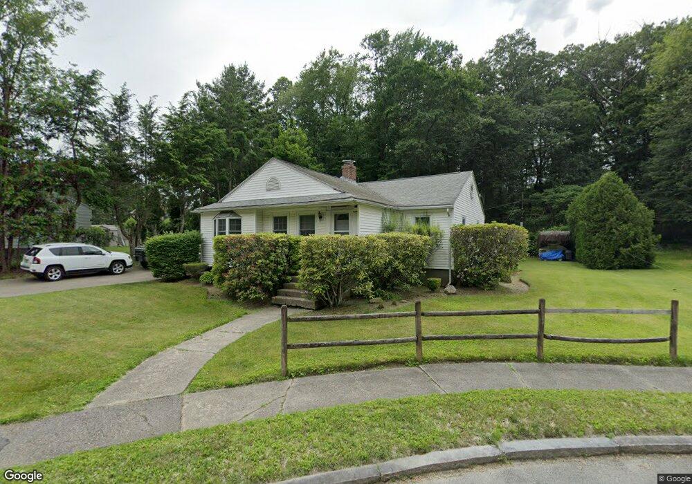
132 S Flagg St Worcester, MA 01602
Newton Square NeighborhoodEstimated Value: $397,000 - $438,298
3
Beds
1
Bath
1,132
Sq Ft
$373/Sq Ft
Est. Value
About This Home
This home is located at 132 S Flagg St, Worcester, MA 01602 and is currently estimated at $422,575, approximately $373 per square foot. 132 S Flagg St is a home located in Worcester County with nearby schools including Chandler Magnet, Jacob Hiatt Magnet School, and May Street Elementary School.
Create a Home Valuation Report for This Property
The Home Valuation Report is an in-depth analysis detailing your home's value as well as a comparison with similar homes in the area
Home Values in the Area
Average Home Value in this Area
Tax History Compared to Growth
Tax History
| Year | Tax Paid | Tax Assessment Tax Assessment Total Assessment is a certain percentage of the fair market value that is determined by local assessors to be the total taxable value of land and additions on the property. | Land | Improvement |
|---|---|---|---|---|
| 2025 | $4,932 | $373,900 | $119,200 | $254,700 |
| 2024 | $4,828 | $351,100 | $119,200 | $231,900 |
| 2023 | $4,751 | $331,300 | $103,600 | $227,700 |
| 2022 | $4,210 | $276,800 | $82,900 | $193,900 |
| 2021 | $4,098 | $251,700 | $66,300 | $185,400 |
| 2020 | $3,930 | $231,200 | $66,200 | $165,000 |
| 2019 | $3,697 | $205,400 | $59,800 | $145,600 |
| 2018 | $3,583 | $189,500 | $59,800 | $129,700 |
| 2017 | $3,642 | $189,500 | $59,800 | $129,700 |
| 2016 | $3,582 | $173,800 | $45,000 | $128,800 |
| 2015 | $3,488 | $173,800 | $45,000 | $128,800 |
| 2014 | $3,253 | $166,500 | $45,000 | $121,500 |
Source: Public Records
Map
Nearby Homes
- 16 Sherwood Rd
- 19 Kenilworth Rd
- 9 Field Way
- 250 May St
- 563 Chandler St
- 24 Hadwen Rd
- 20 Manhattan Rd
- 40 Howland Terrace
- 980 Pleasant St
- 53 Howland Terrace
- 34 Monroe Ave
- 57 Berwick St
- 96 June St Unit 3
- 2 Carlisle St
- 31 Lenox St
- 47R Yarnie Unit 3B
- 47R Yarnie Unit 3A
- 47R Yarnie Unit 1B
- 47R Yarnie Unit 2B
- 47R Yarnie Unit 4B