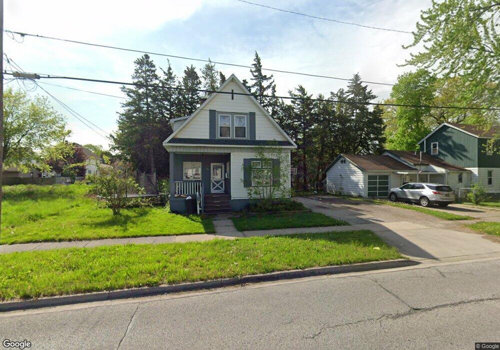
132 S Woodbridge St Saginaw, MI 48602
Estimated Value: $62,668 - $85,000
4
Beds
2
Baths
1,407
Sq Ft
$53/Sq Ft
Est. Value
About This Home
This home is located at 132 S Woodbridge St, Saginaw, MI 48602 and is currently estimated at $75,167, approximately $53 per square foot. 132 S Woodbridge St is a home located in Saginaw County with nearby schools including Herig Elementary School, Thompson Middle School, and Arthur Hill High School.
Ownership History
Date
Name
Owned For
Owner Type
Purchase Details
Closed on
Jun 30, 2007
Sold by
Finger Donald C and Finger Shirley M
Bought by
Wesson Robert W and Wesson Donna K
Current Estimated Value
Purchase Details
Closed on
Apr 30, 2007
Sold by
Coates Brian R and Coates Sarah M
Bought by
Finger Donald C and Finger Shirley M
Purchase Details
Closed on
Oct 5, 2002
Sold by
Finger Donald C and Finger Shirley M
Bought by
Coates Brian R and Coates Sarah M
Purchase Details
Closed on
Sep 19, 2002
Sold by
Dnr-02
Bought by
Coates Brian R
Purchase Details
Closed on
Mar 22, 2002
Sold by
Horn Craig C
Bought by
Dnr-02
Purchase Details
Closed on
Oct 4, 2001
Sold by
Horn Craig C
Bought by
First Union National Bank
Purchase Details
Closed on
Aug 20, 1997
Sold by
Horn Eugene A and Horn Linda M
Bought by
Horn Craig C
Create a Home Valuation Report for This Property
The Home Valuation Report is an in-depth analysis detailing your home's value as well as a comparison with similar homes in the area
Home Values in the Area
Average Home Value in this Area
Purchase History
| Date | Buyer | Sale Price | Title Company |
|---|---|---|---|
| Wesson Robert W | -- | -- | |
| Finger Donald C | -- | -- | |
| Coates Brian R | -- | -- | |
| Coates Brian R | $26,800 | -- | |
| Coates Brian Robert | $68,300 | -- | |
| Dnr-02 | -- | -- | |
| First Union National Bank | $44,100 | -- | |
| Horn Craig C | -- | -- |
Source: Public Records
Tax History Compared to Growth
Tax History
| Year | Tax Paid | Tax Assessment Tax Assessment Total Assessment is a certain percentage of the fair market value that is determined by local assessors to be the total taxable value of land and additions on the property. | Land | Improvement |
|---|---|---|---|---|
| 2025 | $1,460 | $27,800 | $0 | $0 |
| 2024 | $1,194 | $25,400 | $0 | $0 |
| 2023 | $1,146 | $21,800 | $0 | $0 |
| 2022 | $1,339 | $18,800 | $0 | $0 |
| 2021 | $1,260 | $17,600 | $0 | $0 |
| 2020 | $1,135 | $16,900 | $0 | $0 |
| 2019 | $1,478 | $16,900 | $600 | $16,300 |
| 2018 | $1,025 | $18,566 | $0 | $0 |
| 2017 | $1,204 | $18,700 | $0 | $0 |
| 2016 | $1,193 | $18,449 | $0 | $0 |
| 2014 | -- | $19,366 | $0 | $18,784 |
| 2013 | -- | $20,089 | $0 | $0 |
Source: Public Records
Map
Nearby Homes
- 129 S Oakley St
- 1315 Adams St
- 1420 Adams St
- 129 N Mason St
- 1118 Cass St
- 310 S Bates St
- 211 N Woodbridge St
- 1003 Hancock St
- 1014 Hancock St
- 311 S Porter St
- 1323 Mackinaw St
- 1203 Mackinaw St
- 1617 Van Buren St
- 125 S Webster St
- 412 N Oakley St
- 413 N Bond St
- 401 N Porter St
- 203 N Webster St
- 616 S Oakley St
- 1610 Cleveland St
- 126 S Woodbridge St
- 1320 Adams St
- 1314 Adams St
- 122 S Woodbridge St
- 133 S Woodbridge St
- 129 S Woodbridge St
- 1400 Adams St
- 123 S Woodbridge St
- 116 S Woodbridge St
- 133 S Mason St
- 137 S Mason St
- 127 S Mason St
- 121 S Mason St
- 1410 Adams St
- 1321 Adams St
- 117 S Mason St
- 1307 Adams St
- 134 S Bates St
- 1403 Adams St