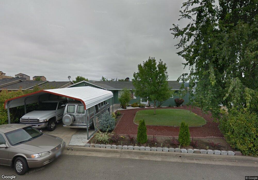
132 Silverado Ct Roseburg, OR 97471
Green NeighborhoodEstimated Value: $302,000 - $336,000
3
Beds
2
Baths
1,178
Sq Ft
$273/Sq Ft
Est. Value
About This Home
This home is located at 132 Silverado Ct, Roseburg, OR 97471 and is currently estimated at $322,000, approximately $273 per square foot. 132 Silverado Ct is a home located in Douglas County with nearby schools including Green Elementary School, John C. Fremont Middle School, and Roseburg High School.
Ownership History
Date
Name
Owned For
Owner Type
Purchase Details
Closed on
Jul 26, 2010
Sold by
Morales Jose M
Bought by
Morales Jose M and Cervantes Maria G
Current Estimated Value
Home Financials for this Owner
Home Financials are based on the most recent Mortgage that was taken out on this home.
Original Mortgage
$86,900
Interest Rate
4.65%
Mortgage Type
New Conventional
Create a Home Valuation Report for This Property
The Home Valuation Report is an in-depth analysis detailing your home's value as well as a comparison with similar homes in the area
Home Values in the Area
Average Home Value in this Area
Purchase History
| Date | Buyer | Sale Price | Title Company |
|---|---|---|---|
| Morales Jose M | -- | None Available |
Source: Public Records
Mortgage History
| Date | Status | Borrower | Loan Amount |
|---|---|---|---|
| Closed | Morales Jose M | $86,900 |
Source: Public Records
Tax History Compared to Growth
Tax History
| Year | Tax Paid | Tax Assessment Tax Assessment Total Assessment is a certain percentage of the fair market value that is determined by local assessors to be the total taxable value of land and additions on the property. | Land | Improvement |
|---|---|---|---|---|
| 2024 | $1,595 | $170,457 | -- | -- |
| 2023 | $1,548 | $165,493 | $0 | $0 |
| 2022 | $1,503 | $160,673 | $0 | $0 |
| 2021 | $1,459 | $155,994 | $0 | $0 |
| 2020 | $1,474 | $151,451 | $0 | $0 |
| 2019 | $1,447 | $147,040 | $0 | $0 |
| 2018 | $1,413 | $142,758 | $0 | $0 |
| 2017 | $1,371 | $138,600 | $0 | $0 |
| 2016 | $1,346 | $134,564 | $0 | $0 |
| 2015 | $1,324 | $130,645 | $0 | $0 |
| 2014 | $1,280 | $126,840 | $0 | $0 |
| 2013 | -- | $125,906 | $0 | $0 |
Source: Public Records
Map
Nearby Homes
- 115 Silverado St
- 235 Umpqua View Dr
- 1300 Rolling Hills Rd
- 135 Othello Ave
- 195 Rowan St
- 114 Umpqua View Dr
- 717 Callahan Dr
- 490 Char St
- 189 Quincy Ave
- 807 Callahan Dr
- 783 Callahan Dr
- 2197 Del Mar Dr
- 10 Carmel Ct
- 2454 Landers Ave
- 4033 Hanna St
- 2065 Bel Air Ct
- 2352 Castle Ave
- 4913 Melody Ln
- 129 S Park Ct
- 1927 Green Ave
- 120 Silverado Ct
- 144 Silverado Ct
- 105 Pasadena Ct
- 115 Pasadena Ct Unit 1
- 115 Pasadena Ct
- 1184 Rolling Hills Rd
- 1212 Rolling Hills Rd
- 125 Pasadena Ct
- 1178 Rolling Hills Rd
- 150 Silverado Ct
- 127 Silverado Ct
- 1216 Rolling Hills Rd
- 139 Silverado Ct
- 111 Silverado Ct
- 147 Silverado Ct
- 1166 Rolling Hills Rd
- 162 Silverado Ct
- 139 Pasadena Ct
- 1242 Rolling Hills Rd
- 103 Silverado Ct