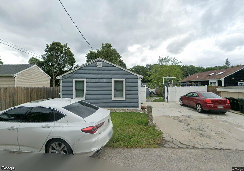
132 Sumner St North Attleboro, MA 02760
North Attleboro NeighborhoodEstimated Value: $484,757 - $654,000
--
Bed
1
Bath
--
Sq Ft
4,966
Sq Ft Lot
About This Home
This home is located at 132 Sumner St, North Attleboro, MA 02760 and is currently estimated at $549,439. 132 Sumner St is a home located in Bristol County with nearby schools including North Attleboro High School.
Ownership History
Date
Name
Owned For
Owner Type
Purchase Details
Closed on
Dec 29, 2020
Sold by
C A Cardoza 2012 Ret and Cardoza
Bought by
Cardoza Joshua
Current Estimated Value
Purchase Details
Closed on
Sep 25, 2012
Sold by
Cardoza Shane B Est and Cardoza
Bought by
Cardoza Joshua
Create a Home Valuation Report for This Property
The Home Valuation Report is an in-depth analysis detailing your home's value as well as a comparison with similar homes in the area
Home Values in the Area
Average Home Value in this Area
Purchase History
| Date | Buyer | Sale Price | Title Company |
|---|---|---|---|
| Cardoza Joshua | -- | None Available | |
| Cardoza Joshua | -- | -- | |
| Charles A Cardoza Ret | -- | -- |
Source: Public Records
Tax History Compared to Growth
Tax History
| Year | Tax Paid | Tax Assessment Tax Assessment Total Assessment is a certain percentage of the fair market value that is determined by local assessors to be the total taxable value of land and additions on the property. | Land | Improvement |
|---|---|---|---|---|
| 2025 | $3,990 | $338,400 | $114,800 | $223,600 |
| 2024 | $3,670 | $318,000 | $114,800 | $203,200 |
| 2023 | $3,435 | $268,600 | $114,800 | $153,800 |
| 2022 | $3,484 | $250,100 | $114,800 | $135,300 |
| 2021 | $3,385 | $237,200 | $114,800 | $122,400 |
| 2020 | $3,249 | $226,400 | $114,800 | $111,600 |
| 2019 | $3,160 | $221,900 | $104,300 | $117,600 |
| 2018 | $4,742 | $214,700 | $104,300 | $110,400 |
| 2017 | $2,680 | $202,700 | $104,300 | $98,400 |
| 2016 | $2,530 | $191,400 | $115,900 | $75,500 |
| 2015 | $2,515 | $191,400 | $115,900 | $75,500 |
| 2014 | $2,427 | $183,300 | $101,800 | $81,500 |
Source: Public Records
Map
Nearby Homes
- 137 Sumner St
- 151 Roosevelt Ave Unit A
- 93 Bank St
- 99 Arnold Rd
- 85 Richards Ave
- 12 Roosevelt Ave
- 60 Crescent Ave
- 16 Johnson St
- 80 Broadway Unit 9
- 33 Ash St
- 16 Richards Ave Unit 106
- 160 Crescent Ave
- 19 Church St Unit A5
- 19 Metcalf Cir
- 20 Holbrook Ave
- 50 Metcalf Rd
- 58 Jay St
- 300 E Washington St Unit 4M
- 300 E Washington St Unit 54R
- 20 South St