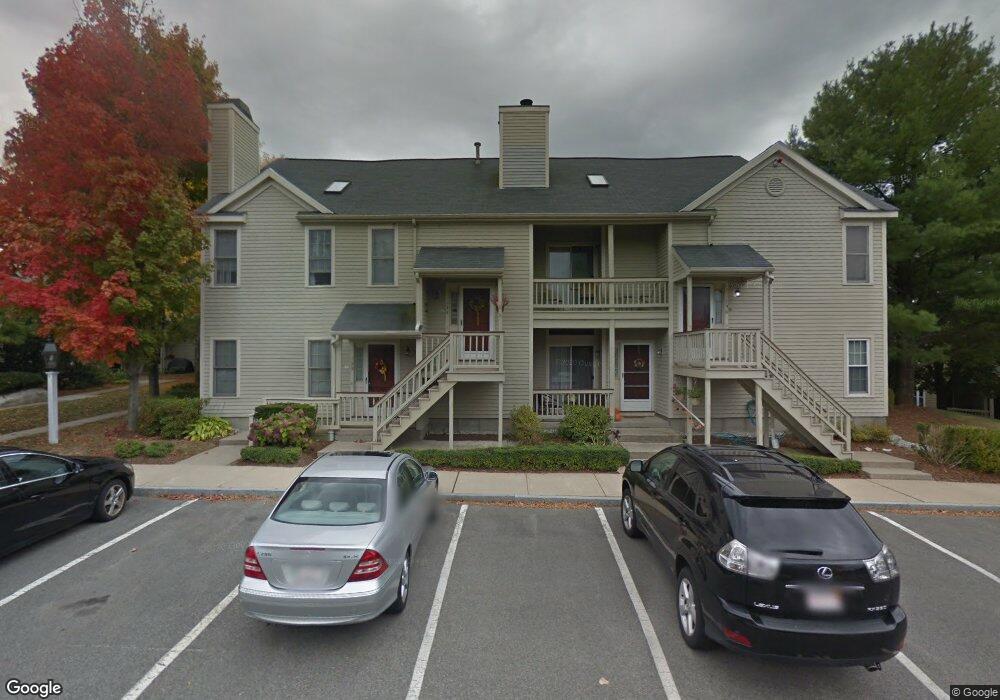
132 Tyson Commons Ln Braintree, MA 02184
South Braintree NeighborhoodEstimated Value: $464,000 - $527,000
2
Beds
2
Baths
1,120
Sq Ft
$442/Sq Ft
Est. Value
About This Home
This home is located at 132 Tyson Commons Ln, Braintree, MA 02184 and is currently estimated at $494,928, approximately $441 per square foot. 132 Tyson Commons Ln is a home located in Norfolk County with nearby schools including Braintree High School, First Baptist Christian School, and Boston Higashi School.
Ownership History
Date
Name
Owned For
Owner Type
Purchase Details
Closed on
Sep 12, 2003
Sold by
Gaughan William B
Bought by
Fox Laurie E
Current Estimated Value
Home Financials for this Owner
Home Financials are based on the most recent Mortgage that was taken out on this home.
Original Mortgage
$100,000
Outstanding Balance
$46,326
Interest Rate
6.22%
Mortgage Type
Purchase Money Mortgage
Estimated Equity
$448,602
Purchase Details
Closed on
Oct 29, 1999
Sold by
Irwin Edward T
Bought by
Gaughan William B
Home Financials for this Owner
Home Financials are based on the most recent Mortgage that was taken out on this home.
Original Mortgage
$140,000
Interest Rate
7.78%
Mortgage Type
Purchase Money Mortgage
Purchase Details
Closed on
Mar 15, 1994
Sold by
Devon Wood Lp
Bought by
Irwin Edward T
Home Financials for this Owner
Home Financials are based on the most recent Mortgage that was taken out on this home.
Original Mortgage
$30,000
Interest Rate
6.93%
Mortgage Type
Purchase Money Mortgage
Create a Home Valuation Report for This Property
The Home Valuation Report is an in-depth analysis detailing your home's value as well as a comparison with similar homes in the area
Home Values in the Area
Average Home Value in this Area
Purchase History
| Date | Buyer | Sale Price | Title Company |
|---|---|---|---|
| Fox Laurie E | $280,000 | -- | |
| Gaughan William B | $175,000 | -- | |
| Irwin Edward T | $127,415 | -- |
Source: Public Records
Mortgage History
| Date | Status | Borrower | Loan Amount |
|---|---|---|---|
| Open | Irwin Edward T | $100,000 | |
| Previous Owner | Irwin Edward T | $140,000 | |
| Previous Owner | Irwin Edward T | $30,000 |
Source: Public Records
Tax History Compared to Growth
Tax History
| Year | Tax Paid | Tax Assessment Tax Assessment Total Assessment is a certain percentage of the fair market value that is determined by local assessors to be the total taxable value of land and additions on the property. | Land | Improvement |
|---|---|---|---|---|
| 2025 | $4,635 | $464,400 | $0 | $464,400 |
| 2024 | $4,136 | $436,300 | $0 | $436,300 |
| 2023 | $3,683 | $377,400 | $0 | $377,400 |
| 2022 | $3,495 | $351,300 | $0 | $351,300 |
| 2021 | $3,495 | $351,300 | $0 | $351,300 |
| 2020 | $3,321 | $336,800 | $0 | $336,800 |
| 2019 | $3,261 | $323,200 | $0 | $323,200 |
| 2018 | $3,143 | $298,200 | $0 | $298,200 |
| 2017 | $3,091 | $287,800 | $0 | $287,800 |
| 2016 | $2,935 | $267,300 | $0 | $267,300 |
| 2015 | $2,857 | $258,100 | $0 | $258,100 |
| 2014 | $2,789 | $244,200 | $0 | $244,200 |
Source: Public Records
Map
Nearby Homes
- 134 Tyson Commons Ln
- 175 Tyson Commons Ln
- 30 Bradford Commons Ln
- 354 Tilden Commons Ln
- 278 Allerton Commons Ln
- 68 Massapoag St Unit 7
- 308 Forest St
- 16 Jay Rd
- 70 Christina Dr
- 24 Fisher Rd
- 193 Randolph St
- 1501 Liberty St
- 116 Cardinal Ct
- 432 Grove St
- 92 Mercury St
- 120 Randolph St
- 1696 Liberty St
- 16 Millstone Ln
- 7 Drake St
- 255 West St
- 136 Tyson Commons Ln
- 135 Tyson Commons Ln
- 133 Tyson Commons Ln
- 131 Tyson Commons Ln
- 130 Tyson Commons Ln
- 129 Tyson Commons Ln
- 128 Tyson Commons Ln
- 127 Tyson Commons Ln
- 126 Tyson Commons Ln
- 125 Tyson Commons Ln
- 124 Tyson Commons Ln
- 123 Tyson Commons Ln
- 122 Tyson Commons Ln
- 121 Tyson Commons Ln
- 120 Tyson Commons Ln
- 119 Tyson Commons Ln
- 118 Tyson Commons Ln
- 117 Tyson Commons Ln
- 116 Tyson Commons Ln
- 115 Tyson Commons Ln